Port Washington North, New York facts for kids
Quick facts for kids
Port Washington North, New York
|
||
|---|---|---|
| Incorporated Village of Port Washington North | ||
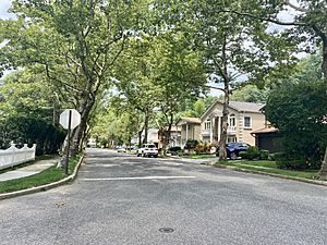
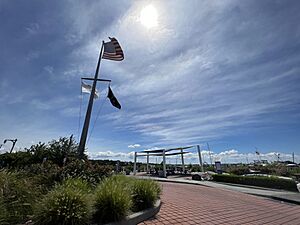
Soundview Drive in the Soundview Village section of Port Washington North in 2021
|
||
|
||
| Nickname(s):
Port North, Soundview, The View
|
||
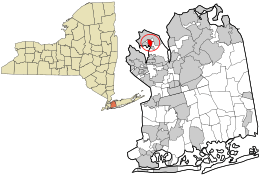
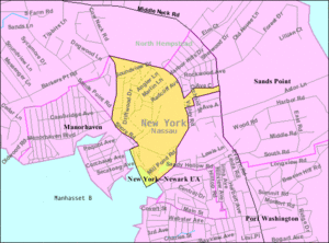
Location in Nassau County and the state of New York
|
||
| Country | ||
| State | ||
| County | Nassau | |
| Town | North Hempstead | |
| Incorporated | 1932 | |
| Founded by | John Cocks | |
| Named for | Its geographic location north of Port Washington | |
| Area | ||
| • Total | 0.50 sq mi (1.29 km2) | |
| • Land | 0.48 sq mi (1.24 km2) | |
| • Water | 0.02 sq mi (0.05 km2) | |
| Elevation | 26 ft (8 m) | |
| Population
(2020)
|
||
| • Total | 3,160 | |
| • Density | 6,597.08/sq mi (2,549.32/km2) | |
| Demonym(s) | Port Norther; Port Washingtonian | |
| Time zone | UTC-5 (Eastern (EST)) | |
| • Summer (DST) | UTC-4 (EDT) | |
| Zip code |
11050
|
|
| Area codes | 516, 363 | |
| FIPS code | 36-59531 | |
| GNIS feature ID | 0960980 | |
Port Washington North is a small village located in Nassau County. It sits on the North Shore of Long Island, in New York, United States. This village is part of the larger Port Washington area. In 2020, about 3,160 people lived here.
The official name is the Incorporated Village of Port Washington North. It is found on the Cow Neck Peninsula, within the Town of North Hempstead.
Contents
History of Port Washington North
How Port Washington North Became a Village
Port Washington North officially became a village in 1932. The people living there voted for it on July 6, 1932. John Cocks was the first Mayor. He led the effort to make it a village and was elected Mayor on August 2, 1932.
Before Port Washington North became its own village, a nearby village called Manorhaven tried to take over the area in 1931. However, the residents wanted to form their own separate village, so Manorhaven's attempt failed.
In 1953, the village grew by adding an empty area. This land was a sand mine along Cow Neck Road.
Developing the Soundview Village Area
In the late 1950s, a company called Colonial Sand and Gravel started selling its land to builders. In 1959, the village allowed developers to begin building the first part of the Soundview Village neighborhood.
In 1982, the Village of Port Washington North celebrated its 50th birthday. The village's name shows its location, as it is in the northern part of the greater Port Washington area.
Geography of Port Washington North
Port Washington North is located at 40°50′41″N 73°42′7″W / 40.84472°N 73.70194°W.
The United States Census Bureau states that the village covers about 0.5 square miles (1.29 square kilometers). Most of this area is land, about 0.48 square miles (1.24 square kilometers). A small part, about 0.02 square miles (0.05 square kilometers), is water.
Economy and Land Use
What People Do for Work
Port Washington North is mainly a bedroom community for New York City. This means many people who live here travel to New York City for their jobs.
The village has a mix of different areas. There are places for homes, businesses, waterfront activities, and industrial work.
Businesses and Studios
Grumman Studios has a large studio space in the industrial part of the village. Also, Publishers Clearing House used to have its main office here. They moved to Jericho in the 2010s. The old building was then turned into the Grumman Studios facility.
The entire village is also part of the Greater Port Washington Business Improvement District. This district helps local businesses.
Types of Homes and Areas
The homes in Port Washington North are varied. You can find single-family houses, multi-family buildings, and townhomes. Most homes are single-family houses.
There are two garden apartment complexes in the Soundview Village area. One townhome development is near the Stop & Shop Plaza. Another is the gated Mill Pond Acres development. This one is for residents aged 55 and older.
The industrial areas are called "Economic Development" and "Maritime Business" districts. They have light manufacturing, offices, warehouses, and studios. The waterfront area includes the Bay Walk Park and places for boats.
The business district has many shops and services. There are also two big shopping centers: the Soundview Marketplace and the Stop & Shop Plaza.
Population and People
| Historical population | |||
|---|---|---|---|
| Census | Pop. | %± | |
| 1940 | 628 | — | |
| 1950 | 650 | 3.5% | |
| 1960 | 722 | 11.1% | |
| 1970 | 2,883 | 299.3% | |
| 1980 | 3,147 | 9.2% | |
| 1990 | 2,736 | −13.1% | |
| 2000 | 2,700 | −1.3% | |
| 2010 | 3,154 | 16.8% | |
| 2020 | 3,160 | 0.2% | |
| U.S. Decennial Census | |||
2020 Census Information
In 2020, there were 3,160 people living in Port Washington North. There were 1,476 households. The population density was about 6,503 people per square mile.
Most residents, about 78.5%, were White. About 9.3% were Asian, and 0.9% were African American. About 5.8% were from two or more races. People of Hispanic or Latino background made up 9.4% of the population.
About 72% of households were married couples. The average family size was 2.88 people. The average income for a household was $137,679. The income per person was $79,557. About 6.3% of the population lived below the poverty line.
Parks and Fun Activities
The Village of Port Washington North has its own park called Bay Walk Park. It is located along Manhasset Bay. This park also has the village's Nautical Art Museum.
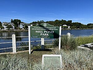
The Town of North Hempstead also has a park within the village called Mill Pond Park. This park has Mill Pond and connects to Bay Walk Park.
Education and Learning
School District
All of Port Washington North is part of the Port Washington Union Free School District. This means that children living in the village go to public schools in Port Washington.
Library Services
The village is also within the Port Washington Library District. This provides library services to residents.
Village Services and Infrastructure
Getting Around: Roads and Buses
Main Roads in the Village
Important roads in Port Washington North include:
- Cow Neck Road (CR C53)
- Harbor Road (CR D07)
- Middle Neck Road (CR D55)
- Mill Pond Road (CR D57)
- Radcliff Avenue
- Soundview Drive
- Shore Road (CR E25)
Bus Routes
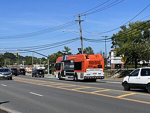
As of July 2024, two Nassau Inter-County Express bus routes serve Port Washington North. These are the n23 and the Port Washington Shuttle.
Utilities for Homes and Businesses
Natural Gas
National Grid USA supplies natural gas to homes and businesses in Port Washington North that use it.
Electricity
PSEG Long Island provides electricity to all homes and businesses in the village.
Sewage System
Port Washington North is part of the Port Washington Water Pollution Control District. This district manages the sanitary sewer system for the village.
Water Supply
The Port Washington Water District provides water to the entire village of Port Washington North.
Healthcare and Emergency Services
Healthcare Facilities
There are no hospitals directly in Port Washington North. The closest hospital is St. Francis Hospital, located in nearby Flower Hill.
However, there is an urgent care center in the village. It is a GoHealth facility, operated by Northwell Health, and is located at the Stop & Shop Plaza.
Fire Department
The entire Village of Port Washington North is served by the Port Washington Fire District. They respond to fire emergencies.
Police Department
The Port Washington Police District provides police services to Port Washington North.
Notable People
- Anthony D'Urso – A former New York State Assemblyman.
See also
 In Spanish: Port Washington North para niños
 | Delilah Pierce |
 | Gordon Parks |
 | Augusta Savage |
 | Charles Ethan Porter |


