
Princetown, New York facts for kids
Quick facts for kids
Princetown, New York
|
|
|---|---|

Location in Schenectady County and the state of New York.
|
|
| Country | United States |
| State | New York |
| County | Schenectady |
| Government | |
| • Type | Town board |
| Area | |
| • Total | 24.21 sq mi (62.71 km2) |
| • Land | 23.93 sq mi (61.97 km2) |
| • Water | 0.29 sq mi (0.74 km2) |
| Elevation | 1,053 ft (321 m) |
| Population
(2020)
|
|
| • Total | 2,024 |
| • Estimate
(2016)
|
2,105 |
| • Density | 83.60/sq mi (32.276/km2) |
| Time zone | UTC-5 (Eastern (EST)) |
| • Summer (DST) | UTC-4 (EDT) |
| ZIP code |
12056
|
| Area code(s) | 518 |
| FIPS code | 36-59861 |
| GNIS feature ID | 0979399 |
Princetown is a small town in Schenectady County, New York, United States. In 2020, about 2,024 people lived there. It is located in the central part of the county, just west of the town of Rotterdam.
Contents
History of Princetown
.jpg)
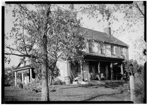
The town of Princetown was created in 1798 by the New York State Legislature. This is the group of elected officials who make laws for New York State. The new town combined land that was once called Corry's Bush with land owned by the Dutch Reformed Church in Schenectady.
Princetown was named after John Prince. He was a New York State assemblyman, which means he was a representative in the state government. Many of the first people to settle in Princetown came from Scotland. For most of its history, Princetown was a rural area. This means it was mostly countryside, not a big city. Its economy was based on agriculture, which means farming was the main way people made a living.
Today, Princetown is still a mix of farms and exurban development. Exurban development means it has homes that are outside of cities but not quite in the countryside. There is also a little light industry, which means small factories or businesses that make things.
In the past, Princetown had seven one-room schools. These were small schools where all grades learned together in one room. The town was also home to the Princetown Academy and Female Seminary. This was a school that opened in 1853. It taught both boys and girls. However, it only stayed open for three years because of money problems. The local Presbyterian church supported the Academy. In 1854, over 400 students attended the school. Most were from the local area, but some came from far away places like Cuba, Germany, and Scotland. The Academy was located in the old center of Princetown.
In the southern part of town was Cheeseman's Tavern, built around 1784. It was in a small community called Gifford's (Corners). The owner, Joshua Cheeseman, was known for a few years as a "shinplaster" banker. This means he printed his own paper money, which was used in the area.
In the northern part of town, near the border with Duanesburg, was the large property of George William Featherstonhaugh. He was an English-American geographer and geologist. A geographer studies the Earth's features and how people live on it. A geologist studies rocks and the Earth's history. Featherstonhaugh was also very interested in using trains to improve farming. His estate was even painted by the famous artist Thomas Cole.
Geography of Princetown
Princetown is located in a central spot. The northern border of the town touches Montgomery County. The southern border touches Albany County. To the east of Princetown is the town of Rotterdam. To the west is the town of Duanesburg. The center of Princetown is about 7 miles (11 km) west of downtown Schenectady.
The United States Census Bureau is a government agency that collects information about the country. According to them, Princetown covers a total area of about 24.2 square miles (62.7 square kilometers). Most of this area, about 23.9 square miles (62.0 square kilometers), is land. The rest, about 0.29 square miles (0.7 square kilometers), is water.
Population Information
| Historical population | |||
|---|---|---|---|
| Census | Pop. | %± | |
| 1820 | 1,075 | — | |
| 1830 | 819 | −23.8% | |
| 1840 | 1,201 | 46.6% | |
| 1850 | 1,031 | −14.2% | |
| 1860 | 996 | −3.4% | |
| 1870 | 846 | −15.1% | |
| 1880 | 826 | −2.4% | |
| 1890 | 732 | −11.4% | |
| 1900 | 694 | −5.2% | |
| 1910 | 684 | −1.4% | |
| 1920 | 487 | −28.8% | |
| 1930 | 472 | −3.1% | |
| 1940 | 553 | 17.2% | |
| 1950 | 774 | 40.0% | |
| 1960 | 912 | 17.8% | |
| 1970 | 1,405 | 54.1% | |
| 1980 | 1,804 | 28.4% | |
| 1990 | 2,031 | 12.6% | |
| 2000 | 2,132 | 5.0% | |
| 2010 | 2,115 | −0.8% | |
| 2020 | 2,024 | −4.3% | |
| U.S. Decennial Census | |||
In the year 2000, a census (a count of the population) showed that 2,132 people lived in Princetown. There were 797 households, which are groups of people living together in one home. Out of these, 611 were families.
The population was spread out by age. About 25.1% of the people were under 18 years old. About 11.8% were 65 years old or older. The median age was 41 years. This means half the people were younger than 41 and half were older.
Communities and Locations
Princetown has several small communities and important locations:
- Bradshaw's Corners - This is an area where North Kelly Road and Weast Road meet Mariaville Road (NY 159).
- Gifford's (Corners) - A small hamlet (a tiny village) in the southern part of town. It is located where New York State Route 406 and U.S. Route 20 cross. It was once home to Cheeseman's Tavern, whose owner was known for printing his own money.
- Kelly's Station - A small hamlet in the southeastern part of town. It used to have a train station for the Schenectady and Duanesburg Railroad. This train line is now run by the Delaware and Hudson Railway. Kelly's Station also had a store and a post office. It is known for its double culverts, which are tunnels built to carry the railroad over Kelly Station Road and a stream called Bonny Kill or Bonny Brook.
- Mariaville (Lake) - This is a hamlet and part of a CDP (Census Designated Place). A CDP is an area identified by the Census Bureau for statistical purposes. It is located on the border between Princetown and the town of Duanesburg, towards the northern end of Princetown.
- Pattersonville – This is a hamlet and also part of a CDP. It is partly in the northern part of Princetown.
- Princetown (center) – This is a hamlet that was once known as Princetown P.O. It changed its name to Kelly's Station after the Schenectady and Duanesburg Railroad arrived in 1873. However, there was another hamlet in the very center of the town called Princetown, or Princetown Center. This area grew around the second Presbyterian Church at the corner of Currybush and North Kelly roads. This hamlet was also home to the Princetown Academy and Female Seminary from 1853 to 1856.
- Rynex Corners - A hamlet in the northern part of the town, on the border between Princetown and the town of Rotterdam. It once had a hotel and a factory that made cheese.
- Willow Run - This is a newer neighborhood in the middle of the town, located north of the D&H railway line.
Notable People
- George William Featherstonaugh - An English-American geologist and geographer. He once owned a large property on the border between Duanesburg and Princetown. This property was featured in several paintings by the artist Thomas Cole.
- Nelson Fryer - He was a farmer and a member of the Wisconsin State Assembly, which is like a state government body. He was born in Princetown.
See also
 In Spanish: Princetown (Nueva York) para niños
