Puelches, La Pampa facts for kids
Quick facts for kids
Puelches
|
|
|---|---|
|
Rural locality and village
|
|

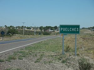
Puelches city sign
|
|
| Country | |
| Province | |
| Founded | 24 February 1900 |
| Area | |
| • Total | 3,070 sq mi (7,950 km2) |
| Elevation | 728 ft (222 m) |
| Population
(2010 census [INDEC])
|
|
| • Total | 560 |
| Time zone | UTC−3 (ART) |
| CPA Base |
8201
|
| Area code(s) | +54 02952 |
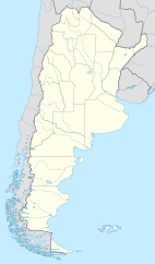
Puelches is a small village in La Pampa Province, Argentina. It is located on National Route 152. This village is the main town for the Curacó Department. Its rural area also reaches into the Lihuel Calel Department.
Puelches was first started as a town for raising cattle. This was common in the farming areas nearby. Today, the main jobs here are making salt and mining. In 1978, Argentina officially declared Puelches to be the country's geographical center.
Contents
What's in a Name? The Story of Puelches
The town was often called "Los Puelches" in the early 1900s. In 1941, the Governor, Miguel Duval, wanted to change its name. He suggested "Coronel Bedoya" to honor an officer. This officer was part of a big historical event called the Conquest of the Desert.
However, many people did not like this idea. So, they decided to keep the original name. "Puelches" refers to the native Puelche people. These people lived in the area long before the Argentine Army arrived. The word comes from the Mapudungun language. It means 'people from the east'.
A Look Back: The History of Puelches
The land around Puelches has been home to native groups for thousands of years. They were generally known as Puelche. This name described where they lived, not just one specific group. Around the 1500s, the Mapuche people began to move into this area. They mixed with the local hunting and gathering tribes. These tribes called themselves gününa-këna.
The Argentine government took control of the area. This happened after the native groups were defeated in the 1870s. The village of Puelches was officially started in 1900. It began as a farming community called Los Puelches. Six years later, a local school opened. A magistrate's court and a civil registry also began.
In the early 1900s, settlers from Spain and France came. They joined the remaining local people and the creole population. The area grew in the 1940s. This was because the Salado River had a strong flow. This helped with cattle farming, fishing, and mining. But this growth ended when other provinces changed the river's flow. This caused a big loss of water in the whole region.
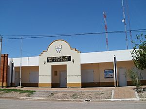
In 1978, Puelches was officially named Argentina's geographical center. A special stone marker shows this exact spot. In 1995, Puelches became an official municipality. This means it has its own local government.
Where is Puelches? Geography and Location
Puelches is located in the southern part of La Pampa province. It is the main town for the Curacó Department. Its rural areas also extend into the Lihuel Calel Department. You can reach the town by National Route 152. Provincial Route 107 and Provincial Route 15 also serve it.
Puelches is about 272 km (169 mi) from Santa Rosa. Santa Rosa is the capital city of the province. It is also about 782 km (486 mi) from Buenos Aires. The town is 222 m (728 ft) above sea level. The Salado River flows through this region. It provides water to lagoons like La Dulce and Urre Lauquen. The river then joins the Colorado River.
Weather in Puelches: Climate Information
Puelches has a temperate climate. This is similar to much of La Pampa province.
| Climate data for Puelches, La Pampa (1961–1970) | |||||||||||||
|---|---|---|---|---|---|---|---|---|---|---|---|---|---|
| Month | Jan | Feb | Mar | Apr | May | Jun | Jul | Aug | Sep | Oct | Nov | Dec | Year |
| Record high °C (°F) | 41.3 (106.3) |
41.0 (105.8) |
37.9 (100.2) |
36.5 (97.7) |
28.5 (83.3) |
26.0 (78.8) |
26.3 (79.3) |
28.9 (84.0) |
36.0 (96.8) |
36.9 (98.4) |
42.1 (107.8) |
42.0 (107.6) |
42.1 (107.8) |
| Mean daily maximum °C (°F) | 32.6 (90.7) |
31.6 (88.9) |
28.2 (82.8) |
23.4 (74.1) |
19.1 (66.4) |
14.2 (57.6) |
14.2 (57.6) |
17.5 (63.5) |
19.7 (67.5) |
23.1 (73.6) |
28.1 (82.6) |
30.9 (87.6) |
23.6 (74.5) |
| Daily mean °C (°F) | 24.4 (75.9) |
23.1 (73.6) |
20.0 (68.0) |
15.0 (59.0) |
10.6 (51.1) |
6.7 (44.1) |
6.6 (43.9) |
8.7 (47.7) |
11.8 (53.2) |
15.7 (60.3) |
20.2 (68.4) |
22.8 (73.0) |
15.5 (59.9) |
| Mean daily minimum °C (°F) | 15.6 (60.1) |
14.5 (58.1) |
11.7 (53.1) |
7.2 (45.0) |
3.9 (39.0) |
0.8 (33.4) |
0.5 (32.9) |
1.6 (34.9) |
4.3 (39.7) |
7.7 (45.9) |
11.7 (53.1) |
13.8 (56.8) |
7.8 (46.0) |
| Record low °C (°F) | 4.8 (40.6) |
3.4 (38.1) |
−1.6 (29.1) |
−4.1 (24.6) |
−9.0 (15.8) |
−12.1 (10.2) |
−12.4 (9.7) |
−9.7 (14.5) |
−8.6 (16.5) |
−4.6 (23.7) |
0.9 (33.6) |
2.9 (37.2) |
−12.4 (9.7) |
| Average precipitation mm (inches) | 43.0 (1.69) |
37.0 (1.46) |
58.0 (2.28) |
37.4 (1.47) |
15.5 (0.61) |
13.3 (0.52) |
14.5 (0.57) |
13.7 (0.54) |
26.6 (1.05) |
41.4 (1.63) |
35.7 (1.41) |
42.8 (1.69) |
378.9 (14.92) |
| Average relative humidity (%) | 40 | 42 | 49 | 58 | 69 | 75 | 73 | 60 | 55 | 52 | 47 | 43 | 55 |
| Percent possible sunshine | 71 | 79 | 71 | 64 | 55 | 43 | 45 | 56 | 53 | 63 | 65 | 62 | 61 |
| Source: Secretaria de Mineria | |||||||||||||
Who Lives Here? Puelches' Population
In 2020, it was thought that about 870 people lived in the Puelches area. The Argentine census in 2010 counted 560 residents. This was a small increase of 3.7% from 2001. In 2001, 540 people lived there. Back in 1991, Puelches had about 352 people.
How Puelches Makes Money: Economy and Jobs
Even though Puelches is in a farming area, its main money comes from making salt. This happens in large salt ponds nearby. Mining also helps the local economy. Workers extract copper and sodium sulfate from the ground.
Puelches is the closest town to the Lihué Calel National Park. Because of this, it serves as a service center. Tourists visiting the National Park often stop here.
Cool Places to See: Landmarks in Puelches
In Puelches, you can visit a special stone. This stone marks Argentina's exact geographical center. It's a unique spot to see!
There is also an old chapel called Angel Custodio. Locals built it in 1963. They used mostly stone and other materials from the area. It still looks much like it did when it was built. Another important historical site is a monument. It honors cacique Ñancufil Calderón. He was one of the people who helped found the town.
See also
 In Spanish: Puelches (localidad) para niños


