Quanah, Texas facts for kids
Quick facts for kids
Quanah
|
|
|---|---|
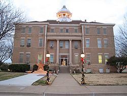
Hardeman County Courthouse in 2006
|
|
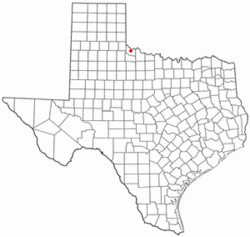
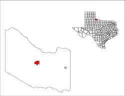
Location of Quanah, Texas
|
|
 |
|
| Country | United States |
| State | Texas |
| County | Hardeman |
| Named for | Quanah Parker |
| Area | |
| • Total | 3.48 sq mi (9.00 km2) |
| • Land | 3.48 sq mi (9.00 km2) |
| • Water | 0.00 sq mi (0.00 km2) |
| Elevation | 1,572 ft (479 m) |
| Population
(2020)
|
|
| • Total | 2,279 |
| • Density | 654.9/sq mi (253.22/km2) |
| Time zone | UTC-6 (Central (CST)) |
| • Summer (DST) | UTC-5 (CDT) |
| ZIP code |
79252
|
| Area code(s) | 940 |
| FIPS code | 48-60044 |
| GNIS feature ID | 2411505 |
Quanah (pronounced "KWAH-nuh") is a city in Hardeman County, Texas, United States. It is the main town where the county government is located, also known as the county seat. In 2020, about 2,279 people lived there. This was a bit less than the 2,641 people who lived there in 2010.
Quanah is about 192 miles northwest of Fort Worth. It is also just 8 miles south of the Red River. This river forms the border between Oklahoma and Texas. A cool place called Copper Breaks State Park is only 12 miles south of the city.
Contents
History of Quanah
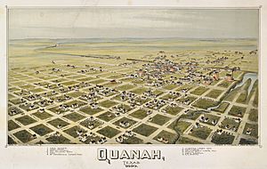
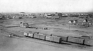
Quanah started in 1884. It was created as a stop along what was then called the Fort Worth and Denver City Railway. This was a train line that helped people and goods travel. The city was named after Quanah Parker, who was the last main chief of the Comanche Native American group.
In 1890, Quanah became the county seat of Hardeman County. Before that, the county seat was in a town called Margaret. There was a big disagreement about moving the county seat. This fight even led to the southern part of Hardeman County becoming its own county, called Foard County.
Geography and Location
Quanah is right in the middle of Hardeman County. It is located where U.S. Route 287 (which is 11th Street in Quanah) and Texas State Highway 6 (Main Street) meet. U.S. Route 287 goes southeast for 30 miles to Vernon. It also goes northwest for 28 miles to Childress.
Highway 6 goes south for 21 miles to Crowell. It goes north for 8 miles to the Oklahoma border at the Red River. If you travel 40 miles northeast from Quanah on Oklahoma Highway 6, you will reach Altus, Oklahoma. The United States Census Bureau says that Quanah covers a total area of 9.0 square kilometers (about 3.48 square miles), and all of it is land.
Quanah's Climate
| Climate data for Quanah, Texas (1981–2010 normals, extremes 1893, 1904–2008) | |||||||||||||
|---|---|---|---|---|---|---|---|---|---|---|---|---|---|
| Month | Jan | Feb | Mar | Apr | May | Jun | Jul | Aug | Sep | Oct | Nov | Dec | Year |
| Record high °F (°C) | 89 (32) |
93 (34) |
102 (39) |
104 (40) |
111 (44) |
119 (48) |
114 (46) |
119 (48) |
110 (43) |
107 (42) |
95 (35) |
88 (31) |
119 (48) |
| Mean daily maximum °F (°C) | 53.5 (11.9) |
56.6 (13.7) |
65.8 (18.8) |
74.6 (23.7) |
82.9 (28.3) |
90.9 (32.7) |
95.7 (35.4) |
94.7 (34.8) |
86.9 (30.5) |
76.1 (24.5) |
64.2 (17.9) |
53.7 (12.1) |
74.6 (23.7) |
| Daily mean °F (°C) | 39.9 (4.4) |
43.1 (6.2) |
51.9 (11.1) |
60.3 (15.7) |
69.9 (21.1) |
78.7 (25.9) |
83.1 (28.4) |
82.1 (27.8) |
73.7 (23.2) |
62.3 (16.8) |
50.4 (10.2) |
40.5 (4.7) |
61.3 (16.3) |
| Mean daily minimum °F (°C) | 26.2 (−3.2) |
29.7 (−1.3) |
37.9 (3.3) |
46.0 (7.8) |
56.9 (13.8) |
66.5 (19.2) |
70.6 (21.4) |
69.5 (20.8) |
60.5 (15.8) |
48.5 (9.2) |
36.5 (2.5) |
27.4 (−2.6) |
48.0 (8.9) |
| Record low °F (°C) | −9 (−23) |
−8 (−22) |
1 (−17) |
21 (−6) |
30 (−1) |
42 (6) |
50 (10) |
50 (10) |
29 (−2) |
16 (−9) |
5 (−15) |
−15 (−26) |
−15 (−26) |
| Average precipitation inches (mm) | 1.00 (25) |
1.19 (30) |
1.90 (48) |
2.13 (54) |
3.29 (84) |
3.95 (100) |
2.42 (61) |
2.79 (71) |
2.83 (72) |
2.56 (65) |
1.64 (42) |
1.15 (29) |
26.85 (682) |
| Average precipitation days (≥ 0.01 in) | 3.8 | 4.6 | 5.3 | 4.8 | 7.3 | 7.6 | 4.9 | 6.4 | 5.6 | 4.7 | 4.2 | 4.4 | 63.6 |
| Source: NOAA | |||||||||||||
Population Changes
| Historical population | |||
|---|---|---|---|
| Census | Pop. | %± | |
| 1890 | 1,477 | — | |
| 1900 | 1,651 | 11.8% | |
| 1910 | 3,127 | 89.4% | |
| 1920 | 3,691 | 18.0% | |
| 1930 | 4,464 | 20.9% | |
| 1940 | 3,767 | −15.6% | |
| 1950 | 4,589 | 21.8% | |
| 1960 | 4,564 | −0.5% | |
| 1970 | 3,948 | −13.5% | |
| 1980 | 3,890 | −1.5% | |
| 1990 | 3,413 | −12.3% | |
| 2000 | 3,022 | −11.5% | |
| 2010 | 2,641 | −12.6% | |
| 2020 | 2,279 | −13.7% | |
| U.S. Decennial Census | |||
2020 Census Information
In the 2020 United States census, there were 2,279 people living in Quanah. There were 1,088 households and 700 families in the city. The table below shows the different groups of people living in Quanah in 2020.
| Race | Number | Percentage |
|---|---|---|
| White (NH) | 1,529 | 67.1% |
| Black or African American (NH) | 106 | 4.7% |
| Native American or Alaska Native (NH) | 9 | 0.4% |
| Asian (NH) | 18 | 0.8% |
| Pacific Islander (NH) | 1 | nil |
| Some Other Race (NH) | 5 | 0.2% |
| Mixed/Multi-Racial (NH) | 79 | 3.5% |
| Hispanic or Latino | 532 | 23.3% |
| Total | 2,279 |
Education in Quanah
The city of Quanah has its own school system called the Quanah Independent School District. Students in Quanah attend Quanah High School, and their sports teams are known as the Indians.
Famous People from Quanah
Many interesting people have come from Quanah, Texas. Here are a few:
- Bill Evans – He was a professional baseball player in the 1940s and 1950s. He also received special awards for his bravery in World War II.
- John Gilliland – A well-known radio broadcaster.
- Edward Givens – An astronaut.
- Welborn Griffith – An American officer who helped save the famous Chartres Cathedral in France during World War II.
- Fred C. Koch – An engineer who started a big company called Koch Industries.
- Juli Reding – An actress.
- Clay Reynolds – A Texas author and writer.
See also
 In Spanish: Quanah (Texas) para niños
 | Sharif Bey |
 | Hale Woodruff |
 | Richmond Barthé |
 | Purvis Young |


