Quinlan, Texas facts for kids
Quick facts for kids
Quinlan, Texas
|
|
|---|---|
|
City
|
|

Quinlan
|
|

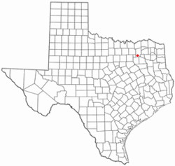
Location of Quinlan, Texas
|
|
 |
|
| Country | United States |
| State | Texas |
| County | Hunt |
| Area | |
| • Total | 1.29 sq mi (3.35 km2) |
| • Land | 1.29 sq mi (3.35 km2) |
| • Water | 0.00 sq mi (0.00 km2) |
| Elevation | 522 ft (159 m) |
| Population
(2020)
|
|
| • Total | 1,414 |
| • Density | 1,096/sq mi (422.1/km2) |
| Time zone | UTC-6 (Central (CST)) |
| • Summer (DST) | UTC-5 (CDT) |
| ZIP code |
75474
|
| Area code(s) | 903, 430 |
| FIPS code | 48-60140 |
| GNIS feature ID | 2411508 |
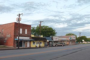
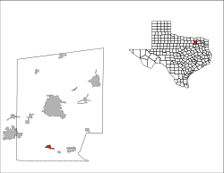
Quinlan is a small city located in the southern part of Hunt County, Texas, in the United States. It's part of the larger Dallas–Fort Worth metropolitan area. In 2020, about 1,414 people lived there. Quinlan is also about 5 miles (8 km) west of Lake Tawakoni.
Contents
History of Quinlan
The city of Quinlan started around 1892. It was a stop along the Texas Midland Railroad. This railroad was owned by a famous investor named Hetty Green. Her son, Edward H.R. Green, ran the railroad.
The Texas Midland Railroad later became part of the Houston & Texas Central Railroad. The town that grew around the train station was named Quinlan. It was named after George A. Quinlan, who was the general manager of the Houston & Texas Central railroad.
A post office opened in Quinlan in 1894. By 1896, Quinlan officially became a city. Harry Ford was the first mayor. Quinlan quickly became an important place for farming. Farmers used the railroad to ship their cotton and other crops.
In the early 1900s, Quinlan had three cotton gins, many businesses, banks, schools, churches, and homes. The town was growing!
Later, in the 1930s and 1940s, finding and producing oil became more important than cotton farming. This changed the economy of the area. In the 1950s, Lake Tawakoni was built nearby, which also helped the local economy.
Some of the first people to settle here were John M. Cook and R. K. Epperson. They moved their businesses to Quinlan. By 1900, the population had grown to 362 people. This growth was largely because of the railroad.
The town kept growing through the early 1900s. In 1904, 463 people lived in Quinlan. By 1910, there were 537 residents, and by 1914, there were 600. At that time, Quinlan had 20 businesses, including a bank and a weekly newspaper.
In 1925, Quinlan was a main shopping area for parts of Hunt, Kaufman, and Van Zandt Counties. It had an elementary school, a high school, and 35 businesses. They even harvested about 5,000 bales of cotton that year!
By 1933, Quinlan had 512 residents and 30 businesses. In 1952, 599 people lived there, and they had 25 businesses. In 1964, the community had 621 people and 22 businesses. After the mid-1960s, Quinlan grew a lot. This was mainly because it was close to Lake Tawakoni. In 1976, Quinlan had 900 people. By 1988, the population was 1,002, with 51 businesses. In 1990, its population reached 1,360.
Geography and Climate
Quinlan is located in the southern part of Hunt County, Texas.
Location and Roads
Texas State Highway 34 runs through the eastern side of Quinlan. This highway goes north about 16 miles (26 km) to Greenville, which is the main city of the county. It also goes southwest about 16 miles (26 km) to Terrell.
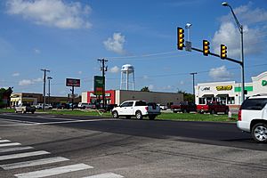
Texas State Highway 276 is known as Main Street in Quinlan. It goes east across Lake Tawakoni about 22 miles (35 km) to Emory. To the west, it goes about 20 miles (32 km) to Rockwall. Downtown Dallas is about 42 miles (68 km) west of Quinlan.
According to the U.S. Census Bureau, Quinlan covers an area of about 1.29 square miles (3.4 km²). All of this area is land.
Weather in Quinlan
| Climate data for Quinlan, Texas | |||||||||||||
|---|---|---|---|---|---|---|---|---|---|---|---|---|---|
| Month | Jan | Feb | Mar | Apr | May | Jun | Jul | Aug | Sep | Oct | Nov | Dec | Year |
| Mean daily maximum °F (°C) | 56.7 (13.7) |
60.1 (15.6) |
68.7 (20.4) |
78.0 (25.6) |
83.5 (28.6) |
90.6 (32.6) |
95.7 (35.4) |
95.7 (35.4) |
87.5 (30.8) |
79.9 (26.6) |
68.4 (20.2) |
58.9 (14.9) |
77.0 (25.0) |
| Mean daily minimum °F (°C) | 34.2 (1.2) |
35.7 (2.1) |
44.5 (6.9) |
55.7 (13.2) |
62.1 (16.7) |
68.6 (20.3) |
72.3 (22.4) |
71.2 (21.8) |
65.0 (18.3) |
55.1 (12.8) |
44.7 (7.1) |
37.3 (2.9) |
53.9 (12.2) |
| Average precipitation inches (mm) | 1.8 (46) |
2.7 (69) |
2.8 (71) |
5.1 (130) |
4.8 (120) |
2.8 (71) |
2.2 (56) |
2.3 (58) |
4.9 (120) |
4.5 (110) |
2.8 (71) |
2.9 (74) |
39.5 (1,000) |
| Source: Weatherbase | |||||||||||||
Population Information
| Historical population | |||
|---|---|---|---|
| Census | Pop. | %± | |
| 1900 | 362 | — | |
| 1910 | 537 | 48.3% | |
| 1920 | 580 | 8.0% | |
| 1930 | 512 | −11.7% | |
| 1940 | 677 | 32.2% | |
| 1950 | 599 | −11.5% | |
| 1960 | 621 | 3.7% | |
| 1970 | 844 | 35.9% | |
| 1980 | 1,002 | 18.7% | |
| 1990 | 1,360 | 35.7% | |
| 2000 | 1,370 | 0.7% | |
| 2010 | 1,394 | 1.8% | |
| 2020 | 1,414 | 1.4% | |
| U.S. Decennial Census | |||
Here's a look at the different groups of people living in Quinlan as of 2020:
| Race | Number | Percentage |
|---|---|---|
| White (NH) | 1,102 | 77.93% |
| Black or African American (NH) | 23 | 1.63% |
| Native American or Alaska Native (NH) | 12 | 0.85% |
| Asian (NH) | 8 | 0.57% |
| Pacific Islander (NH) | 1 | 0.07% |
| Some other race (NH) | 1 | 0.07% |
| Mixed/multiracial (NH) | 63 | 4.46% |
| Hispanic or Latino | 204 | 14.43% |
| Total | 1,414 |
As of the 2020 United States census, there were 1,414 people living in Quinlan. These people made up 675 households and 447 families.
Education in Quinlan
The city of Quinlan is served by the Quinlan Independent School District. This district includes CB Thompson Middle School and Ford High School.
Some other parts of Quinlan are served by the Boles Independent School District.
Transportation in Quinlan
 Texas State Highway 34 is a road that goes north and south through the middle of Quinlan. It connects to Terrell in the south and Greenville in the north.
 Texas State Highway 276 is a road that goes east and west. In Quinlan, it's known as Quinlan Parkway. It connects to Rockwall in the west and Emory in the east.
 Texas State Highway Loop 264 starts in downtown Quinlan. It connects State Highway 276 and State Highway 34.
 Farm-to-market Road 751 goes south towards Wills Point.
 Farm-to-market Road 2101 is a few miles outside Quinlan. It goes north towards L3Harris and Majors Airport in Greenville.
- Rockin' M Airport is a small airport a few miles from Quinlan. Majors Airport is about 20 minutes away in Greenville.
Public transportation is available through a service called The Connection. This service helps people travel within Quinlan and all of Hunt County. It runs Monday through Friday from 7 am to 7 pm. You need to book your ride one day in advance.
A ride within the same town costs $2 ($4 for a round trip). If you travel from one town to another within Hunt County, it costs $3 ($6 for a round trip). The Connection also offers round trips to Dallas for Hunt County residents. This costs $34, and at least three passengers are needed for this trip.
Notable Person
- Uel Eubanks was a baseball pitcher. He played for the Philadelphia A's in 1922.
See also
 In Spanish: Quinlan (Texas) para niños
 | Victor J. Glover |
 | Yvonne Cagle |
 | Jeanette Epps |
 | Bernard A. Harris Jr. |


