
Greenville, Texas facts for kids
Quick facts for kids
Greenville, Texas
|
|
|---|---|
.jpg)
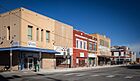
Lee Street in downtown Greenville
|
|
| Motto(s):
"Rich Heritage, Vibrant Future"
|
|

Location of Greenville in Hunt County, Texas
|
|

Greenville, Texas
Location in Texas

Greenville, Texas
Location in the United States
|
|
| Country | |
| State | |
| County | Hunt |
| Incorporated | April 13, 1852 |
| Named for | Thomas J. Green |
| Government | |
| • Type | Council-Manager |
| Area | |
| • Total | 33.11 sq mi (85.75 km2) |
| • Land | 32.29 sq mi (83.62 km2) |
| • Water | 0.82 sq mi (2.12 km2) |
| Elevation | 564 ft (172 m) |
| Population
(2020)
|
|
| • Total | 28,164 |
| • Density | 850.62/sq mi (328.443/km2) |
| Time zone | UTC-6 (Central (CST)) |
| • Summer (DST) | UTC-5 (CDT) |
| ZIP codes |
75401–75404
|
| Area codes | 903, 430 |
| FIPS code | 48-30920 |
| GNIS feature ID | 2410660 |
Greenville is a city in Hunt County, Texas, United States. It is the largest city in the county and its main center. Greenville is located in Northeast Texas, about 50 miles northeast of Dallas. In 2020, the city had a population of 28,164 people.
The city was named after Thomas J. Green. He was an important person in the creation of the Texas Republic.
Contents
- Welcome to Greenville, Texas!
- Photo gallery
- See also
Welcome to Greenville, Texas!
A Look at Greenville's Past
Early Days and Growth
Greenville was founded in 1846. It was named after Thomas J. Green, who helped establish the Texas Republic. He later served in the Congress of the Texas Republic.
During the American Civil War, people in Greenville had different ideas about whether to leave the United States. Some residents fought for the Union, while others fought for the Confederacy. This division is remembered with a historical marker in "The SPOT" Park downtown. After the war, Greenville's economy started to rely on cotton.
By 1920, Greenville had 12,384 residents. This made it the 20th largest city in Texas at that time. During World War II, the Mexican Escuadrón 201 trained in Greenville at Majors Field.
Changes Over Time
For many years, a large sign stood over Lee Street in downtown Greenville. This sign, put up in 1921, had a message that caused problems because of its meaning about race. Because of this, the sign was taken down in 1965. Later, in 1968, a new version of the sign was put up. It had a much more positive message, saying "The Greatest People." The original sign is now kept at the Audie Murphy American Cotton Museum.
In 1957, Greenville welcomed the small town of Peniel. Peniel was founded in 1899 as a religious community. Its citizens approved the change, and Peniel became part of Greenville.
On May 12, 2011, a rare white buffalo calf was born near Greenville. It was named "Lightning Medicine Cloud." This was a special event for many people. Sadly, the white buffalo passed away on August 21, 2012.
Greenville's Location and Weather
Where is Greenville?

Greenville is in Northeast Texas, right in the middle of Hunt County. It sits in an area known for its rich, dark soil called the Texas Blackland Prairies. It is also near the East Central Texas forests. The city is about 50 miles northeast of Dallas. It is also about 45 miles south of the Texas/Oklahoma border.
The U.S. Census Bureau states that Greenville covers about 33.4 square miles. Most of this area is land, with a small part covered by water. The Cowleech Fork of the Sabine River flows through the northeastern part of the city.
What's the Weather Like?
Greenville has a humid subtropical climate. This means the weather is usually humid. It also gets a moderate amount of rain.
| Climate data for Greenville, Texas (1991–2020 normals, extremes 1900–present) | |||||||||||||
|---|---|---|---|---|---|---|---|---|---|---|---|---|---|
| Month | Jan | Feb | Mar | Apr | May | Jun | Jul | Aug | Sep | Oct | Nov | Dec | Year |
| Record high °F (°C) | 90 (32) |
95 (35) |
95 (35) |
101 (38) |
104 (40) |
109 (43) |
113 (45) |
116 (47) |
109 (43) |
103 (39) |
91 (33) |
87 (31) |
116 (47) |
| Mean daily maximum °F (°C) | 57.8 (14.3) |
61.7 (16.5) |
69.3 (20.7) |
77.4 (25.2) |
84.6 (29.2) |
92.6 (33.7) |
97.1 (36.2) |
98.3 (36.8) |
91.3 (32.9) |
80.7 (27.1) |
68.3 (20.2) |
59.5 (15.3) |
78.2 (25.7) |
| Daily mean °F (°C) | 45.5 (7.5) |
49.4 (9.7) |
56.7 (13.7) |
64.8 (18.2) |
73.2 (22.9) |
81.4 (27.4) |
85.6 (29.8) |
85.8 (29.9) |
78.4 (25.8) |
67.3 (19.6) |
55.9 (13.3) |
47.5 (8.6) |
66.0 (18.9) |
| Mean daily minimum °F (°C) | 33.3 (0.7) |
37.2 (2.9) |
44.2 (6.8) |
52.2 (11.2) |
61.9 (16.6) |
70.2 (21.2) |
74.1 (23.4) |
73.3 (22.9) |
65.6 (18.7) |
54.0 (12.2) |
43.4 (6.3) |
35.5 (1.9) |
53.7 (12.1) |
| Record low °F (°C) | −4 (−20) |
0 (−18) |
8 (−13) |
26 (−3) |
31 (−1) |
48 (9) |
55 (13) |
49 (9) |
36 (2) |
21 (−6) |
13 (−11) |
−3 (−19) |
−4 (−20) |
| Average precipitation inches (mm) | 3.16 (80) |
3.46 (88) |
4.42 (112) |
4.12 (105) |
5.79 (147) |
4.16 (106) |
3.15 (80) |
2.39 (61) |
3.84 (98) |
4.96 (126) |
3.58 (91) |
3.98 (101) |
47.01 (1,194) |
| Average snowfall inches (cm) | 0.0 (0.0) |
0.1 (0.25) |
0.0 (0.0) |
0.0 (0.0) |
0.0 (0.0) |
0.0 (0.0) |
0.0 (0.0) |
0.0 (0.0) |
0.0 (0.0) |
0.0 (0.0) |
0.0 (0.0) |
0.0 (0.0) |
0.1 (0.25) |
| Average precipitation days (≥ 0.01 in) | 6.4 | 7.0 | 7.5 | 6.7 | 7.2 | 6.6 | 4.9 | 4.6 | 5.6 | 6.6 | 6.0 | 5.7 | 74.8 |
| Average snowy days (≥ 0.1 in) | 0.1 | 0.1 | 0.0 | 0.0 | 0.0 | 0.0 | 0.0 | 0.0 | 0.0 | 0.0 | 0.1 | 0.0 | 0.3 |
| Source: NOAA | |||||||||||||
People and Community in Greenville
| Historical population | |||
|---|---|---|---|
| Census | Pop. | %± | |
| 1890 | 4,330 | — | |
| 1900 | 6,860 | 58.4% | |
| 1910 | 8,850 | 29.0% | |
| 1920 | 12,384 | 39.9% | |
| 1930 | 12,407 | 0.2% | |
| 1940 | 13,995 | 12.8% | |
| 1950 | 14,727 | 5.2% | |
| 1960 | 19,087 | 29.6% | |
| 1970 | 22,043 | 15.5% | |
| 1980 | 22,161 | 0.5% | |
| 1990 | 23,071 | 4.1% | |
| 2000 | 23,960 | 3.9% | |
| 2010 | 25,557 | 6.7% | |
| 2020 | 28,164 | 10.2% | |
| 2023 (est.) | 32,717 | 28.0% | |
| U.S. Decennial Census | |||
| Race | Number | Percentage |
|---|---|---|
| White (NH) | 14,525 | 51.57% |
| Black or African American (NH) | 3,892 | 13.82% |
| Native American or Alaska Native (NH) | 142 | 0.5% |
| Asian (NH) | 368 | 1.31% |
| Pacific Islander (NH) | 40 | 0.14% |
| Some Other Race (NH) | 108 | 0.38% |
| Mixed/Multi-Racial (NH) | 1,207 | 4.29% |
| Hispanic or Latino | 7,882 | 27.99% |
| Total | 28,164 |
In 2020, Greenville had 28,164 residents. There were 10,454 households and 6,602 families living in the city.
How Greenville Makes a Living
.jpg)
.jpg)
Long ago, Hunt County was famous as a major center for cotton. The world's largest inland cotton compress was in Greenville. It was destroyed by fire in the mid-1900s.
Today, a big employer is L3Harris Technologies Mission Integration Division. This company is a major defense contractor. It is located at Majors Airport. This airport was built in 1942. It was first used to train fighter pilots during World War II. Since then, it has helped Greenville's economy grow.
Tourism is also becoming more important for the local economy. Attractions include Splash Kingdom Water Park. The historic downtown area is also being improved. It features Landon Winery and the restored Texan Theater. Greenville is also known for making saddles.
.jpg)
Top Employers in Greenville
Here are some of the largest employers in Greenville, based on a 2022–2023 report:
| # | Employer | # of Employees |
|---|---|---|
| 1 | L3Harris | 6,500 |
| 2 | Hunt Regional Medical Center | 1,100 |
| 3 | Greenville Independent School District | 844 |
| 4 | McKesson | 500 |
| 5 | Hunt County | 350 |
| 6 | Solvay | 350 |
| 7 | City of Greenville | 301 |
| 8 | Masonite International | 250 |
| 9 | Walmart Supercenter | 250 |
| 10 | Cytec Engineered Materials | 225 |
| 11 | Weatherford International | 225 |
| 12 | Innovation First | 225 |
| 13 | Raytheon | 200 |
| 14 | West Rock | 130 |
.jpg)
Fun Things to Do and See
Greenville offers many fun activities. You can enjoy concerts at the Greenville Municipal Auditorium. The Greenville Chamber Music Society has several concerts each year. Community theater groups also put on shows. The historic Texan Theatre hosts many concerts. There are also local clubs with music, art shows, and a bowling alley.
Popular places to visit include the Audie Murphy/American Cotton Museum. The historic downtown area has wineries, antique shops, and gardens. The Lee Street Jamboree happens every September. Other yearly events include the Christmas Parade, 4th of July Parade, and Veteran's Day Parade. The Bob Wills Fiddle Festival is held downtown each November. You can also enjoy the Hunt County Festival of the Arts and the Bottle Rocket Bash.
Greenville is also home to the Hunt Regional Medical Center.
News and Information in Greenville

Greenville receives television stations from the Dallas/Fort Worth area.
KGVL radio serves the city of Greenville. KETR in Commerce also reaches Greenville.
The local daily newspaper is the Herald-Banner. The The Dallas Morning News also serves the area.
Learning in Greenville

Kids in Greenville attend schools in the Greenville Independent School District. There is also a charter school, Pioneer Technology and Arts Academy. Private schools like Greenville Christian School are also available.
For higher education, students can go to Paris Junior College-Greenville Center. East Texas A&M University is a large university. It is located about 15 miles northeast in Commerce.
How Greenville is Governed
Local Leadership
.jpg)
Greenville's city government manages its finances. In a recent report, the city had $19.9 million in revenues. It had $21.7 million in expenditures. The city is a member of the North Central Texas Council of Governments. This group helps local governments work together. They find solutions for regional issues.
State and National Connections
Greenville is part of the Texas Senate District 8. It is represented by Republican Angela Paxton. In the Texas House of Representatives, Greenville is in District 2. It is represented by Republican Brent Money.
The Texas Department of Criminal Justice has a parole office in Greenville.
For the United States government, Texas is represented by U. S. Senators John Cornyn and Ted Cruz. Since 2021, Greenville has been represented by Republican Keith Self. He represents Texas's 3rd congressional district.
The United States Postal Service has several post offices in Greenville.
Getting Around Greenville
Major Roads
 Interstate 30 (Martin Luther King Jr. Freeway) is a main road through Greenville. It goes west to Dallas and east to Texarkana. Many businesses and homes are along this interstate.
 U.S. Highway 67 (Martin Luther King Jr. Freeway) runs with Interstate 30.
 U.S. 69 (Joe Ramsey Boulevard) forms a partial loop around Greenville. It connects to towns north and south of the city.
 U.S. 380 (Joe Ramsey Boulevard/Lee Street) goes west from Greenville. It passes through McKinney and Denton.
Business U.S. 69 uses several local streets. These streets serve the northern, downtown, and southern parts of the city. Texas Highway 34 (Wesley Street, Wolfe City Drive) is a main north-south road. It is a busy area for businesses.
 Texas Highway 66 (Old Dallas Highway) heads southwest from the city.
 Texas Highway 224 (Commerce Drive) heads northeast towards Commerce.
 Texas Highway Spur 302 (Lee Street / Washington Street) is an east-west road through Greenville. It goes through the downtown area.
Airports and Public Transport
The closest airports with passenger flights are Dallas Love Field and Dallas/Fort Worth International Airport.
Majors Airport is a local airport in Greenville.

"The Connection" is a public transportation system. It serves Greenville and all of Hunt County. It operates Monday through Friday. You need to make reservations one day in advance. There are different fees depending on where you travel.
Famous Faces from Greenville
Many interesting people have connections to Greenville:
- Byron Bell, a player for the NFL's Green Bay Packers and Dallas Cowboys
- Yusuf Bey, a Black Muslim activist
- John Boles, a movie and stage actor from the early 20th century
- Brandon Couts, an athlete and Baylor University Hall of Famer
- Kay Granger, a Republican politician in the U.S. House of Representatives
- Dean E. Hallmark, a pilot in the Doolittle Raid during World War II
- Mack Harrell, an opera singer
- Stanley Hauerwas, a professor of theological ethics
- Burt Hooton, a Major League Baseball pitcher
- V. E. Howard, a minister who started a radio program
- Ben Kweller, a rock musician
- Haldor Lillenas, a famous hymn writer
- George Maddox, a former NFL player
- Bart Millard, lead singer of the Christian band MercyMe
- Robert Neyland, a Hall of Fame football coach
- Howie Parker, a football player for SMU
- Collin Raye, a country music singer
- Monty Stratton, a Major League Baseball pitcher from the 1930s
- Earl Thomas, a former NFL wide receiver
- Jimmy Thomas, a former running back for the San Francisco 49ers
- Mike Thomas, an NFL running back
- Francia White, an opera singer and radio/TV personality
- Buzz Williams, head coach of the men's basketball team at Texas A&M University
More About Greenville
- Audie Murphy American Cotton Museum
- Majors Stadium
- Greenville Club Lake
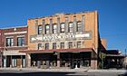
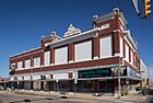
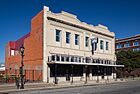
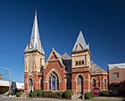
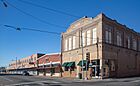
Photo gallery
-
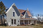
Gen. Hal C. Horton Home
-
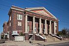
Kavanaugh United Methodist Church
-
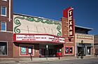
The Texan
-
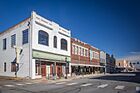
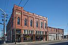
Downtown Greenville
-
Downtown Greenville
-
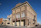
Kress Building
-
Fred Ende Building
-
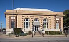
United States Post Office
-

Downtown Greenville
-
Downtown Greenville
-
Central Christian Church
-
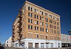
Washington Hotel
-
Downtown Greenville
-
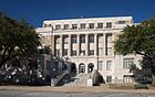
Hunt County Courthouse
-
Ende Building
-
Masonic Lodge
.jpg)
.jpg)
.jpg)
.jpg)
.jpg)
.jpg)
.jpg)
.jpg)
.jpg)
.jpg)
.jpg)
.jpg)
.jpg)
.jpg)
.jpg)
.jpg)
See also
 In Spanish: Greenville (Texas) para niños
