
Randall, Minnesota facts for kids
Quick facts for kids
Randall, Minnesota
|
|
|---|---|

Houses in Randall
|
|
| Motto(s):
Little City with a Big Heart
|
|

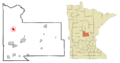
Location in Morrison County and the state of Minnesota
|
|
| Country | United States |
| State | Minnesota |
| County | Morrison |
| Area | |
| • Total | 2.00 sq mi (5.18 km2) |
| • Land | 2.00 sq mi (5.18 km2) |
| • Water | 0.00 sq mi (0.00 km2) |
| Elevation | 1,178 ft (359 m) |
| Population
(2020)
|
|
| • Total | 607 |
| • Density | 303.65/sq mi (117.25/km2) |
| Time zone | UTC-6 (Central (CST)) |
| • Summer (DST) | UTC-5 (CDT) |
| ZIP code |
56475
|
| Area code(s) | 320 |
| FIPS code | 27-53080 |
| GNIS feature ID | 2396313 |
Randall is a small city located in Morrison County, Minnesota, in the United States. In 2020, about 607 people lived there. Randall is known as the "Little City with a Big Heart."
Contents
History of Randall
Randall was first planned out in 1890. It was named after John H. Randall, who worked for the railroad. A post office opened in Randall in 1889, and the city officially became a city in 1900.
The Great Flood of 1972
On July 21 and 22, 1972, Randall experienced a huge flash flood. The Little Elk River overflowed its banks, and the downtown area of Randall was completely flooded. For several weeks, cars could not drive through the area.
People living in Randall said that over 13 inches (330 mm) of rain fell in just one day! While there are no official rain records for Randall itself, a weather station nearby in Fort Ripley recorded 10.84 inches (275 mm) of rain in 24 hours. This was the second-biggest one-day rainfall ever recorded in Minnesota at that time.
The flood caused even more problems because it happened just 12 days after another big storm. That earlier storm had already dropped up to 7 inches (180 mm) of rain, causing floods in towns west of Randall. Because of these storms, almost every major highway in the northern part of Minnesota had to close.
Geography and Nature
Randall is in the northwestern part of Morrison County. It is surrounded by Darling Township to the north, east, and south, and Parker Township to the west. The main roads that go through Randall are U.S. Highway 10 and Minnesota State Highway 115.
- US 10 goes southeast about 11 miles (18 km) to Little Falls, which is the main city for Morrison County.
- US 10 also goes northwest about 20 miles (32 km) to Motley.
- Highway 115 goes east about 8 miles (13 km) to Camp Ripley and the Mississippi River.
The city of Randall covers an area of about 2.00 square miles (5.18 km2), and all of it is land. Randall is located right next to the Little Elk River. This river flows into the Mississippi River about 10 miles (16 km) to the southeast.
The area around Randall has rolling hills and wide river valleys. It's also on the edge of the Brainerd Lakes area, which is famous for its many lakes.
- The biggest lake nearby is Lake Alexander, about 8 miles (13 km) north of Randall. It's known for its clear water and great fishing.
- Many smaller lakes are also in the area, like Little Round Lake, Green Prairie Fish Lake, Fish Trap Lake, Round Lake, and Lake Shamineau. These lakes offer lots of fun activities all year round, like fishing, boating, and swimming.
Population and People
| Historical population | |||
|---|---|---|---|
| Census | Pop. | %± | |
| 1910 | 195 | — | |
| 1920 | 301 | 54.4% | |
| 1930 | 302 | 0.3% | |
| 1940 | 362 | 19.9% | |
| 1950 | 425 | 17.4% | |
| 1960 | 516 | 21.4% | |
| 1970 | 536 | 3.9% | |
| 1980 | 527 | −1.7% | |
| 1990 | 571 | 8.3% | |
| 2000 | 535 | −6.3% | |
| 2010 | 650 | 21.5% | |
| 2020 | 607 | −6.6% | |
| U.S. Decennial Census | |||
What the 2010 Census Showed
In 2010, the city of Randall had 650 people living there. There were 264 households, which are groups of people living together in one home.
- About 34% of households had children under 18 years old.
- About 42% were married couples living together.
- The average household had about 2.45 people.
The average age of people in Randall was about 33.9 years old.
- About 27% of residents were under 18.
- About 9% were between 18 and 24.
- About 28% were between 25 and 44.
- About 21% were between 45 and 64.
- About 15% were 65 years old or older.
The population was almost evenly split between males (50.2%) and females (49.8%).
Getting Around
The Empire Builder train, run by Amtrak, travels through Randall. This train goes between Seattle/Portland and Chicago. However, the train does not stop in Randall. The closest train station is in Staples, which is about 28 miles (45 km) to the northwest.
Schools
Randall has one elementary school called Dr. S G Knight Elementary School. It is part of the Little Falls School District. This school teaches students from kindergarten all the way through fifth grade.
Images for kids
-

Houses in Randall
-
Location in Morrison County and the state of Minnesota
See also
 In Spanish: Randall (Minnesota) para niños
