
Morrison County, Minnesota facts for kids
Quick facts for kids
Morrison County
|
|
|---|---|

|
|

Location within the U.S. state of Minnesota
|
|
 Minnesota's location within the U.S. |
|
| Country | |
| State | |
| Founded | February 25, 1856 |
| Named for | William and Allan Morrison |
| Seat | Little Falls |
| Largest city | Little Falls |
| Area | |
| • Total | 1,153 sq mi (2,990 km2) |
| • Land | 1,125 sq mi (2,910 km2) |
| • Water | 28 sq mi (70 km2) 2.5%% |
| Population
(2020)
|
|
| • Total | 34,010 |
| • Estimate
(2023)
|
34,250 |
| • Density | 29.497/sq mi (11.389/km2) |
| Time zone | UTC−6 (Central) |
| • Summer (DST) | UTC−5 (CDT) |
| Congressional district | 8th |
Morrison County is a county in the state of Minnesota, USA. In 2020, about 34,010 people lived here. The main city and government center is Little Falls. A large military training area called Camp Ripley Military Reservation is also located in the northern part of the county.
Contents
History of Morrison County
Long ago, Dakotah and Ojibwe Native American tribes lived in central Minnesota, especially near the Mississippi River. From the 1600s to the 1800s, French and English fur traders and explorers traveled through this area. They used the Mississippi River to move their goods and trade with the Native Americans. Morrison County is named after two fur trading brothers, William and Allan Morrison.
Early Explorers and Settlers
In the 1800s, three important explorers came through the area that would become Morrison County:
- In 1805, Zebulon Pike explored the region.
- In 1820, Michigan Territory Governor Lewis Cass led an expedition.
- In 1836, scientist Joseph Nicollet created the first accurate map of the Mississippi River area.
Missionaries were some of the first European settlers. In 1838, Methodist missionaries briefly settled near the Little Elk River. Later, in 1849, Reverend Frederic and Elisabeth Ayer started a mission and school for the Ojibwe people in the Belle Prairie area. In 1852, Father Francis Xavier Pierz helped start many communities in central Minnesota, including Sobieski and Pierz in Morrison County.
How Morrison County Was Formed
The Wisconsin Territory was created in 1836. Then, the Minnesota Territory was formed in 1849. In 1856, a part of Benton County was separated to create Morrison County. Little Falls became the county seat, which is the main town where the county government is located. The county was named after the Morrison brothers, who were early fur traders.
Building Fort Ripley and Growth
A big step for the county's growth was the building of Fort Ripley in 1849. To help build the fort, a company called the Little Falls Mill and Land Company built a dam and a sawmill. This fort was first built to protect the Winnebago Native Americans, who had moved to central Minnesota. However, the plan didn't work, and the Winnebago moved again in 1855.
The Little Falls area was first settled in 1848. It grew slowly at first, facing some economic challenges. But it kept growing and officially became a village in 1879.
New Industries and People
Between 1880 and 1920, many different groups of people moved to Morrison County. This happened because a new dam was built in Little Falls in 1887. Investors from Kentucky helped pay for the dam. They wanted their investment to succeed, so they encouraged big companies to move to the city. These companies used the water power from the dam.
Two important businesses that started in Little Falls in 1890 were Pine Tree Lumber Company and Hennepin Paper Company. In 1889, Little Falls changed from a village to a city. Nathan Richardson, one of the people who helped create Morrison County, became the city's first mayor.
Geography of Morrison County
Morrison County has low, rolling hills, some covered with trees. The land is also used for farming. The famous Mississippi River flows south through the western part of the county.
Rivers and Waterways
Several other rivers flow through Morrison County:
- The Platte River flows south and joins the Mississippi River.
- The Little Elk River starts in the county and flows east to join the Mississippi River near Little Falls.
- The Nokasippi River also flows into the Mississippi River near Camp Ripley.
- The Skunk River flows through the eastern part of the county and joins the Platte River.
The county covers about 1,153 square miles. Most of this (1,125 square miles) is land, and 28 square miles (about 2.5%) is water.
Important Roads
 U.S. Highway 10
 Minnesota State Highway 25
 Minnesota State Highway 27
 Minnesota State Highway 28
 Minnesota State Highway 115
 Minnesota State Highway 238
 Minnesota State Highway 371
Airports
- Little Falls/Morrison County Airport (LXL) - located southeast of Little Falls.
Neighboring Counties
- Cass County - to the north
- Crow Wing County - to the northeast
- Mille Lacs County - to the east
- Benton County - to the southeast
- Stearns County - to the south
- Todd County - to the west
Protected Natural Areas
Morrison County has many parks and wildlife areas where nature is protected. These include:
- Belle Prairie County Park
- Charles A. Lindbergh State Park
- Coon Lake State Wildlife Management Area
- Crane Meadows National Wildlife Refuge
- Crane Meadows State Wildlife Management Area
- Crow Wing State Park (part)
- Culdrum State Wildlife Management Area
- Ereaua State Wildlife Management Area
- Lake Alexander Woods Scientific and Natural Area
- Little Elk State Wildlife Management Area
- Mud Lake State Wildlife Management Area
- Neitermeier State Wildlife Management Area
- Popple Lake State Wildlife Management Area
- Rice-Skunk Lake State Wildlife Management Area
- Richardson State Wildlife Management Area
- Ripley Esker Scientific and Natural Area
- Sponsa State Wildlife Management Area
- Wittiker State Wildlife Management Area
Population of Morrison County
| Historical population | |||
|---|---|---|---|
| Census | Pop. | %± | |
| 1860 | 618 | — | |
| 1870 | 1,681 | 172.0% | |
| 1880 | 5,875 | 249.5% | |
| 1890 | 13,325 | 126.8% | |
| 1900 | 22,891 | 71.8% | |
| 1910 | 24,053 | 5.1% | |
| 1920 | 25,841 | 7.4% | |
| 1930 | 25,442 | −1.5% | |
| 1940 | 27,473 | 8.0% | |
| 1950 | 25,832 | −6.0% | |
| 1960 | 26,641 | 3.1% | |
| 1970 | 26,949 | 1.2% | |
| 1980 | 29,311 | 8.8% | |
| 1990 | 29,604 | 1.0% | |
| 2000 | 31,712 | 7.1% | |
| 2010 | 33,198 | 4.7% | |
| 2020 | 34,010 | 2.4% | |
| 2023 (est.) | 34,250 | 3.2% | |
| U.S. Decennial Census 1790-1960 1900-1990 1990-2000 2010-2020 |
|||
The population of Morrison County has grown steadily over the years. In 2020, the county had 34,010 people. Most of the people living in Morrison County are White.
Cities and Towns
Morrison County has several cities and many smaller communities.
Cities in Morrison County
Smaller Communities (Unincorporated)
These are smaller towns or areas that are not officially cities.
- Belle Prairie
- Center Valley
- Cushing
- Darling
- Freedhem
- Gregory
- Lincoln
- Little Rock
- Morrill
- North Prairie
- Platte
- Ramey
- Shamineau Park
- Sullivan
- Vawter
Townships
Townships are smaller local government areas within the county.
- Agram Township
- Belle Prairie Township
- Bellevue Township
- Buckman Township
- Buh Township
- Culdrum Township
- Cushing Township
- Darling Township
- Elmdale Township
- Granite Township
- Green Prairie Township
- Hillman Township
- Lakin Township
- Leigh Township
- Little Falls Township
- Morrill Township
- Motley Township
- Mount Morris Township
- Parker Township
- Pierz Township
- Pike Creek Township
- Platte Township
- Pulaski Township
- Rail Prairie Township (no longer exists)
- Richardson Township
- Ripley Township
- Rosing Township
- Scandia Valley Township
- Swan River Township
- Swanville Township
- Two Rivers Township
Images for kids
-
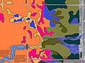
Soils of Rice Area Sportsmen's WMA neighborhood

See also
 In Spanish: Condado de Morrison para niños
