Lastrup, Minnesota facts for kids
Quick facts for kids
Lastrup, Minnesota
|
|
|---|---|

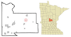
Location in Morrison County and the state of Minnesota
|
|
| Country | United States |
| State | Minnesota |
| County | Morrison |
| Area | |
| • Total | 0.38 sq mi (0.99 km2) |
| • Land | 0.37 sq mi (0.95 km2) |
| • Water | 0.01 sq mi (0.03 km2) |
| Elevation | 1,237 ft (377 m) |
| Population
(2020)
|
|
| • Total | 120 |
| • Density | 325.20/sq mi (125.69/km2) |
| Time zone | UTC-6 (Central (CST)) |
| • Summer (DST) | UTC-5 (CDT) |
| ZIP code |
56344 (P.O. box)
56364 (Pierz) |
| Area code(s) | 320 |
| FIPS code | 27-35720 |
| GNIS feature ID | 2395637 |
Lastrup is a small city in Morrison County, Minnesota, United States. In 2020, about 120 people lived there.
Contents
History of Lastrup
Lastrup was started by people who moved from a small farming area called Schnelten. This place was near a town also named Lastrup in Lower Saxony, Germany.
Geography of Lastrup
Lastrup is located in the eastern part of Morrison County. Minnesota State Highway 27 is the main road that goes through the city. This highway can take you about 6 miles (10 km) southwest to Pierz. It also goes about 20 miles (32 km) to Little Falls, which is the main town for the county. If you go east on the highway for about 20 miles (32 km), you will reach Onamia.
Land and Water Features
The city of Lastrup covers a total area of about 0.38 square miles (0.99 square kilometers). Most of this area is land, but a small part, about 0.01 square miles (0.03 square kilometers), is water.
Inside the city limits, you can find two small bodies of water called Lastrup Lake and Ortman Lake. A small stream named Little Mink Creek also flows through the southeast part of the city. This creek eventually joins the Platte River, which then flows into the large Mississippi River.
Population and People
The number of people living in Lastrup has changed over the years. Here's a quick look at the population counts from different years:
- 1920: 121 people
- 1930: 118 people
- 1940: 128 people
- 1950: 158 people
- 1960: 138 people
- 1970: 161 people
- 1980: 150 people
- 1990: 112 people
- 2000: 99 people
- 2010: 104 people
- 2020: 120 people
Lastrup in 2010
According to the census from 2010, there were 104 people living in Lastrup. These people lived in 49 different homes, and 30 of those were families. The city had about 236 people per square mile (91 people per square kilometer).
All the people living in Lastrup at that time were identified as White.
Households and Families
Out of the 49 homes in 2010:
- About 24.5% had children under 18 years old living there.
- About 53.1% were married couples living together.
- About 6.1% had a female head of the house with no husband.
- About 2.0% had a male head of the house with no wife.
- About 38.8% were not families.
Also, about 32.7% of all homes had only one person living there. About 8.2% of homes had someone living alone who was 65 years old or older. On average, there were 2.12 people in each home and 2.70 people in each family.
Age and Gender
In 2010, the average age of people in Lastrup was 41.5 years old.
- 17.3% of the people were under 18 years old.
- 9.6% were between 18 and 24 years old.
- 28.9% were between 25 and 44 years old.
- 28.9% were between 45 and 64 years old.
- 15.4% were 65 years old or older.
When it came to gender, 49.0% of the people in Lastrup were male, and 51.0% were female.
See also
 In Spanish: Lastrup (Minnesota) para niños
 | Percy Lavon Julian |
 | Katherine Johnson |
 | George Washington Carver |
 | Annie Easley |

