Raton Mesa facts for kids
Quick facts for kids Raton Mesa |
|
|---|---|

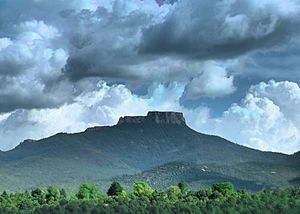
Raton Mesa, the highest of the Raton Mesas, stands majestically over Trinidad, Colorado. Its summit, Fishers Peak, reaches an elevation that dominates the surrounding landscape, marking the northern edge of the Raton Basin. This iconic mesa, once known as Raton Mountain, is not only a natural landmark but also the namesake for the entire cluster of mesas that stretch along the Colorado-New Mexico border.
|
|
| Location | Las Animas County, Colorado, United States |
| Designated: | 1967 |
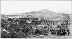
Raton Mesa is a large, flat-topped mountain that looks over the town of Trinidad in Las Animas County, Colorado. Its highest point is called Fishers Peak. In 1967, the U.S. government named it a National Natural Landmark. This means it's a special place because of its unique natural features.
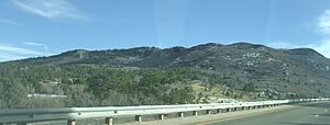
Raton Mesa also gives its name to Raton Pass. It's part of a group of similar landforms called the Raton Mesas. These mesas stretch between New Mexico and Colorado.
The Raton Mesas were formed by ancient volcanoes. Hot lava flowed out and cooled into hard rock called basalt. Over millions of years, softer rocks around the basalt wore away. This left behind the tall, flat-topped mesas we see today.
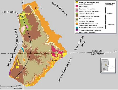
The Raton Mesas start near the Sangre de Cristo Mountains. They go eastward for about 90 miles (140 km). This long chain reaches all the way to the Oklahoma panhandle. Besides Raton Mesa itself, other important mesas include Bartlett Mesa and Horseshoe Mesa.
Just like "New York" can mean a city or a state, "Raton" refers to both a single mesa and the whole group of mesas.
Exploring Raton Mesa's Landscape
Interstate Highway 25 goes through Raton Pass. This pass is about 7,834 feet (2,388 m) high. It separates the mountains to the west from the mesa country to the east.
For this article, Raton Mesa is the area east of Interstate 25. It lies between Trinidad, Colorado and Raton, New Mexico. This area is about 19 miles (30 km) long from north to south. It stretches eastward for about 13 miles (21 km).
Within this area, there are three main mesas. They are separated by deep canyons.
- Fishers Peak Mesa is in Colorado. It reaches a height of 9,633 feet (2,936 m).
- Bartlett Mesa is mostly in New Mexico. Its highest point is about 8,900 feet (2,700 m).
- Barela/Horseshoe/Horse Mesa sits on the state line. It reaches about 8,757 feet (2,669 m) high.
The land at the bottom of these mesas is already quite high, at 6,000 feet (1,800 m) or more.
Plants and Animals of Raton Mesa
The flat tops of the mesas are mostly covered in grassland. However, their steep sides have many trees. Ponderosa pine trees are very common. Higher up, you can find quaking aspen, Douglas fir, and white fir. Lower down, there are pinyon trees, juniper trees, and Gambel oak.
Many animals live here. You might see American black bears, cougars, and mule deer. Beavers also make their homes in the area. Elk are especially common. You can often spot herds of more than 100 elk. Hunting, especially for elk, is a popular activity during certain times of the year. This happens on both public and private lands.
Visiting Raton Mesa's Public Lands
There are no public roads that go all the way to the top of the mesas. The only public road that enters the area is through Sugarite Canyon State Park in New Mexico. This road stops shortly after crossing into Colorado. It reaches an altitude of about 7,560 feet (2,300 m).
This road gives access to three public areas on Raton Mesa:
- Sugarite Canyon State Park in New Mexico, which is about 3,600 acres (15 km2).
- Lake Dorothey State Wildlife Area in Colorado, about 5,152 acres (20.85 km2).
- James M. John State Wildlife Area in Colorado, about 8,339 acres (33.75 km2).
From the parking area at Lake Dorothey, Fishers Peak is about eight miles away. You can reach it by an unmarked trail.
A large part of Raton Mesa in Colorado, including Fishers Peak, was once private land. It was known as the Crazy French Ranch. In 2019, this 19,200-acre (7,770 ha) ranch was bought. It became a new Colorado state park. Funds for this purchase came from several groups. These included Great Outdoors Colorado, The Nature Conservancy, and the Trust for Public Land.
 | Sharif Bey |
 | Hale Woodruff |
 | Richmond Barthé |
 | Purvis Young |


