Richford (CDP), Vermont facts for kids
Quick facts for kids
Richford, Vermont
|
|
|---|---|

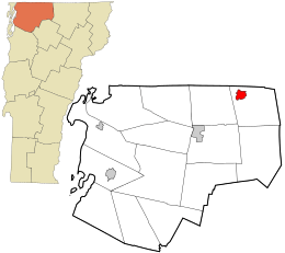
Location in Franklin County and the state of Vermont.
|
|
| Country | United States |
| State | Vermont |
| County | Franklin |
| Town | Richford |
| Area | |
| • Total | 4.9 sq mi (13 km2) |
| • Land | 4.8 sq mi (12 km2) |
| • Water | 0.1 sq mi (0.3 km2) |
| Elevation | 443 ft (135 m) |
| Population
(2010)
|
|
| • Total | 1,361 |
| • Density | 734/sq mi (283.4/km2) |
| Time zone | UTC-5 (Eastern (EST)) |
| • Summer (DST) | UTC-4 (EDT) |
| ZIP code |
05476
|
| Area code(s) | 802 |
| GNIS feature ID | 2378132 |
| FIPS code | 50-59050 |
Richford is a small community in Franklin County, Vermont, United States. It's known as a census-designated place (CDP), which means it's a specific area identified by the U.S. Census Bureau for statistical purposes. In 2010, about 1,361 people lived in Richford, making it the main part of the larger town of Richford.
Contents
Where is Richford, Vermont?
Richford is located in the northwest part of the town of Richford. It sits right next to the Missisquoi River. This river is a key natural feature of the area.
How to Get Around Richford
Two main roads help people travel through Richford. Vermont Route 105 runs through the community. It stays on the south side of the Missisquoi River. This route can take you east about 18 miles over the Green Mountains to North Troy. If you go southwest, it follows the Missisquoi River valley for about 10 miles to Enosburg Falls.
Vermont Route 139, also known as Main Street, crosses VT 105 in the southern part of Richford. After crossing the Missisquoi River, it becomes Province Street. This road leads north about 1.5 miles directly to the Canada–United States border.
Crossing the Border to Canada
If you continue north from the border on the Canadian side, Quebec Route 139 takes you about 7 miles to Sutton, Quebec. This shows how close Richford is to Canada.
What is Richford's Size?
The Richford CDP covers a total area of about 4.9 square miles. Most of this area, about 4.8 square miles, is land. A small part, about 0.1 square miles, is water. This water area makes up about 2% of Richford's total size.
See also
 In Spanish: Richford (condado de Franklin) para niños
 | James Van Der Zee |
 | Alma Thomas |
 | Ellis Wilson |
 | Margaret Taylor-Burroughs |

