Steer Creek (West Virginia) facts for kids
Quick facts for kids Steer Creek |
|
|---|---|
|
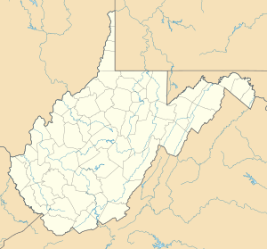
Location of the mouth of Steer Creek in Calhoun County, West Virginia
|
|
| Country | United States |
| State | West Virginia |
| Counties | Gilmer, Calhoun |
| Physical characteristics | |
| Main source | Right Fork Steer Creek western Braxton County 1,230 ft (370 m) 38°38′41″N 80°55′57″W / 38.6448192°N 80.9326051°W |
| 2nd source | Left Fork Steer Creek central Braxton County 1,242 ft (379 m) 38°43′01″N 80°46′40″W / 38.717042°N 80.7778777°W |
| River mouth | Little Kanawha River southeast of Grantsville, Calhoun County 673 ft (205 m) 38°52′27″N 81°03′24″W / 38.8742550°N 81.0567776°W |
| Length | 6.3 mi (10.1 km) |
| Basin features | |
| Basin size | 184 sq mi (480 km2) |
Steer Creek is a stream in central West Virginia in the United States. It flows into the Little Kanawha River. This creek is part of a much larger water system. Its waters eventually join the Ohio River and then the mighty Mississippi River. This means Steer Creek is part of the huge area of land that drains into the Mississippi River, called a watershed.
Steer Creek itself is about 6.3 miles (10.1 km) long. However, if you include its longest starting branch, called the Right Fork, it stretches to about 31.7 miles (51.0 km). The creek drains an area of about 184 square miles (477 km²). This area is mostly rural and sits on a part of the Allegheny Plateau that was not covered by glaciers long ago.
Contents
Where Steer Creek Begins
Steer Creek is formed when two smaller streams, called forks, meet. These are the Right Fork Steer Creek and the Left Fork Steer Creek.
Right Fork Steer Creek
The Right Fork Steer Creek is about 25.4 miles (40.9 km) long. It starts in western Braxton County, about 5 miles (8 km) northwest of a town called Frametown. From there, it flows generally towards the north-northwest. As it travels, it passes through southern Gilmer County and goes by the communities of Tague, Rosedale, and Shock.
Left Fork Steer Creek
The Left Fork Steer Creek is about 24.5 miles (39.4 km) long. It begins in central Braxton County, about 3 miles (5 km) north of Gassaway. This fork flows mostly northwestward. It also enters southern Gilmer County, passing through the towns of Chapel, Normantown, and Lockney.
Journey to the Little Kanawha River
The Right Fork and Left Fork of Steer Creek come together at a place called Stumptown in Gilmer County. From this meeting point, the main part of Steer Creek flows west-northwest. It then enters eastern Calhoun County. Finally, Steer Creek joins the Little Kanawha River about 4 miles (6 km) southeast of Grantsville.
Nature Around Steer Creek
The land around Steer Creek is mostly covered by nature. According to the West Virginia Department of Environmental Protection, about 91.1% of the Steer Creek watershed is forest. Most of these trees are deciduous, meaning they lose their leaves in the fall. The remaining 8.7% of the land is used for pasture (where animals graze) and agriculture (farming).
 | William L. Dawson |
 | W. E. B. Du Bois |
 | Harry Belafonte |


