
Braxton County, West Virginia facts for kids
Quick facts for kids
Braxton County
|
|||
|---|---|---|---|

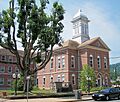
The Braxton County Courthouse in Sutton in 2007
|
|||
|
|||

Location within the U.S. state of West Virginia
|
|||
 West Virginia's location within the U.S. |
|||
| Country | |||
| State | |||
| Founded | January 15, 1836 | ||
| Named for | Carter Braxton | ||
| Seat | Sutton | ||
| Largest town | Sutton | ||
| Area | |||
| • Total | 516.28 sq mi (1,337.2 km2) | ||
| • Land | 510.74 sq mi (1,322.8 km2) | ||
| • Water | 5.54 sq mi (14.3 km2) | ||
| Population
(2020)
|
|||
| • Total | 12,447 | ||
| • Estimate
()
|
12,247 |
||
| • Density | 24.37/sq mi (9.41/km2) | ||
| Time zone | UTC−5 (Eastern) | ||
| • Summer (DST) | UTC−4 (EDT) | ||
| Congressional district | 1st | ||

Braxton County is a county in the central part of West Virginia, a state in the United States. In 2020, about 12,447 people lived here. The main town and county seat is Sutton.
The county was started in 1836. It was made from parts of other counties like Lewis, Kanawha, and Nicholas. It was named after Carter Braxton. He was an important person from Virginia who signed the Declaration of Independence.
In 2010, the very center of West Virginia was found in the northern part of Braxton County. This means it's right in the middle of the state!
Long ago, important places for making salt were found in an area called Bulltown. This area has a lot of history. Early settlers and Native American groups sometimes had conflicts here.
Contents
About Braxton County
Where is Braxton County?
Braxton County covers about 516 square miles. Most of this area, about 511 square miles, is land. The rest, about 5.5 square miles, is water.
In the past, West Virginia counties were split into smaller areas to help with local government. These areas were first called townships. Later, in 1872, they became known as magisterial districts. Braxton County first had four of these districts. Over time, their names changed. Today, the county is divided into four new magisterial districts: Northern, Southern, Eastern, and Western.
Roads and Neighbors
You can find several important roads that go through Braxton County. These include:
 Interstate 79
 U.S. Highway 19
 West Virginia Route 4
 West Virginia Route 5
 West Virginia Route 15
Braxton County shares its borders with several other counties:
- Lewis County (to the northeast)
- Webster County (to the southeast)
- Nicholas County (to the south)
- Clay County (to the southwest)
- Calhoun County (to the west)
- Gilmer County (to the northwest)
People of Braxton County
| Historical population | |||
|---|---|---|---|
| Census | Pop. | %± | |
| 1840 | 2,575 | — | |
| 1850 | 4,212 | 63.6% | |
| 1860 | 4,992 | 18.5% | |
| 1870 | 6,480 | 29.8% | |
| 1880 | 9,787 | 51.0% | |
| 1890 | 13,928 | 42.3% | |
| 1900 | 18,904 | 35.7% | |
| 1910 | 23,023 | 21.8% | |
| 1920 | 23,973 | 4.1% | |
| 1930 | 22,579 | −5.8% | |
| 1940 | 21,658 | −4.1% | |
| 1950 | 18,082 | −16.5% | |
| 1960 | 15,152 | −16.2% | |
| 1970 | 12,666 | −16.4% | |
| 1980 | 13,894 | 9.7% | |
| 1990 | 12,998 | −6.4% | |
| 2000 | 14,702 | 13.1% | |
| 2010 | 14,523 | −1.2% | |
| 2020 | 12,447 | −14.3% | |
| 2021 (est.) | 12,247 | −15.7% | |
| U.S. Decennial Census 1790–1960 1900–1990 1990–2000 2010–2020 |
|||
What the 2020 Census Shows
The 2020 census counted 12,447 people living in Braxton County. There were 4,532 households, which are groups of people living together in a home.
Most people in the county, about 96.2%, were White. A small number were African American (0.4%), Asian (0.2%), or Native American (0.2%). About 2.8% of people were from two or more races. People who are Hispanic or Latino made up 0.7% of the population.
The average age of people in the county was 46.3 years old. About 19.6% of the people were under 18 years old. The average income for a household was about $42,519. About 18.3% of the people lived below the poverty line, meaning they had very low incomes.
Towns and Areas
Braxton County has several towns and many smaller communities.
Towns You Can Visit
- Burnsville
- Flatwoods
- Gassaway
- Sutton (This is the county seat, where the main government offices are.)
Local Districts
These are the main areas the county is divided into for local government:
- Eastern
- Northern
- Southern
- Western
Other Small Communities
Many smaller, unincorporated communities are also part of Braxton County:
Images for kids
-
The Braxton County Courthouse in Sutton in 2007
See also
 In Spanish: Condado de Braxton para niños
