
Río de la Plata (Puerto Rico) facts for kids
Quick facts for kids La Plata River |
|
|---|---|

La Plata River in 2007
|
|
| Commonwealth | Puerto Rico |
| Municipality | Guayama, Cayey, Comerío, Naranjito, Toa Alta, Toa Baja, and Dorado |
| Physical characteristics | |
| Main source | Guayama, Puerto Rico 18°28′33″N 66°15′19″W / 18.47583°N 66.25528°W |
| River mouth | Atlantic Ocean, at Dorado |
| Length | 46 mi (74 km) |
The La Plata River (in Spanish, Río de la Plata) is the longest river in Puerto Rico. It starts in the southern part of the island and flows north. Eventually, it empties into the Atlantic Ocean near Dorado. This area is known for its beautiful white sandy beaches.
The La Plata River is about 74 kilometers (46 miles) long. It begins in the mountains of Guayama, Puerto Rico, about 800 meters (2,625 feet) above sea level. As it travels, the river passes through several towns. These include Guayama, Cayey, Comerío, Naranjito, Toa Alta, Toa Baja, and Dorado. Along its way, the river also forms two important lakes: Carite Lake and La Plata Lake.
Contents
River Crossings: Famous Bridges
Many bridges cross the La Plata River. One of the most famous is the Arenas Bridge in Cayey. This strong steel bridge was built way back in 1894. It was the longest bridge built by the Spanish in Puerto Rico at that time, and it's still used today!
Another impressive bridge is the Jesús Izcoa Moure Bridge. This is a special type of bridge called a cable-stayed bridge. It connects the towns of Naranjito, Toa Alta, and Bayamon.
History of the La Plata River

Long ago, the Taíno people, who were the native people of Puerto Rico, had a special name for this river. They called it "thoa," which means "mother." This ancient name is why two towns located near the river's mouth are called Toa Alta and Toa Baja.
Hurricane Maria's Impact
On September 20, 2017, Hurricane Maria hit Puerto Rico very hard. The La Plata River, which flows through the middle of Comerío, rose dramatically. The water level went up more than 3.3 meters (11 feet).
This caused huge floods and a lot of damage to the areas along the river. The hurricane destroyed many homes, businesses, the local school, and even the police station in Comerío. Other towns along the river also suffered a lot of damage.
Protecting the River: Flood Control
Because of past floods, the United States Army Corps of Engineers started a big project. This project aims to control flooding in the La Plata River basin. A basin is the area of land that drains into a river.
In mid-2018, they announced a budget of $500 million for this important work. The goal is to protect towns like Toa Baja from future floods caused by the river.
Gallery
-
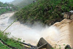
Dam at Río de la Plata in Comerío
-
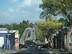
Bridge on Calle Méndez Vigo over Río de la Plata in Dorado
-
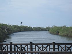
Río de la Plata from Bridge on Calle Méndez Vigo in Dorado
-
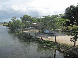
View of river from bridge on Calle Méndez Vigo in Dorado
.jpg)


See also
 In Spanish: Río de la Plata (Puerto Rico) para niños
- Arenas Bridge: A historic bridge over the river
- La Liendre Bridge: A historic bridge over a river that flows into the La Plata River
- Plata Bridge: Another historic bridge over the river
- List of rivers in Puerto Rico
