River Brathay facts for kids
The River Brathay is a beautiful river located in the north-west of England. Its name comes from an old language called Old Norse, and it means "broad river." This river starts high up in the mountains, about 1,289 feet (393 meters) above sea level. It begins near a famous spot called the Three Shire Stone on Wrynose Pass in the amazing Lake District. The area where the river collects its water, called its catchment area, includes parts of mountains like Wetherlam and Great Carrs, which are part of the Furness Fells and Langdale Fells.
Contents
The River's Journey: From Mountains to Lakes
The Brathay begins as a small stream at the top of Wrynose Pass. It quickly flows downhill, dropping about 930 feet (283 meters) over just two miles (3.2 km). It runs alongside the Wrynose Pass road.
How Does the Brathay Flow into Little Langdale Tarn?
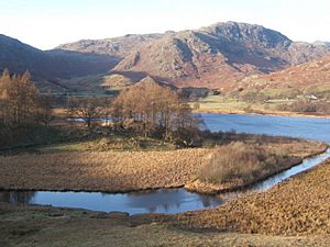
Before the Brathay reaches Little Langdale Tarn, it joins with another stream called Bleamoss Beck. Bleamoss Beck brings water from Blea Tarn. Little Langdale Tarn also gets water from Greenburn Beck. The Brathay then flows out of Little Langdale Tarn from its eastern side.
What Happens at Colwith Force?
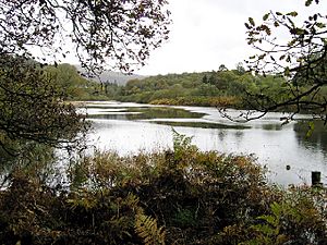
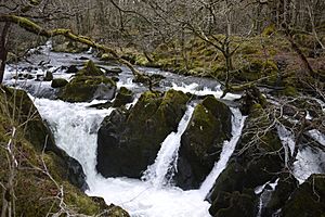
The river continues flowing east and then tumbles over a waterfall called Colwith Force. Here, the water drops about 40 feet (12 meters)! After this, the river turns north and flows into another tarn (a small mountain lake) called Elter Water. Elter Water is about 187 feet (57 meters) above sea level and also receives water from Great Langdale Beck.
Where Does the Brathay Go After Elter Water?
The Brathay leaves Elter Water and flows for about half a mile (0.8 km) towards the south-east. It then goes over Skelwith Force, another waterfall, where it drops 15 feet (4.6 meters). The river then passes under the A593 road at Skelwith Bridge and continues east towards a small village called Clappersgate.
How Does the Brathay Join Windermere?
After another quarter of a mile (400 meters) past Clappersgate, the Brathay meets the River Rothay. They join together near Croft Lodge, just south-west of Ambleside. From there, the combined rivers flow into the northern end of Windermere, which is one of England's largest and most famous lakes.
Fun Activities on the River Brathay
The parts of the River Brathay around Clappersgate and Skelwith Force are very popular for canoeing. People who love paddling can enjoy the river's flow and the beautiful scenery.
The Brathay and County Borders
For its entire length, the River Brathay forms a natural border between two old English counties: Lancashire and Westmorland. However, since 1974, when local government was reorganized, the whole river has been within the modern administrative county of Cumbria.
Brathay Hall and Exploration Group
The river also gives its name to Brathay Hall and the Brathay exploration group. Both of these are located just south of where the Brathay joins the River Rothay, right on the edge of Windermere. The Brathay exploration group is known for its outdoor adventure and learning programs.
 | Jackie Robinson |
 | Jack Johnson |
 | Althea Gibson |
 | Arthur Ashe |
 | Muhammad Ali |


