Great Carrs facts for kids
Quick facts for kids Great Carrs |
|
|---|---|

|
|
| Highest point | |
| Elevation | 788 m (2,585 ft) |
| Prominence | c. 20 m |
| Parent peak | Swirl How |
| Listing | Wainwright, Nuttall |
| Geography | |
| Location | Cumbria, England |
| Parent range | Lake District, Southern Fells |
| OS grid | NY271009 |
| Topo map | OS Landranger 89,90, Explorer OL6 |
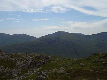
Great Carrs is a beautiful fell (which is another word for a mountain or hill) located in the English Lake District. It stands tall above Wrynose Pass, in the southern part of this famous national park.
Contents
Exploring Great Carrs
The Coniston Fells
Great Carrs is part of a group of fells called the Coniston Fells. These fells separate two valleys: the Coniston Water valley and the Duddon valley. The range starts at Wrynose Pass and stretches south for about 10 miles.
A famous writer named Alfred Wainwright wrote popular guidebooks about the Lake District. He considered Great Carrs to be one of the 214 main fells in the area. Many hikers enjoy trying to visit all of these "Wainwrights."
Swirl How is another important fell nearby. It's often seen as the central point of the Coniston Fells. Great Carrs is the highest point on a long, curved ridge that extends from Swirl How.
Greenburn Valley
Like many fells, Great Carrs has gentle slopes on its western side. But on the eastern side, it has steep cliffs called crags. These crags drop straight down into a valley called Greenburn.
Greenburn is a marshy valley that leads to Little Langdale. Its water eventually flows into the River Brathay. There's a small lake, or tarn, in Greenburn. It used to be a reservoir, created in the 1700s to provide water for the Greenburn Mine.
The mine was used to dig for copper from 1845 to 1865. The shafts went very deep, about 700 feet underground! Today, the dam has broken, leaving behind a collection of pools and bogs.
Wet Side Edge and Wrynose Pass
To the north of Greenburn is a ridge called Wet Side Edge. This ridge has a few smaller tops, including Little Carrs and Hell Gill Pike.
Wrynose Pass is a road that connects Langdale and the Duddon Valley. It's a very old route, even used by the Romans! Across the pass, you can see other fells like Cold Pike and Pike of Blisco.
On the western side of Great Carrs, long slopes lead down to the Duddon valley. This is where the Duddon River begins its journey.
The Sad Story of the Air Crash
There's a sad but important historical site on the ridge between Great Carrs and Swirl How. This area is called Top of Broad Slack. Here, you can find the remains of a Royal Canadian Air Force Handley Page Halifax bomber.
This plane crashed during World War II in 1944. It was flying a navigation exercise at night and got lost in thick clouds. The pilot tried to drop below the clouds to see where they were, but sadly, they were over the fells of Swirl How and Great Carrs. The aircraft hit the mountainside, and everyone on board died.
To prevent other planes from repeatedly reporting the wreckage, it was cut into smaller pieces and spread down Broad Slack. Parts of it are still visible today. Over the years, two of the plane's engines were recovered. One of them is now on display at the Ruskin Museum in Coniston. A wooden cross and a memorial cairn (a pile of stones) also mark the site, honoring those who lost their lives.
Reaching the Top
The very top of Great Carrs has a small cairn on a grassy spot. From here, you can see amazing views! You can look north at many other fells, and on clear days, you might even see the Isle of Man or the Pennines mountain range.
Many people climb Great Carrs by following the Wet Side Edge route from Little Langdale. You can also reach the Edge from the top of Wrynose Pass. Some hikers also arrive at Great Carrs after climbing Swirl How or Grey Friar.
 | Ernest Everett Just |
 | Mary Jackson |
 | Emmett Chappelle |
 | Marie Maynard Daly |


