Grey Friar facts for kids
Quick facts for kids Grey Friar |
|
|---|---|

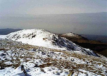
Grey Friar from Great Carrs, one km to the east, Harter Fell is in the background.
|
|
| Highest point | |
| Elevation | 770 m (2,530 ft) |
| Prominence | 78 m (256 ft) |
| Parent peak | Swirl How |
| Listing | Hewitt, Nuttall, Wainwright |
| Geography | |
| Location | Cumbria, England |
| Parent range | Lake District, Southern Fells |
| OS grid | NY259003 |
| Topo map | OS Landranger 96, 90 OS Explorer OL6 |
Grey Friar is a cool mountain, or "fell," located in the beautiful Lake District in England. It's part of a group of mountains called the Coniston Fells. Standing at 770 meters (about 2,526 feet) tall, Grey Friar is a bit off by itself compared to the other Coniston Fells. This means it's often the quietest and least visited mountain in the group. It's a pretty big fell, forming the eastern side of the Duddon Valley for many kilometers. All the water flowing off Grey Friar goes into the Duddon Valley, not into Coniston Water.
Contents
Exploring Grey Friar's Landscape
The Coniston Fells are like a natural wall that separates Coniston Water from the Duddon Valley to the west. This mountain range starts at Wrynose Pass and stretches south for about 16 kilometers (10 miles). Grey Friar is special because it's the only major mountain in this group that isn't directly on the main line of fells. It stands to the west of Great Carrs.
The northern and western sides of Grey Friar have long, rough slopes with many small rocky areas. The southern edge of the mountain is shaped by Seathwaite Tarn and the streams that flow from it.
Seathwaite Tarn: A Watery Feature
Seathwaite Tarn is a mountain lake that was made much bigger in the early 1900s. This was done to provide drinking water for the nearby area of Barrow-in-Furness. The dam that created the larger tarn is almost 400 yards long. It's made of concrete with slate supports, and the lake is now about 24 meters (80 feet) deep. Water isn't taken directly from the tarn. Instead, it flows a bit further downriver to a special spot where it's collected. Grey Friar curves southward, so the main mountain ridge stands across the tarn. Brim Fell and the back of Dow Crag form the opposite side of the lake.
Mining History on Grey Friar
People used to mine for copper on Grey Friar a lot in the past. The Seathwaite mine was located on the southern slopes, just above Seathwaite Tarn. Another mine, called Cockley Beck mine, was on the lower northwestern slopes of the fell. These mines were active in the mid-1800s. However, they weren't as successful or as large as the main Coniston copper mines, which were in a place called the "Coppermines Valley."
How to Climb Grey Friar
You can climb Grey Friar from a few different places. Often, people climb it as part of a longer hike that includes the other six Coniston fells. This longer walk usually starts from Coniston village. If you want to climb just Grey Friar, you can start your journey from the Duddon Valley, the top of the Wrynose Pass, or from Cockley Beck.
Reaching the Summit
The very top of Grey Friar is rocky. It has two piles of stones, called cairns, on rocky outcrops. The one to the southeast is a bit higher. However, the cairn to the northwest offers a better view of the surrounding area. From the summit, you can see the impressive Scafell massif and get great views of the other Coniston fells stretching along the ridge to the south. About 200 meters (650 feet) northwest of the main summit, there's a unique pointed rock. People often call this rock the "Matterhorn Rock" because of its shape.
 | Sharif Bey |
 | Hale Woodruff |
 | Richmond Barthé |
 | Purvis Young |


