Harter Fell (Eskdale) facts for kids
Quick facts for kids Harter Fell |
|
|---|---|

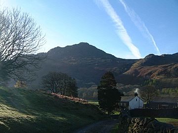
Harter Fell as seen from Wha House Farm in Eskdale
|
|
| Highest point | |
| Elevation | 649 m (2,129 ft) |
| Prominence | c. 276 m |
| Parent peak | Scafell Pike |
| Listing | Marilyn, Hewitt, Wainwright, Nuttall |
| Geography | |
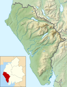
| Location | Cumbria, England |
| Parent range | Lake District, Southern Fells |
| OS grid | SD218997 |
| Topo map | OS Landranger 96, Explorer OL6 |
Harter Fell is a beautiful fell (which is a type of mountain or hill) in the western part of the English Lake District. It stands tall between two lovely valleys: Eskdale and Duddon. This fell is 649 meters (about 2,128 feet) high. Many people enjoy hiking up to its top using different walking paths.
Contents
Exploring Harter Fell's Landscape
Harter Fell is part of a long line of hills that stretches for about 15 miles. This ridge starts near Crinkle Crags and goes all the way to the sea. Harter Fell is one of the first fells on this ridge, right after Hard Knott. They are separated by a mountain road called Hardknott Pass.
From Harter Fell, the ridge continues over other fells like Green Crag and Whitfell. A famous guidebook writer named Alfred Wainwright loved Harter Fell. He said it was one of the few fells that could be described as beautiful. He especially liked how it looked from Eskdale.
The sides of Harter Fell are covered with many Forestry Commission trees. These tall, green trees sweep down into the Duddon Valley, making the area look very green and wild. Harter Fell often looks like a cone-shaped hill from a distance. This is because its slopes are quite round.
Views from Harter Fell's Summit
When you reach the top of Harter Fell, you'll find three rocky peaks, called tors. The middle one is the highest point. There's also a special marker there used for mapping.
From the summit, you can see amazing views all around. You can spot many other famous fells that form a circle around Eskdale. These include Sca Fell, Scafell Pike (England's highest mountain), Broad Crag, Great End, Esk Pike, Bow Fell, and Crinkle Crags.
Looking south, you can see the sandy areas of the Duddon estuary and Morecambe Bay. If you look west, you might even catch a glimpse of the Irish Sea and the distant Isle of Man on a clear day!
Harter Fell's Volcanic Past
Harter Fell is a great place to learn about how the Earth was formed long ago. The fell is mostly made of lava from ancient volcanoes. These rocks are called andesite. When the lava flowed out, it sometimes broke into pieces on the surface.
The top of the fell is made of one type of lava flow. Just a little lower down, you can find another type of volcanic rock called Dacite. Deeper down, there are even more layers of different volcanic rocks. These include tuff, which is made of volcanic ash and small rock pieces.
On the northern side of the fell, you can see layers of sandstone mixed in with the lava flows. This sandstone was formed from volcanic material. In the past, people even found a small amount of copper ore on the northern slopes. There are still some signs of this old mining activity from the Victorian era.
Hiking Up Harter Fell
There are several ways to climb Harter Fell, depending on where you start.
- From Eskdale: You can begin your walk from Jubilee Bridge in the west. Another option is to start from the top of Hardknott Pass in the east.
- From Duddon Valley: Many walkers start from the car park at Birks Bridge. This path goes fairly straight up from the west. You could also start from Fickle Steps and walk around the fell clockwise to join the path from Jubilee Bridge.
Harter Fell is also the last big challenge for hikers doing the famous Woolpack walk. This walk is usually done in a specific direction, and Harter Fell is the final climb.
 | Aaron Henry |
 | T. R. M. Howard |
 | Jesse Jackson |


