Hard Knott facts for kids
Quick facts for kids Hard Knott |
|
|---|---|
| Highest point | |
| Elevation | 549 m (1,801 ft) |
| Prominence | 154 m (505 ft) |
| Parent peak | Scafell Pike |
| Listing | Marilyn, Wainwright |
| Geography | |
| Location | Cumbria, England |
| Parent range | Lake District, Southern Fells |
| OS grid | NY231023 |
| Topo map | OS Landrangers 89, 90, Explorer OL6 |
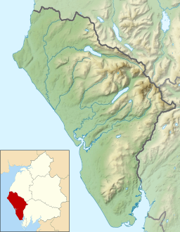
Hard Knott is a famous 'fell' (which means a hill or mountain) found in the amazing Lake District in England. It sits right at the top of a valley called Eskdale. This area is known for its stunning views and challenging hikes. Hard Knott is a popular spot for adventurers and nature lovers.
Contents
Exploring Hard Knott's Landscape
Hard Knott is part of a long line of hills that stretches for about 15 kilometers (9 miles). This ridge separates the starting points of two rivers: the River Esk and the Duddon. The ridge begins at a larger fell called Crinkle Crags. Hard Knott is the first major fell you reach along this ridge.
Famous Fells and Guides
After Hard Knott, the ridge continues to other fells like Harter Fell and Green Crag. A very famous guidebook writer named Alfred Wainwright wrote about the fells of the Lake District. He didn't include all the hills on this ridge in his main books at first. However, he later added them to a special extra book called The Outlying Fells of Lakeland. This shows how important these hills are to explorers.
Unique Features of Hard Knott
Hard Knott has some interesting features. On one side, the slopes are gentle. But on the western side, above the River Esk, you'll find steep cliffs. One cool rock formation here is called the Eskdale Needle. It's also known as The Steeple. This is a tall, thin piece of rock that stands apart from the main cliff face.
The Hardknott Pass and Roman Fort
A very steep and winding road, known as the Hardknott Pass, goes over the fell. This road connects Eskdale with the Duddon Valley. It's a single-track road, meaning it's only wide enough for one car at a time. It has very steep sections, some as steep as 30% (or 1 in 3), and reaches a height of 393 meters (1,289 feet).
Near the pass, you can find the ruins of the Hardknott Roman Fort. This ancient fort stands at about 200 meters (656 feet) high. A Roman road used to cross the pass, connecting Ravenglass to Ambleside. The Romans built this fort to guard the route.
Hard Knott's Rocks
The rocks at the top of Hard Knott are made of a type of volcanic rock called rhyolitic tuff. This rock was formed from ancient volcanic ash and lava. Other rocks in the area include dacitic rocks and andesite lavas. These different types of rocks tell us about the volcanic activity that shaped the Lake District millions of years ago.
Reaching the Summit
Hard Knott stands 549 meters (1,803 feet) tall. At the very top, there's a pile of stones called a cairn. From the summit, you get amazing views. You can see the huge Scafell mountains to the north. To the south, Harter Fell looks impressive. For an even better view of Eskdale valley, many people walk to Border End. This is another smaller top about half a mile south of the main summit.
Climbing Hard Knott
Most people start their climb of Hard Knott from the top of the Hardknott Pass. There are a few places to park your car there. You can also start your walk from the bottom of the pass in Eskdale. But this makes the walk much longer and higher!
A great way to explore is to climb Hard Knott along with its neighbor, Harter Fell. You can do this as a circular walk, starting and finishing in Eskdale. From the top of the pass, it's a fairly short climb to the summit. You can follow an electric fence that goes around a rocky area called Raven Crag. This path leads you quickly to the top.
Other ways to climb include:
- Walking up from the Esk valley, past The Steeple.
- Taking a longer route through the head of Moasdale valley.
- Climbing the eastern side, near Dod Pike.
 | Janet Taylor Pickett |
 | Synthia Saint James |
 | Howardena Pindell |
 | Faith Ringgold |


