Pike of Blisco facts for kids
Quick facts for kids Pike of Blisco |
|
|---|---|

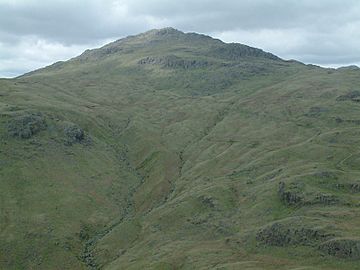
Pike of Blisco from the ridge of Wet Side Edge, between the Three Shire Stone and Great Carrs
|
|
| Highest point | |
| Elevation | 705 m (2,313 ft) |
| Prominence | 177 m (581 ft) |
| Parent peak | Scafell Pike |
| Listing | Marilyn, Hewitt, Wainwright, Nuttall |
| Geography | |
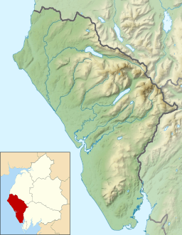
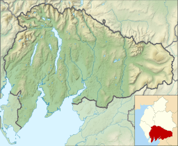
| Location | Cumbria, England |
| Parent range | Lake District, Southern Fells |
| OS grid | NY271042 |
| Topo map | OS Landrangers 89, 90, Explorer OL6 |
Pike of Blisco, also known as Pike o' Blisco, is a mountain in the beautiful Lake District in Cumbria, England. It sits between the Great Langdale and Little Langdale valleys. Because it stands alone, not too close to other hills, it offers amazing views in every direction. The sight of the Langdale Pikes across Great Langdale is especially stunning!
The name 'Pike of Blisco' is what you'll find on official maps. But a famous writer named Alfred Wainwright loved 'Pike o' Blisco' more. He even called 'Pike of Blisco' its "Sunday name". He said its sound was "swashbuckling" – like something from an adventure movie!
Contents
Where is Pike of Blisco Located?
Pike of Blisco is part of a long line of hills. This line stretches southeast from the huge Scafell mountains. It includes other peaks like Esk Pike and Bowfell. After these, the line turns sharply towards Pike of Blisco.
To the north of Pike of Blisco is the Oxendale part of Great Langdale. To the southeast is Little Langdale. Both valleys drain eastward, joining up further down. South of Pike of Blisco is Wrynose Pass, a mountain road. This pass connects Little Langdale with the Duddon Valley.
Red Tarn and Its Surroundings
Between Cold Pike and Pike of Blisco, there's a wide, grassy dip. This spot is about 528 meters (1,740 feet) high. The River Duddon starts on the southern side of this dip. To the north, you'll find Red Tarn.
Red Tarn is a long, shallow lake. Its clear water lets you see the stony bottom. People say there are trout living in it! The tarn's name comes from the color of the soil around it, not the water itself.
This tarn is a popular spot for walkers. A wide path from Wrynose Pass to Great Langdale runs right beside it. Another path branches off towards Crinkle Crags. This main path was first made for the Red Crag Mine. This mine, which looked for iron ore, was active from 1860 to 1875. However, it never made much money.
The Mountain's Shape
Pike of Blisco itself has a steep, cone-shaped top above Red Tarn. It also has hilly land spreading out to the south and east. The summit is protected by rocky areas like Kettle Crag and Black Wars.
The eastern part of the mountain has a smaller peak called Blake Rigg. This area is full of rocky outcrops and small lakes. From Blake Rigg, a ridge goes northeast to cross the road at Blea Tarn. This road is narrow and steep, even for the Lake District! It connects the two Langdale valleys. Blea Tarn is a large lake that sits below the eastern cliffs of Blake Rigg. Its waters have trout, perch, and pike. The easy-to-reach shoreline of Blea Tarn is often seen in photos of the Langdale Pikes.
What is Pike of Blisco Made Of?
The rocks that make up Pike of Blisco are mostly volcaniclastic sandstone. This means they are made of volcanic ash and rock fragments. There are also layers of tuff and lapilli-tuff. You can also find a type of volcanic rock called rhyolite on the eastern slopes.
The Top of the Mountain
It's quite unusual for a Lake District mountain, but you can clearly see Pike of Blisco's summit from the valley below, especially from Great Langdale. This means you get a fantastic view of the valley from the top!
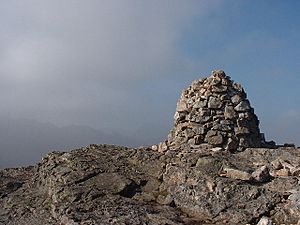
Before 1959, the summit had a tall, cone-shaped pile of stones called a cairn. You could see it from the valley. But between 1958 and 1959, it was damaged. It has since been rebuilt, but it's not as tall today as it looked in Alfred Wainwright's drawing from 1958.
How to Climb Pike of Blisco
There are a few ways to climb Pike of Blisco. Two main paths start from Dungeon Ghyll, a popular spot for walkers.
One route goes past Stool End farm. From there, it follows a public path over Oxendale Beck and up to Red Tarn. From Red Tarn, you climb the steep western side of Pike of Blisco. The other route is usually less steep. It climbs the mountain's east side, starting from the Little Langdale road.
You can also climb Pike of Blisco from Little Langdale. One way is a public path from Wrynose Bridge, on the road to Wrynose Pass. Another way, suggested by Alfred Wainwright, involves scrambling up a rocky gully. Then you walk across open land to the summit. The easiest way to climb is from the Three Shire Stone at the top of Wrynose Pass. You can park your car there at 393 meters (1,289 feet) high.
Pike of Blisco is often climbed as part of a longer walk. This walk usually goes around the head of Great Langdale and includes Crinkle Crags and Bowfell. Sometimes, people even extend it to include Rossett Pike and the Langdale Pikes.
 | Mary Eliza Mahoney |
 | Susie King Taylor |
 | Ida Gray |
 | Eliza Ann Grier |


