River Ver facts for kids
Quick facts for kids River Ver |
|
|---|---|

River Ver in St Albans
|
|
|
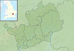
Location of mouth in Hertfordshire
|
|
| Country | England |
| County | Hertfordshire |
| Towns | St Albans |
| Settlements | Kensworth, Markyate, Flamstead, Redbourn, Park Street, Bricket Wood |
| Physical characteristics | |
| Main source | Kensworth Lynch 51°51′05″N 0°29′03″W / 51.851300°N 0.484174°W |
| River mouth | River Colne Bricket Wood 51°41′58″N 0°21′00″W / 51.699488°N 0.349866°W |
| Length | 28.251 km (17.554 mi) |
| Basin features | |
| Progression | Ver, Colne, Thames, North Sea |
| River system | Thames |
| Tributaries |
|
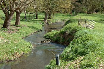
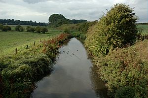
The Ver is a 28-kilometer (about 17.5 miles) long chalk stream in Hertfordshire, England. It is a smaller river that flows into the River Colne.
Contents
The River Ver: A Hertfordshire Gem
The River Ver is a special type of river called a chalk stream. These rivers are rare and important because they are fed by clear, cool water that filters through chalk bedrock. This makes them very clean and good for wildlife.
Where Does the River Ver Flow?
The River Ver starts in a place called Lynch Lodge, near Kensworth Lynch. It then flows underground through pipes, or "culverts," in some areas, like under the A5 road. After that, it comes back to the surface and flows through several towns and villages. These include Markyate, Flamstead, Redbourn, St Albans, and Park Street. Finally, the River Ver joins the River Colne in Bricket Wood.
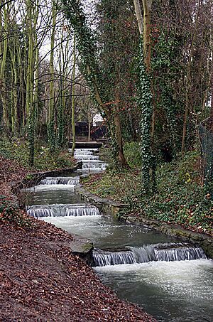
Sometimes, the northern part of the river, especially north of Redbourn, dries up completely in the summer. This is because it's a "winterbourne," meaning it only flows strongly during the wetter winter months. In the 1930s, parts of the river were changed to create artificial lakes in Verulamium Park in St Albans. This happened during important archaeological digs of the ancient Roman city of Verulamium. In the 1960s and 1970s, the river faced problems because too much water was being taken out upstream.
Historic Buildings Along the Ver
The River Ver has been important for a very long time. The Romans built their city of Verulamium right next to the river. They liked building in valleys, and the river was wide enough for boats back then.
One of the oldest bridges in Hertfordshire is on St Michael's Street in St Albans, right next to Kingsbury Mill. This bridge was built in 1765. People believe that the Romans might have built a bridge here as early as the 3rd century AD. There was also a "ford" next to the bridge. A ford is a shallow place where people and animals can cross a river. This ford is thought to have been used for 2,000 years. It's even traditionally believed to be where Saint Alban crossed the river on his way to his execution. Local people helped restore this historic crossing in 2001.
Ye Olde Fighting Cocks is a famous pub in St Albans. It claims to be the oldest pub in England! In the early 1600s, it was moved to its current spot right by the River Ver, next to the Abbey Mill.
How the River Ver Helped Local Industries
For hundreds of years, the River Ver has powered many watermills. These mills used the river's flow to grind corn into flour. But they also did other jobs, like making paper, cleaning cloth, spinning silk, and even polishing diamonds! There were once eleven mills along the river. Some of them can still be seen today, either working, as museums, or converted into homes or pubs.
Here are a few notable mills:
- Dolittle Mill: This mill closed in 1927 and was later taken down. A story from the 15th century says that a child fell into the mill's water channel and was thrown out by the wheel, seemingly dead. The child's mother prayed to Saint Alban, and the child came back to life.
- Redbournbury Mill: Located between Redbourn and St Albans, this flour mill has been restored. It still makes flour today and is sometimes open for visitors.
- Kingsbury Watermill: This 16th-century mill in St Albans used to belong to St Albans Abbey. It's known to have existed since at least 1194. Today, it's a restored museum that you can visit.
- Moor Mill: Found in Bricket Wood, this mill is now a public house and conference center. You can still see the water wheel and other old machinery inside.
- Shafford Mill: This 19th-century mill is now a private house.
You can also see old watercress beds along the river, especially between Redbourn and St Albans. The Ver valley was once a major center for growing watercress for the whole country. The many poplar and willow trees near Pre Mill show another industry: making cricket bats!
Checking the River's Health
The Environment Agency regularly checks the water quality of rivers in England, including the River Ver. They look at things like the types of tiny creatures, plants, and fish living in the river. They also test for chemicals. This helps them understand how healthy the river is. In 2019, the River Ver's overall health was rated as "moderate," but its chemical status was "fail," meaning there were some chemical concerns. This shows that monitoring and protecting the river are very important.
 | Janet Taylor Pickett |
 | Synthia Saint James |
 | Howardena Pindell |
 | Faith Ringgold |


