Rocher Lake (Nipukatasi River) facts for kids
Quick facts for kids Rocher Lake |
|
|---|---|

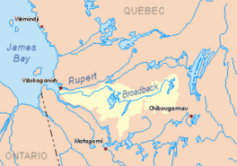
Watershed of Broadback River
|
|
| Location | Eeyou Istchee Baie-James (municipality) (RCM) |
| Coordinates | 50°34′16″N 76°25′38″W / 50.57111°N 76.42722°W |
| Type | Natural |
| Primary inflows | Nipukatasi River and few forested creek |
| Primary outflows | Nipukatasi River |
| Basin countries | Canada |
| Max. length | 27.1 kilometres (16.8 mi) |
| Max. width | 2.7 kilometres (1.7 mi) |
| Surface area | 45.79 kilometres (28.45 mi) |
| Surface elevation | 255 metres (837 ft) |
Rocher Lake is a large freshwater lake in the Nord-du-Québec region of Quebec, Canada. It is part of the Broadback River system, located in the area known as Eeyou Istchee James Bay.
The main activity around the lake is forestry, which means cutting down trees for wood. After forestry, tourism is important. Many people enjoy boating and exploring the lower Nipukatasi River and the Broadback River, which are connected to Rocher Lake.
Getting to Rocher Lake is possible by forest roads. Road R1023 comes from the west and connects to the "James Bay Road." Another road on the east side of Rocher Lake also helps people get there.
The lake usually freezes over from early November until mid-May. However, it's safest to travel on the ice from mid-November to mid-April.
Exploring Rocher Lake's Geography
Rocher Lake gets its water from the Nipukatasi River, which flows in from the south. The main source for the Nipukatasi River is Amisquioumisca Lake.
Rocher Lake is one of several long lakes in this area. These lakes often run side-by-side, like Ouescapis Lake, Quénonisca Lake, Salamandre Lake (Broadback River), Opataouaga Lake, and Amisquioumisca Lake. To the west of Rocher Lake, you'll find the big Evans Lake.
Rocher Lake is about 27.1 kilometres (16.8 mi) long and 2.7 kilometres (1.7 mi) wide. It sits at an elevation of 255 metres (837 ft) above sea level and covers an area of 45.79 square kilometres (17.68 sq mi). The lake was formed by the widening of the Nipukatasi River. It has 17 islands and several smaller bays.
The land around the lake is mostly flat. However, there's a hill called Mount Dome, which is 381 metres (1,250 ft) high. It's located about 3.6 kilometres (2.2 mi) northwest of the lake.
Where Rocher Lake's Water Flows
The water from Rocher Lake flows out on its northeast side through the Nipukatasi River. This river travels about 4.1 kilometres (2.5 mi) northeast into a marshy area and then into an unnamed lake. The water flows through this lake and continues north for another 2.9 kilometres (1.8 mi) through more marshland.
Finally, the Nipukatasi River joins the Broadback River. From there, the water flows west along the Broadback River for about 15.3 kilometres (9.5 mi) to Corbeau Bay, which is part of Evans Lake. After Lake Evans, the water continues flowing west until it reaches Rupert Bay.
Naming Rocher Lake
The name "Lac Rocher" (Rocher Lake) honors Robert Rocher. He was a member of the Geographical Survey of Quebec back in 1917.
The name Lac Rocher was officially recognized on December 5, 1968, when the Commission de toponymie du Québec (Quebec's Place Names Commission) was created.
 | Selma Burke |
 | Pauline Powell Burns |
 | Frederick J. Brown |
 | Robert Blackburn |


