Rock Hall, Maryland facts for kids
Quick facts for kids
Rock Hall, Maryland
|
|||
|---|---|---|---|
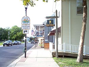
Main St. Rock Hall
|
|||
|
|||
| Nickname(s):
Rock City
|
|||
| Motto(s):
"Pearl of the Chesapeake"
|
|||
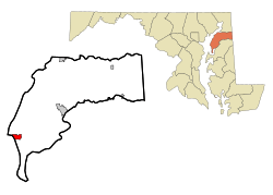
Location of Rock Hall, Maryland
|
|||
| Country | |||
| State | |||
| County | |||
| Founded | 1707 | ||
| Incorporated | 1908 | ||
| Government | |||
| • Type | Mayor-Council-Manager | ||
| Area | |||
| • Total | 1.55 sq mi (4.02 km2) | ||
| • Land | 1.34 sq mi (3.47 km2) | ||
| • Water | 0.21 sq mi (0.55 km2) | ||
| Elevation | 10 ft (3 m) | ||
| Population
(2020)
|
|||
| • Total | 1,198 | ||
| • Density | 895.37/sq mi (345.74/km2) | ||
| Time zone | UTC-5 (Eastern (EST)) | ||
| • Summer (DST) | UTC-4 (EDT) | ||
| ZIP code |
21661
|
||
| Area code(s) | 410 | ||
| FIPS code | 24-67400 | ||
| GNIS feature ID | 0586872 | ||
| Website | Town of Rock Hall, Maryland | ||
Rock Hall is a lovely town right on the water in Kent County, Maryland, United States. It's part of the beautiful National Chesapeake Scenic Byway. In 2010, about 1,310 people lived here.
Contents
A Look at Rock Hall's Past
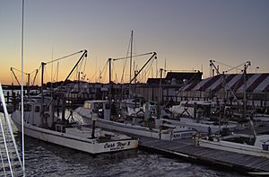
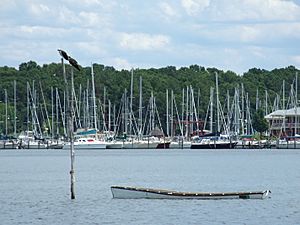
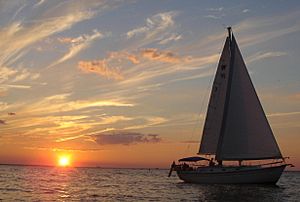
Rock Hall was first known as Rock Hall Crossroads. Today, it's a busy town for fishing, sailing, and fun on the water. It sits on the upper part of the Chesapeake Bay. This town is important for water-related jobs in Kent County. It's also a popular place for tourists to visit.
The town was started in 1707. It got its name from a large house made of white sandstone. Rock Hall officially became a town in 1908.
In the past, Rock Hall was a key spot for shipping goods like tobacco and seafood. It also helped people travel during the Colonial era. Later, catching and processing seafood became the town's biggest industry.
Rock Hall almost got a railroad connection in 1872. The Kent County Railroad planned to build tracks from Massey through Chestertown. This would connect to a ferry to Baltimore for both people and goods. But the company went out of business in 1877. They only built a small part of the track and left the rest unfinished.
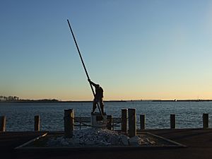
Today, Rock Hall Harbor is still a working harbor. Many commercial watermen, charter fishing boats, and sailing boats use it. The town has three museums, including one about watermen.
Two historic places, Hinchingham and Trumpington, are listed on the National Register of Historic Places. This means they are important to the country's history.
Where is Rock Hall?
Rock Hall is a small town. The United States Census Bureau says it covers about 1.55 square miles (4.02 square kilometers). Most of this area, about 1.34 square miles (3.47 square kilometers), is land. The rest, about 0.21 square miles (0.55 square kilometers), is water.
Getting Around Rock Hall
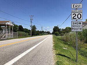
The main way to get into and out of Rock Hall is by road. Two state highways serve the town. Maryland Route 20 is the main road. It goes east from Rock Hall to Chestertown. Maryland Route 445 also runs through the town, going north and south.
Who Lives in Rock Hall?
| Historical population | |||
|---|---|---|---|
| Census | Pop. | %± | |
| 1880 | 221 | — | |
| 1910 | 781 | — | |
| 1930 | 405 | — | |
| 1940 | 781 | 92.8% | |
| 1950 | 786 | 0.6% | |
| 1960 | 1,073 | 36.5% | |
| 1970 | 1,125 | 4.8% | |
| 1980 | 1,511 | 34.3% | |
| 1990 | 1,584 | 4.8% | |
| 2000 | 1,396 | −11.9% | |
| 2010 | 1,310 | −6.2% | |
| 2020 | 1,198 | −8.5% | |
| U.S. Decennial Census | |||
Rock Hall's Population in 2010
In 2010, a census counted 1,310 people living in Rock Hall. There were 630 households and 374 families. The town had about 977.6 people per square mile (377.5 per square kilometer). There were 930 homes, with about 694.0 homes per square mile (268.0 per square kilometer).
Most people in Rock Hall were White (92.0%). About 5.8% were African American, and 0.2% were Asian. A small number were from other races or mixed races. About 1.5% of the population was Hispanic or Latino.
Out of 630 households, 19.2% had children under 18 living there. About 43.5% were married couples. About 11.4% had a female head of household with no husband. And 4.4% had a male head of household with no wife. About 40.6% were not families.
Many households (35.9%) were made up of just one person. About 19.7% had someone living alone who was 65 or older. The average household had 2.05 people, and the average family had 2.57 people.
The average age in Rock Hall was 54.3 years. About 15.2% of residents were under 18. About 5.3% were between 18 and 24. About 16.4% were from 25 to 44. About 33% were from 45 to 64. And 30% were 65 years old or older. The town had slightly more females (52.8%) than males (47.2%).
Rock Hall's Economy
You can find many different shops on Main Street in Rock Hall. The town's economy gets a boost from catching oysters, crabbing, and fishing. Boats that take people on fishing trips also help the economy.
Tourism is another big source of money, especially in the summer. Special events like the Pirates and Wenches Weekend bring many visitors. Rock Hall is also a popular place for July 4 celebrations.
Schools in Rock Hall
Rock Hall is part of the Kent County Public Schools system. Rock Hall Elementary School is right in the town. Students go to Kent County Middle School in Chestertown. For high school, they attend Kent County High School, which is near Worton.
Rock Hall Middle School used to be in town, but it joined Kent County Middle School in Chestertown in 2010.
The Kent County Public Library also has a branch in Rock Hall.
Famous People from Rock Hall
- Lambert Wickes (1735–1777) was a captain in the Continental Navy during the American Revolution.
- Wylie F. L. Tuttle (died 2002) was a real estate developer. He helped build the famous Tour Montparnasse in Paris and had a home in Rock Hall.
See also
 In Spanish: Rock Hall (Maryland) para niños


