
Rohtang Pass facts for kids
Quick facts for kids Rohtang Pass |
|
|---|---|

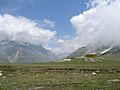
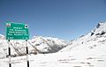
A view from Rohtang Pass
|
|
| Elevation | 3,978 m (13,051 ft) |
| Traversed by | Leh-Manali Highway |
| Location | India |
| Range | Pir Panjal, Himalayas |
| Coordinates | 32°22′17″N 77°14′47″E / 32.37139°N 77.24639°E |

Location in Himachal Pradesh
|
|
Rohtang Pass (which means "pile of corpses" or "field of corpses" in the local language, because it was once a very difficult and dangerous path to cross) is a high mountain pass in the Himalayas. It sits at an elevation of about 3,978 meters (13,050 feet) above sea level. This famous pass is located about 51 kilometers (32 miles) from Manali in India.
Rohtang Pass is a super important link! It connects the beautiful Kullu Valley with the high-altitude Lahaul and Spiti Valleys in the state of Himachal Pradesh. Many travelers and locals use this pass to move between these two very different regions.
Geography of Rohtang Pass
Rohtang Pass acts like a natural border, separating two distinct areas. To the south, you have the green Kullu Valley, where most people follow the Hindu culture. To the north, you'll find the dry, high-altitude Lahaul and Spiti valleys, where the main culture is Buddhist.
This pass is also a special place for rivers. It's where the waters divide, flowing into different river systems. On the southern side, the Beas River starts its journey, flowing south. On the northern side, the Chandra River begins. This river is one of the main sources for the mighty Chenab, which flows west.
Weather at Rohtang Pass
The weather at Rohtang Pass is very cold, similar to what you'd find in polar regions. It's so high up that snow can fall even during the summer months! This makes the pass a challenging but beautiful place to visit.
Images for kids
-
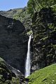
A beautiful waterfall on the Beas River near Marhi
-
A wide view of Rohtang Pass
-
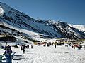
People enjoying winter sports in the snowy valley
-
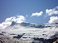
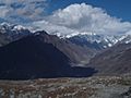
A stunning panoramic view of distant Himalayan peaks from the pass
-
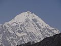
Majestic mountains surrounding Rohtang Pass
-
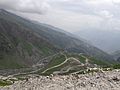
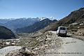
The Leh-Manali Highway winding its way near Rohtang Pass
-
Rohtang Pass covered in snow during winter
-
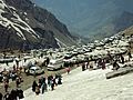
Cars and buses carrying tourists at Rohtang Pass
-
Roadside eateries (Dhabas) along the way to Rohtang Pass
-
A breathtaking view from the very top of Rohtang Pass
-
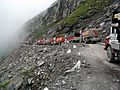
Traffic can sometimes get busy when descending from Rohtang
-
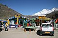
A rest stop for tourists on the southern approach to Rohtang Pass
-
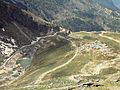
The steep, winding road going down from Rohtang Pass towards Manali
-
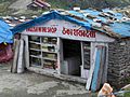
A shop on the route to the pass
-
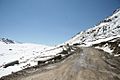
The road approaching Rohtang Pass from the northern side
-
The very top of Rohtang Pass, at 13,000 feet above sea level
-
The summit of Rohtang Pass in October
-
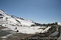
A view near Rohtang Pass


