
Roosendaal facts for kids
Quick facts for kids
Roosendaal
|
|||
|---|---|---|---|
_-_Aerial_photograph.jpg)
Aerial view of Roosendaal
|
|||
|
|||
.svg)
Location in North Brabant
|
|||

Roosendaal
Location in Netherlands

Roosendaal
Location in Europe
|
|||
| Country | Netherlands | ||
| Province | North Brabant | ||
| Established | 1 January 1997 | ||
| Government | |||
| • Body | Municipal council | ||
| Area | |||
| • Total | 107.16 km2 (41.37 sq mi) | ||
| • Land | 106.42 km2 (41.09 sq mi) | ||
| • Water | 0.74 km2 (0.29 sq mi) | ||
| Elevation | 3 m (10 ft) | ||
| Population
(May 2014)
|
|||
| • Total | 76,959 | ||
| • Density | 723/km2 (1,870/sq mi) | ||
| Demonym(s) | Roosendaler, Roosendaalder | ||
| Time zone | UTC+1 (CET) | ||
| • Summer (DST) | UTC+2 (CEST) | ||
| Postcode |
4700–4709, 4724–4727
|
||
| Area code | 0165 | ||


Roosendaal is a city and a municipality in the southern Netherlands. It is located in the province of North Brabant.
Contents
Exploring Roosendaal's Communities
Roosendaal is a municipality made up of several towns and villages. Each one has its own unique charm.
Towns and Villages in Roosendaal
- Roosendaal (population: 66,760)
- Wouw (4,920)
- Heerle (1,900)
- Nispen (1,440)
- Wouwse Plantage (1,230)
- Moerstraten (660)
The City of Roosendaal
Roosendaal became an official city in 1809. This happened under King Louis Bonaparte of the Kingdom of Holland.
How Roosendaal Grew
The city of Roosendaal has changed over time. In 1997, two areas, Roosendaal en Nispen and Wouw, joined together. This created the larger municipality we know today as Roosendaal.
A Look Back at Roosendaal's History
Roosendaal's story began a long time ago, in the 12th and 13th centuries. The name "Rosendaele" was first written down in 1268. The city was always part of North Brabant.
In the Middle Ages, Roosendaal grew because of its peat business. Peat is like soil that can be burned for fuel. However, the Eighty Years' War (1568–1648) caused problems. Soldiers moved through the area, causing damage. For many years, the countryside around Roosendaal was empty.
During World War II, German forces occupied the city.
Sports in Roosendaal
If you love football, you might know about RBC. This is Roosendaal's main football team.
Military Presence in Roosendaal
Roosendaal is home to the Korps Commandotroepen. This is a special forces unit in the Dutch army. Their main base, the Engelbrecht van Nassaukazerne, is located here.
The Royal Marechaussee, which is like a military police force, also had a presence in the city for many years. They kept a small office at the railway station. This was because the station connects directly to Belgium.
Getting Around: Transport in Roosendaal
Roosendaal has an important railway station. It's a key spot for trains in the region.
Trains from Zwolle start and end here. The Intercity train from Amsterdam to Vlissingen also stops at the station. Until 2018, an international train to Brussels stopped here too. Now, there's still a train that goes to Antwerp every hour.
Staying Healthy: Medical Care
The Bravis Ziekenhuis Roosendaal is the main hospital for people living in Roosendaal. It offers many types of medical care.
Special departments include:
- Cardiology (heart care)
- Dermatology (skin care)
- Gynaecology (women's health)
- Oncology (cancer care)
- Ophthalmology (eye care)
- Intensive Care (for very sick patients)
Fun Events in Roosendaal
Roosendaal hosts several exciting events throughout the year:
- Carnaval: A big celebration with parades and costumes.
- Draai van de Kaai: A popular cycling race.
- Annual "International ABBA Day": This is a weekend event for fans of the music group ABBA. ABBA's official fan club is based in Roosendaal!
Famous People from Roosendaal
Many interesting people have come from Roosendaal:
.jpg)
- Cornelis of Glymes (1458–1508/1509): A famous Dutch admiral.
- Hendrick Lonck (1568–1634): The first Dutch sea captain to reach the New World.
- Léon Orthel (1905–1985): A talented classical pianist and composer.
- Fons Rademakers (1920–2007): An actor, film director, and producer.
- Jack Jersey (1941–1997): A popular singer-songwriter.
- Frans Bauer (born 1973): A well-known Dutch singer.
- Jeroen van Koningsbrugge (born 1973): An actor, comedian, and TV presenter.
- Jesse Klaver (born 1986): A political leader in the Netherlands.
Sports Stars from Roosendaal
Roosendaal has also produced many great athletes:

- Harry Broos (1898–1954): A sprinter who won a bronze medal at the 1924 Summer Olympics.
- Antoine Mazairac (1901–1966): A cyclist who won a silver medal at the 1928 Summer Olympics.
- Theo Laseroms (1940–1991): A footballer with over 400 club games.
- Bram Lomans (born 1975): A hockey player who won two gold medals at the Olympics (1996 and 2000).
- Tim van Rijthoven (born 1997): A professional tennis player.
- Niek van der Velden (born 2000): A snowboarder and Roosendaal Sportsman of the Year in 2017.
Gallery
-
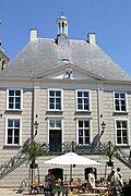
Town hall of Roosendaal
-
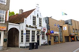
Marketplace of Roosendaal
-
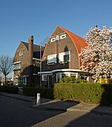
Villa in Amsterdam School style
-
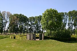
Former Castle of Wouw


See also
 In Spanish: Roosendaal para niños
