Roseau River Anishinabe First Nation facts for kids
Quick facts for kids
Roseau River No. 2
|
|||||||||||
|---|---|---|---|---|---|---|---|---|---|---|---|
| Country | |||||||||||
| Province | |||||||||||
| Area | |||||||||||
| • Total | 21.99 km2 (8.49 sq mi) | ||||||||||
| Population
(2016)
|
|||||||||||
| • Total | 558 | ||||||||||
|
|||||||||||
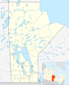
The Roseau River Anishinabe First Nation is a First Nation group located in southern Manitoba, Canada. Their name in the Ojibwe is Okwewanashko-ziibiing, which means "Rag Weed River." This community is found near the Roseau River. Their main land area is called Roseau River No. 2.
Contents
About Roseau River Anishinabe First Nation
A Look at Their History
The people of Roseau River Anishinabe First Nation have lived in the areas of the Pembina and Red River Valleys for a very long time. These valleys are in Manitoba, Minnesota, and North Dakota. The Roseau River people used to have a special system called a clan system. This system gave different families or groups specific jobs and duties within the community.
The Anishinabe (Ojibway) people from Manitoba, Western Ontario, North Dakota, and Northern Minnesota were known as the Zoong-gi-dah Anishinabe. This name means "Strong-Hearted People."
When Europeans first came to this area, they called the community the Pembina Band. This was because they lived in the Pembina Valley. Over time, more settlers arrived. This led to the people moving away from their traditional hunting grounds.
Eventually, an important agreement called Treaty 1 was signed on August 3, 1871. After this treaty, the people living around the Roseau River became known as the Roseau River Anishinabe First Nation. This is where their community is located today.
The community has faced challenges from floods. They had to leave their homes in 1997, 2009, and 2011. These floods cut off roads to the community. However, a special protective wall called a ring dike helps keep the main community safe from large floods.
Their Land: Reserves Explained
The Roseau River Anishinabe First Nation has a total registered population of 2,152 people. A "reserve" is a special area of land set aside for a First Nation community.
The First Nation has three main reserves:
Roseau River No. 2
This is the main reserve for the First Nation. It covers an area of about 22.242 square kilometers (8.588 square miles). It is next to the Municipality of Emerson – Franklin and the Rural Municipality of Montcalm. In 2011, 588 people lived on this reserve.
Roseau Rapids No. 2A
This reserve is about 3.23 square kilometers (798 acres) in size. It is completely surrounded by the Emerson – Franklin area. In 2011, 107 people lived on this reserve.
Roseau River No. 2B
This reserve is smaller, about 75.4 acres (305,000 square meters). It is located far away from the other two reserves. You can find it where Highway 6 and Highway 236 meet the Perimeter Highway. This is on the northwest side of Winnipeg, Manitoba. It's more than 100 kilometers (62 miles) from the other two reserves. The population of this reserve is counted as part of the Rural Municipality of Rosser. So, its population is not reported separately.
Roseau River No. 2 and Roseau Rapids No. 2A are about 40 kilometers (25 miles) apart. They are both about 80 kilometers (50 miles) south of Winnipeg.
Who Leads the Community?
The Roseau River Anishinabe First Nation is part of the Dakota Ojibway Tribal Council. This council is a group of First Nations that work together. The community is led by a Chief and Council, who are like their local government.
The current Chief is Craig Alexander. The Councillors are Alfred Hayden, Terrance Nelson, June Thomas, and Max Seenie.
Famous People from Roseau River
- Shingoose, a well-known musician.
More to Explore
 | Jewel Prestage |
 | Ella Baker |
 | Fannie Lou Hamer |


