Rosthwaite Fell facts for kids
Quick facts for kids Rosthwaite Fell |
|
|---|---|

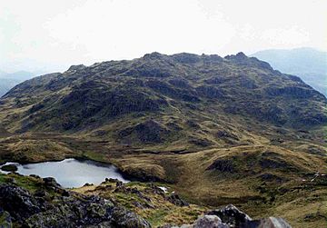
Rosthwaite Cam from Bessyboot with Tarn at Leaves in between
|
|
| Highest point | |
| Elevation | 612 m (2,008 ft) |
| Prominence | c. 15 m |
| Parent peak | Dovenest Top |
| Listing | Wainwright (Bessyboot) |
| Geography | |
| Location | Cumbria, England |
| Parent range | Lake District, Southern Fells |
| OS grid | NY255118 |
| Topo map | OS Landrangers 89,90, Explorer OL4 |
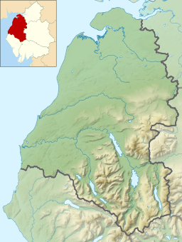
Rosthwaite Fell is a mountain, also called a fell, located in the beautiful Lake District in England. It sits about 12 kilometers (7.5 miles) south of Keswick and 2 kilometers (1.2 miles) south of the village of Rosthwaite in an area called Borrowdale.
The name Rosthwaite Fell comes from the Old Norse language. It means "The peak above the clearing with a heap of stones." The word “hreysi” means a heap of stones, and “thveit” means a clearing.
Contents
What is Rosthwaite Fell Like?
Rosthwaite Fell reaches a height of 612 meters (2,008 feet) at its highest point. This peak is usually called Rosthwaite Cam. The mountain also has another important top, called Bessyboot, which is 550 meters (1,804 feet) high. Bessyboot is about 800 meters (half a mile) north of the main summit.
The famous fell walker Alfred Wainwright considered Bessyboot to be the main summit of Rosthwaite Fell in his guidebooks. Another part, Dovenest Crag, is often thought of as part of the nearby Glaramara mountain.
Where are the Edges of the Fell?
The edges of Rosthwaite Fell are clearly marked by valleys and streams on three sides. To the west, the land slopes down to Borrowdale and the young River Derwent. On the eastern side, it goes down to the Langstrath valley and its stream. The northern slopes lead down to the Stonethwaite valley.
To the south, Rosthwaite Fell is connected to the taller mountain, Glaramara. This connection is a wet and bumpy ridge that crosses over a few smaller hills.
Why is Rosthwaite Fell Quiet?
Rosthwaite Fell has steep, rocky sides where it meets the valleys. This means there isn't an easy or obvious path to climb it. Also, there are many other mountains in the area that are more popular for climbing. Because of this, Rosthwaite Fell is a very peaceful and less visited place.
Why is Rosthwaite Fell Special?
Rosthwaite Fell is very important because of its unique rocks and history. In 1985, a large area of 230 hectares (about 568 acres) was named a Site of Special Scientific Interest. This means it's a protected area because of its special natural features.
What Makes the Rocks Unique?
The many cliffs and rock outcrops on Rosthwaite Fell show amazing layers of volcanic rock. These layers tell us about a huge period of volcanic activity that happened about 460 million years ago. This was during the Middle Ordovician Period, when the Borrowdale Volcanic Group of rocks was formed.
Many different types of rocks can be seen clearly here. This site is very important for studying geology. It's also historically interesting because some types of volcanic rocks were first identified here.
How Can You Climb Rosthwaite Fell?
You can climb Rosthwaite Fell from the village of Stonethwaite or from the main road in Borrowdale, between Seatoller and Rosthwaite.
Routes to the Top
- From Borrowdale Road: This path goes up Combe Gill for about a kilometer (0.6 miles). Then, it climbs steeply up the eastern side of the gill to reach the top of the mountain.
- From Stonethwaite: This route follows Stanger Gill up to nearly 500 meters (1,640 feet) high. From there, it's an easy walk to the summit of Bessyboot.
- North Ridge: You can also scramble up the north ridge. This starts behind Chapel Farm and stays to the west of a local rock called Papelay Crag.
What are the Main Summits?
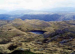
Rosthwaite Fell has two main summits: Rosthwaite Cam and Bessyboot. They are separated by a dip in the land that is about 500 meters (1,640 feet) high.
Tarn at Leaves
In this dip, you'll find a small mountain lake called Tarn at Leaves. It's about 100 meters (330 feet) long and has a charming name. To reach the very highest point of Rosthwaite Cam, you'll need to do a bit of easy scrambling over the rocks.
 | Dorothy Vaughan |
 | Charles Henry Turner |
 | Hildrus Poindexter |
 | Henry Cecil McBay |


