Royal Geographical Society facts for kids
 |
|

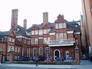
The main entrance in London. The original building, Lowther Lodge, is on the right.
|
|
| Abbreviation | RGS-IBG |
|---|---|
| Formation | 1830 |
| Type | Learned society |
| Headquarters | 1 Kensington Gore, London |
|
Membership
|
16,500 |
|
President
|
Professor Dame Jane Francis |
|
Director
|
Joe Smith |
|
Patron
|
Anne, Princess Royal |
The Royal Geographical Society (often called the RGS) is a famous British club and professional group for people who love geography. It was started in 1830 to help advance the science of geography. Today, it has over 16,000 members. The society shares its work with everyone through books, research projects, and talks.
The RGS began as the Geographical Society of London. Its goal was to promote the "advancement of geographical science." It later joined with other groups, like the African Association, which was started in 1788. In 1995, it merged with the Institute of British Geographers, a group for university geographers.
The society is run by a team called the council, led by a president. Members of the society, known as fellows, can use the letters FRGS after their name. The RGS also keeps a list of professional geographers who have special qualifications.
Contents
The Society's History

The RGS was founded on July 16, 1830, as the Geographical Society of London. It was started by seven members, including geographer Sir John Barrow and geologist Sir Roderick Murchison. Like many groups at the time, it began as a club where members would have dinner and discuss new scientific ideas.
The society met in different places in London before finding a permanent home. In 1859, Queen Victoria gave the society a royal charter, which is a special permission from the monarch. This is when it became known as the Royal Geographical Society.
In 1911, a new president named Lord Curzon helped the society move to its current home, Lowther Lodge in Kensington. The building was bought for £100,000 and opened in 1913. That same year, the society began allowing women to become members.
Famous Explorers and Expeditions
For many years, the society was closely linked with exploration. It supported famous explorers on their journeys to Africa, India, the polar regions, and Central Asia.
The RGS was a key supporter of many well-known explorers and their expeditions. These include:
- Charles Darwin, who developed the theory of evolution.
- David Livingstone, who explored Africa.
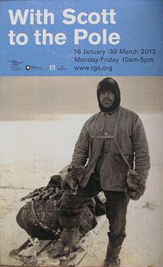
- Robert Scott and Ernest Shackleton, who led expeditions to Antarctica.
- Sir Edmund Hillary, who was one of the first people to climb Mount Everest.
Information, maps, and knowledge from these trips were sent back to the RGS. This helped build its amazing collection of geographical items. The society started publishing its first journal in 1831, and today it still publishes The Geographical Journal.
Geography in Schools
The society also played a big role in making geography a subject taught in British universities. It helped fund the first geography teaching positions at the University of Oxford and the University of Cambridge.
In 1933, another group called the Institute of British Geographers (IBG) was formed. They felt the RGS was too focused on exploration. The two groups worked separately for 60 years. In 1995, they merged to become the Royal Geographical Society (with the Institute of British Geographers).
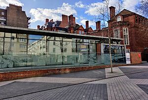
In 2004, the RGS opened its historical collections to the public for the first time. New spaces, like the Foyle Reading Room and a glass exhibition area, were also opened.
How the Society is Run
The society is managed by a group of trustees called the council. The council is led by the society's president. Members of the council are elected by the society's fellows and serve for three years. There are also five special committees that give advice on topics like education, research, and expeditions.
Becoming a Member
There are a few ways to join the RGS:
- Membership: Anyone who is interested in geography can apply to be a member.
- Student Membership: This is for students studying geography in school or at university.
- Fellowship: To become a Fellow, a person usually needs to be recommended by another fellow or show their own work in geography. Fellows can use the letters FRGS after their names.
Chartered Geographer
Since 2002, the society can give a special status called Chartered Geographer. This is for people with a geography degree and at least six years of experience, or for those with 15 years of work experience in geography. It shows they are highly skilled professionals. Teachers can also earn a special "Chartered Geographer (teacher)" title.
Research and Study Groups
The society has 27 research groups where geographers can work together on specific topics. These groups study everything from climate change and economic geography to the geography of cities and tourism. They organize their own events, like workshops and conferences, to share their findings.
Medals and Awards
The RGS gives out medals and awards to people who have made great contributions to geography.
The most famous awards are the Founder's Medal and the Patron's Medal. These have been given out since 1839 and are approved by the King. Famous winners include David Livingstone, Alfred Russel Wallace, and more recently, Professor David Harvey.
Other important awards include:
- The Victoria Medal for outstanding research in geography.
- The Murchison Award for an important publication in geography.
- The Ness Award for travelers who have helped people better understand the world.
- The Cherry Kearton Medal and Award for travelers who study natural history, especially those interested in photography or film.
Amazing Collections
The society has a huge collection of over two million items. This includes maps, photos, books, and objects from 500 years of exploration and geography.
- Artefacts: The collection has over a thousand objects from around the world. These include Inuit boots from the Arctic and oxygen tanks used on Mount Everest.
- Books and Journals: The library has over 150,000 books about the history and geography of places all over the globe.
- Maps and Atlases: The RGS has one of the largest private map collections in the world, with over a million maps. The oldest printed item is from 1482!
- Photographs: The picture library holds over half a million photos. They show everything from Scott and Shackleton's Antarctic adventures to the journeys of explorers in Africa.
Grants for Research and Travel
The RGS gives money, called grants, to support geographical research and expeditions. Each year, it gives out over £180,000 to more than 70 projects. This funding helps researchers, students, and teachers conduct studies in over 120 countries.
Grants are available for:
- Fieldwork: Helping students and researchers conduct studies outdoors.
- Student Projects: Supporting students from high school to university with their geography projects.
- Research: Funding academic geographers for both small and large research projects.
- Teaching: Helping teachers develop new resources for the classroom.
Sharing Geography with Everyone
The RGS works to get the public excited about geography.
- Discovering Britain: This is a website with over 120 free walking tours across the U.K. Each walk explores the history and nature of a landscape.
- Hidden Journeys: This project turns a flight into a journey of discovery. It provides interactive guides for popular flight paths, showing you the amazing places you are flying over. It has even been used on some airlines as a new type of in-flight entertainment.
Geography in Schools
The RGS has a dedicated education department to support geography teachers and students.
- Educational Resources: The society creates lesson plans and case studies for all school levels.
- Geography Ambassadors: This program sends trained university students into schools. They run fun sessions to show younger students how exciting geography can be.
- Competitions: The RGS runs competitions like the "Young Geographer of the Year" to challenge students and reward their hard work.
See also
 In Spanish: Royal Geographical Society para niños
- Concepts and Techniques in Modern Geography
- Gamma Theta Upsilon
- Hakluyt Society
- History of science
- List of British professional bodies
- List of Royal Societies
- Royal Geographical Society of Australasia
- Royal Institution
- Royal Scottish Geographical Society
 | Toni Morrison |
 | Barack Obama |
 | Martin Luther King Jr. |
 | Ralph Bunche |


