Rutland, Illinois facts for kids
Quick facts for kids
Rutland, Illinois
|
|
|---|---|

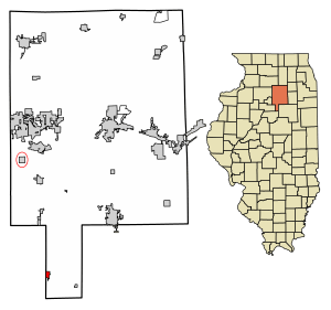
Location in LaSalle County, Illinois
|
|

Location of Illinois in the United States
|
|
| Country | United States |
| State | Illinois |
| County | LaSalle |
| Township | Groveland |
| Area | |
| • Total | 0.69 sq mi (1.80 km2) |
| • Land | 0.69 sq mi (1.80 km2) |
| • Water | 0.00 sq mi (0.00 km2) |
| Elevation | 702 ft (214 m) |
| Population
(2020)
|
|
| • Total | 259 |
| • Density | 373.20/sq mi (144.03/km2) |
| Time zone | UTC-6 (CST) |
| • Summer (DST) | UTC-5 (CDT) |
| ZIP code |
61358
|
| Area code(s) | 815 |
| FIPS code | 17-66443 |
| GNIS feature ID | 2399151 |
| Wikimedia Commons | Rutland, Illinois |
Rutland is a small village located in LaSalle County, Illinois, in the United States. It is part of the Ottawa area. In 2020, the village had 259 people living there. This was a bit less than the 318 people counted in 2010.
The village got its name from Rutland, Vermont.
Contents
Discovering Rutland's Past
Rutland has an interesting history that dates back to the mid-1800s.
How Rutland Was Founded
The village was first called "New Rutland." It was started in 1855 by about 200 people from the Vermont Emigration Association. Each person paid $10 for a piece of land to build their homes. The first part of the town was only in LaSalle County. However, in October 1856, ten more blocks of land were added. These new blocks were mostly in the nearby Marshall County.
Village Hall Fire in 2021
On October 15, 2021, a fire broke out at the village's hall. Many fire departments, including Streator, came to help put out the fire. Several ambulances and police officers also responded. Officials are looking into what caused the fire.
Where is Rutland Located?
Rutland is in the southern part of LaSalle County, which looks a bit like a panhandle. The western edge of the village is also the line between LaSalle County and Marshall County. About five blocks of developed land stretch into Marshall County, just outside the village limits.
Roads and Travel Near Rutland
Illinois Route 251 runs along the county line and the western edge of Rutland. If you go north on this road for about 5 miles, you'll reach Wenona. Going south for about 7 miles will take you to Minonk in Woodford County. Interstate 39 is very close, about 0.5 miles away, but you can't get directly onto it from Rutland. The closest exits are about 3 miles north or 5 miles south.
Rutland's Size
According to information from 2021, Rutland covers a total area of about 0.69 square miles (1.80 square kilometers). All of this area is land.
Who Lives in Rutland?
Understanding the population helps us learn about the people who call Rutland home.
| Historical population | |||
|---|---|---|---|
| Census | Pop. | %± | |
| 1870 | 412 | — | |
| 1880 | 402 | −2.4% | |
| 1890 | 509 | 26.6% | |
| 1900 | 894 | 75.6% | |
| 1910 | 754 | −15.7% | |
| 1920 | 618 | −18.0% | |
| 1930 | 495 | −19.9% | |
| 1940 | 462 | −6.7% | |
| 1950 | 486 | 5.2% | |
| 1960 | 509 | 4.7% | |
| 1970 | 437 | −14.1% | |
| 1980 | 487 | 11.4% | |
| 1990 | 391 | −19.7% | |
| 2000 | 354 | −9.5% | |
| 2010 | 318 | −10.2% | |
| 2020 | 259 | −18.6% | |
| U.S. Decennial Census | |||
Population Numbers
In 2020, there were 259 people living in Rutland. There were 124 households and 79 families. The village had about 373 people per square mile. There were 132 homes in total.
Community Makeup
Most people in Rutland are White (about 89.58%). A smaller number are African American (3.09%), from other races (1.54%), or from two or more races (5.79%). About 6.18% of the population identified as Hispanic or Latino.
Out of the 124 households, about 24.2% had children under 18 living with them. Nearly 46% were married couples. About 36% of households were made up of single individuals, and 25% of these were people aged 65 or older living alone.
Age Groups in Rutland
The population of Rutland includes people of all ages. About 30.1% of the residents were under 18 years old. People aged 65 or older made up about 22.6% of the population. The average age in the village was 38.9 years.
See Also
 In Spanish: Rutland (Illinois) para niños
 | DeHart Hubbard |
 | Wilma Rudolph |
 | Jesse Owens |
 | Jackie Joyner-Kersee |
 | Major Taylor |

