Salamá facts for kids
Quick facts for kids
Salamá
|
|
|---|---|
|
Municipality of Guatemala
|
|
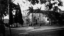
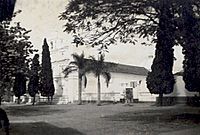
San Mateo church
|
|
| Country | |
| Department | |
| Area | |
| • Municipality of Guatemala | 295 sq mi (764 km2) |
| Elevation | 3,080 ft (940 m) |
| Population
(2018 census)
|
|
| • Municipality of Guatemala | 65,275 |
| • Density | 221.28/sq mi (85.44/km2) |
| • Urban | 65,275 |
| Climate | Aw |
Salamá is a city in Guatemala. It is the main city of the department of Baja Verapaz. The city is located 940 meters (about 3,084 feet) above sea level. The area around Salamá, called the municipality, covers 764 square kilometers (about 295 square miles). In 2018, about 65,275 people lived there.
Contents
What's in a Name? The Meaning of Salamá
The name Salamá comes from the Kʼicheʼ words Tz'alam Ha. This means "table on water."
A Look Back: The History of Salamá
Early Days: Settling Salamá
In the 1550s, a group of religious people called the Order of Preachers settled Salamá. They were part of a plan by a friar named Bartolomé de las Casas. The friars owned a lot of land with hills, forests, and plenty of water. The area was perfect for growing grapevines. They even built a great irrigation system, like the ancient Romans, to water their plants.
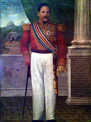
After Guatemala became independent in 1821, new leaders tried to reduce the power of the Catholic Church. In 1829, a general named Francisco Morazán forced many religious groups, including the Dominicans, to leave Central America. In Salamá, the Dominicans had to leave their monastery, church, and vineyards. The government took their property, but it was left empty because of political problems at the time.
The Battle of Salamá in 1839
In 1838, a peasant leader named Rafael Carrera led a revolt in Guatemala. General Morazán, a powerful leader from Central America, and his ally José Francisco Barrundia came back to Guatemala. They executed Carrera's father-in-law, Chúa Álvarez, as a warning. Carrera and his wife were very upset and promised to get revenge.
Morazán's forces then attacked many towns, stealing things and forcing Carrera's supporters to hide. Thinking Carrera was defeated, Morazán went to Guatemala City. The leaders there were happy he had stopped the peasant revolt. Morazán helped some areas and appointed new leaders, but he didn't give back property that had been taken from rich families. This made some people unhappy.
As Morazán left for El Salvador, Carrera tried to take Salamá with his remaining forces. But he was defeated and his brother Laureano died in the battle. Carrera escaped, badly hurt, with only a few men. After recovering, he won some battles but lost many soldiers.
Eventually, Morazán's forces captured Carrera. However, they couldn't execute him because they needed him to control the peasants. Morazán was forced to give Carrera a military role. This decision was a mistake for Morazán, as Carrera later defeated him in 1840. This ended Morazán's time as the main political leader in Central America. By 1850, about 4,500 people lived in Salamá.
A Presidential Election in 1892
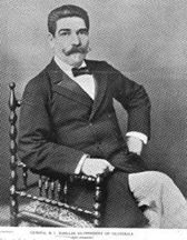
In 1892, President General Manuel Barillas decided to hold an election. This was unusual because he was the first Guatemalan president to willingly step down. It was also the first election where candidates could advertise in newspapers. Some of the candidates were:
- Lorenzo Montúfar y Rivera: A well-known and respected thinker.
- General José María Reina Barrios: The nephew of a former president and the person who would win the election.
- Miguel Enríquez: A landowner from Salamá.
President Barillas wanted to make sure the right person won. He spoke with the candidates and was happy with General Reyna Barrios's plans. Barillas then made sure many Indigenous people from other areas came to vote for Reyna. Reyna Barrios became president on March 15, 1892.
However, Miguel Enríquez was not rewarded. After the election, he was accused of trying to cause trouble and had to flee his farm in Salamá. He was later caught and executed.
A Famous Writer's Time in Salamá
In 1904, the father of Miguel Ángel Asturias, who would later win the Literature Nobel Prize, was a judge. He released some students who had been arrested for protesting. Because of this, the president removed him from his job. In 1905, Miguel Ángel Asturias's family had to move to Salamá.
There, young Miguel Ángel lived on his grandparents' farm. This was his first time truly connecting with native Guatemalan people. His nanny, Lola Reyes, was a native girl who told him many stories, myths, and legends from her culture. These stories greatly influenced his later writing. In 1908, when he was nine, his family moved back to Guatemala City.
A Brief Uprising in 1953
During the time of President Jacobo Árbenz, some wealthy landowners and business leaders were against his government's changes. These changes included social security and allowing workers to form groups. When Árbenz was elected in 1950, some hoped he would reverse these policies.
However, Árbenz supported the formation of the Guatemalan Communist Party and introduced new land reforms. This made the opposition determined to protect their traditional way of life. They used the idea of fighting communism to explain their actions against the government. Meanwhile, many middle-class people and peasants supported Árbenz because they felt they were treated better.
On March 29, 1953, a group of about 100 people who were against the government attacked Salamá and a nearby town. The attack was not well-planned. By 6:00 a.m., army forces from Cobán had defeated them. This event led to the government starting to investigate people who were against them. This increased until May 1954, when the CIA helped overthrow the Árbenz government.
Fun Times: Festivals in Salamá
Salamá has an annual festival that takes place from September 17 to September 22.
Weather in Salamá
Salamá has a tropical savanna climate. This means it's generally warm all year with a wet season and a dry season.
| Climate data for Salamá | |||||||||||||
|---|---|---|---|---|---|---|---|---|---|---|---|---|---|
| Month | Jan | Feb | Mar | Apr | May | Jun | Jul | Aug | Sep | Oct | Nov | Dec | Year |
| Mean daily maximum °C (°F) | 26.6 (79.9) |
28.0 (82.4) |
29.5 (85.1) |
30.6 (87.1) |
29.9 (85.8) |
28.4 (83.1) |
27.9 (82.2) |
28.4 (83.1) |
28.2 (82.8) |
27.7 (81.9) |
27.0 (80.6) |
26.8 (80.2) |
28.3 (82.9) |
| Daily mean °C (°F) | 20.1 (68.2) |
21.1 (70.0) |
22.5 (72.5) |
24.0 (75.2) |
23.9 (75.0) |
23.6 (74.5) |
23.0 (73.4) |
23.2 (73.8) |
23.0 (73.4) |
22.5 (72.5) |
21.2 (70.2) |
20.4 (68.7) |
22.4 (72.3) |
| Mean daily minimum °C (°F) | 13.6 (56.5) |
14.2 (57.6) |
15.6 (60.1) |
17.4 (63.3) |
18.0 (64.4) |
18.8 (65.8) |
18.2 (64.8) |
18.0 (64.4) |
17.8 (64.0) |
17.3 (63.1) |
15.4 (59.7) |
14.1 (57.4) |
16.5 (61.8) |
| Average precipitation mm (inches) | 15 (0.6) |
11 (0.4) |
16 (0.6) |
28 (1.1) |
82 (3.2) |
204 (8.0) |
148 (5.8) |
99 (3.9) |
169 (6.7) |
102 (4.0) |
39 (1.5) |
16 (0.6) |
929 (36.4) |
| Source: Climate-Data.org Instituto Nacional de Sismología, Vulcanología, Meteorología e Hidrología de Guatemala |
|||||||||||||
Where is Salamá? Geography and Location
Neighboring Towns and Villages
Salamá has 146 smaller towns and villages, called settlements. Some of the main ones include:
- San Nicolás
- El Tunal
- El Tempisque
- San Juan
- Paso Ancho
- Las Tunas
- La Laguna
- San Ignacio
- Trapiche de Agua
- Llano Grande
- Los Paxtes
- La Canoa
- Chilascó
- Niño Perdido
- La Unión Barrios
- La Paz 1 y 2
- Cachil
- El Amate
- San José El Espinero
- Las Limas
- El Nance
- Llano Largo
- La Divina Providencia
San Rafael Chilasco is the largest settlement. It's a popular place for tourists because it has one of the tallest waterfalls in Central America!
Surrounding Areas
Salamá is mostly surrounded by other towns in the Baja Verapaz area. To the south, it borders Chuarrancho, a town in the Guatemala Department.
 |
Purulhá | Purulhá |  |
|
| San Miguel Chicaj | San Jerónimo | |||
| Chuarrancho, Guatemala Department municipality |
See also
 In Spanish: Salamá para niños
 | James Van Der Zee |
 | Alma Thomas |
 | Ellis Wilson |
 | Margaret Taylor-Burroughs |


