San Acacio, Colorado facts for kids
Quick facts for kids
San Acacio, Colorado
|
|
|---|---|

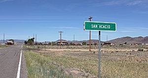
Entering San Acacio from the east on State Highway 142.
|
|

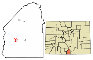
Location of the San Acacio CDP in Costilla County, Colorado.
|
|
| Country | |
| State | |
| County | Costilla County |
| Founded | 1850 |
| Government | |
| • Type | unincorporated community |
| Area | |
| • Total | 1.257 sq mi (3.255 km2) |
| • Land | 1.257 sq mi (3.255 km2) |
| • Water | 0 sq mi (0.000 km2) |
| Elevation | 7,720 ft (2,350 m) |
| Population
(2020)
|
|
| • Total | 56 |
| • Density | 44.6/sq mi (17.20/km2) |
| Time zone | UTC-7 (MST) |
| • Summer (DST) | UTC-6 (MDT) |
| ZIP Code |
81151
|
| Area code(s) | 719 |
| GNIS feature | 2583291 |
San Acacio is a small community in Costilla County, Colorado, United States. It's known as a census-designated place (CDP). This means it's a special area set up by the government for counting people.
In 2020, 56 people lived in San Acacio. The local mail for San Acacio is handled by the Sanford post office, which uses Zip Code 81151.
Contents
A Look Back: San Acacio's History
San Acacio is located in the Rio Culebra valley. This area was part of a large piece of land called the Sangre de Cristo Land Grant. This land was given to the family of Carlos Beaubien in 1843.
The San Acacio Post Office opened in 1909. It served the community until 1992. The town was named after Saint Acacius.
Important Buildings and Places
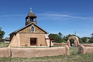
- San Acacio Mission Church (Capilla de Viejo San Acacio) – This church was built in the early 1860s. It is the oldest church still standing in Colorado. Its walls are made of thick adobe, about 24 inches wide. The church was repaired a lot in the 1990s. Workers added wooden columns inside to help hold up the roof. An artist named Maria Romero Cash made a special altar screen, called a retablo, for the church.
- San Acacio Bank – This is another historic building in the community.
- Old San Acacio Cemetery – This cemetery is also called Viejo Cemetery. It's located in a churchyard in Old San Acacio. The oldest grave marker here is from 1907. This cemetery is now full.
- New San Acacio Cemetery – This newer cemetery is about three-quarters of a mile south of San Acacio. It is open to the public. The oldest grave marker in this cemetery is from 1906. People are still buried here today.
Where is San Acacio?
San Acacio is in the western part of Costilla County. It's located in the San Luis Valley in southern Colorado. Colorado State Highway 142 goes right through San Acacio. If you go east on this highway, you'll reach San Luis in about 8 miles. If you go west, you'll get to U.S. Route 285 at Romeo in about 25 miles.
The area of San Acacio is about 3.255 square kilometers (1.257 square miles). All of this area is land.
How Many People Live Here?
The United States Census Bureau first counted San Acacio as a CDP for the United States Census 2010.
| San Acacio CDP, Colorado | ||
|---|---|---|
| Year | Pop. | ±% |
| 2010 | 40 | — |
| 2020 | 56 | +40.0% |
| Source: United States Census Bureau | ||
See also
 In Spanish: San Acacio (Colorado) para niños
 | Bayard Rustin |
 | Jeannette Carter |
 | Jeremiah A. Brown |


