Sanbornville, New Hampshire facts for kids
Quick facts for kids
Sanbornville, New Hampshire
|
|
|---|---|

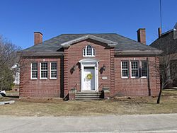
Gafney Library
|
|
| Country | United States |
| State | New Hampshire |
| County | Carroll |
| Town | Wakefield |
| Area | |
| • Total | 1.61 sq mi (4.18 km2) |
| • Land | 1.61 sq mi (4.18 km2) |
| • Water | 0.00 sq mi (0.00 km2) |
| Elevation | 581 ft (177 m) |
| Population
(2020)
|
|
| • Total | 963 |
| • Density | 596.65/sq mi (230.40/km2) |
| Time zone | UTC-5 (Eastern (EST)) |
| • Summer (DST) | UTC-4 (EDT) |
| ZIP code |
03872
|
| Area code(s) | 603 |
| FIPS code | 33-67460 |
| GNIS feature ID | 0869768 |
Sanbornville is a small community in New Hampshire, United States. It is known as a census-designated place (CDP). This means it is an area that the government counts as a separate place for population statistics. Sanbornville is the main village within the larger town of Wakefield. It is located in Carroll County. In 2020, about 963 people lived here.
Where is Sanbornville Located?
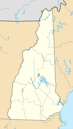
Sanbornville is in the southwest part of the town of Wakefield. It sits south of Wakefield village and north of another community called Union.
Several important roads pass through or near Sanbornville. New Hampshire Route 16 runs along its western side. This highway goes north about 10 miles (16 km) to Ossipee. It also goes south about 20 miles (32 km) to Rochester.
New Hampshire Route 153 goes right through the middle of Sanbornville. It leads north about 17 miles (27 km) to Effingham. To the south, it goes about 12 miles (19 km) to Farmington.
Another road, New Hampshire Route 109, also crosses through Sanbornville. It heads west about 13 miles (21 km) to Wolfeboro. To the southeast, it travels about 18 miles (29 km) to Sanford, Maine.
Land and Water Features
The Sanbornville CDP covers a total area of about 1.6 square miles (4.2 km2). All of this area is land.
The village is located where water flows out of Lovell Lake. This lake forms the eastern edge of the community. The Branch River starts from Lovell Lake. It flows west through the village before turning south. This river eventually joins the Salmon Falls River.
Who Lives in Sanbornville?
| Historical population | |||
|---|---|---|---|
| Census | Pop. | %± | |
| 2010 | 1,056 | — | |
| 2020 | 963 | −8.8% | |
| U.S. Decennial Census | |||
Let's look at the population of Sanbornville. In 2010, there were 1,056 people living here. By 2020, the population had changed slightly to 963 people.
In 2010, there were 417 households in Sanbornville. A household is a group of people living together in one home. Most households were families, including married couples.
The community has people of all ages. About 23.9% of residents were under 18 years old. About 12.3% of residents were 65 years old or older. The average age of people in Sanbornville was about 40.9 years old.
The average yearly income for a household in Sanbornville was around $45,352 between 2011 and 2015. For families, the average income was about $55,655.
See also
- Sanbornville (Nuevo Hampshire) for kids (in Spanish)
 | James B. Knighten |
 | Azellia White |
 | Willa Brown |


