
Union, New Hampshire facts for kids
Quick facts for kids
Union, New Hampshire
|
|
|---|---|

Reunion Grange 303
|
|

Union, New Hampshire
Location in New Hampshire

Union, New Hampshire
Location in the United States
|
|
| Country | United States |
| State | New Hampshire |
| County | Carroll |
| Town | Wakefield |
| Area | |
| • Total | 0.31 sq mi (0.81 km2) |
| • Land | 0.31 sq mi (0.81 km2) |
| • Water | 0.00 sq mi (0.00 km2) |
| Elevation | 486 ft (148 m) |
| Population
(2020)
|
|
| • Total | 196 |
| • Density | 630.23/sq mi (243.47/km2) |
| Time zone | UTC-5 (Eastern (EST)) |
| • Summer (DST) | UTC-4 (EDT) |
| ZIP code |
03887
|
| Area code(s) | 603 |
| FIPS code | 33-77780 |
| GNIS feature ID | 0870569 |
Union is a small village in New Hampshire, United States. It is part of the town of Wakefield in Carroll County. In 2020, about 196 people lived there. Union is known as a census-designated place (CDP), which means it's a special area defined for counting people. It even has its own special ZIP code, 03887!
Contents
Where is Union Located?
Union is in the southern part of the town of Wakefield. A river called the Branch River flows through it. This river eventually joins the Salmon Falls River.
Union is close to other towns. To its west is Middleton. To the southeast is Milton. Both of these towns are in a different county called Strafford County.
Roads and Travel
Several important roads pass through or near Union:
- New Hampshire Route 16 runs along the northeastern edge of Union. You can take this highway north about 16 miles (26 km) to Ossipee. Or, you can go south about 15 miles (24 km) to Rochester.
- New Hampshire Route 153 goes through the northern part of the village. It leads north about 4.5 miles (7.2 km) to Sanbornville. It also goes southwest about 8 miles (13 km) to Farmington.
- New Hampshire Route 125 starts in Union at Route 16. It goes southeast about 5 miles (8 km) to Milton.
Size of Union
According to the U.S. Census Bureau, the Union CDP covers a total area of about 0.31 square miles (0.81 square kilometers). All of this area is land.
Who Lives in Union?
| Historical population | |||
|---|---|---|---|
| Census | Pop. | %± | |
| 2010 | 204 | — | |
| 2020 | 196 | −3.9% | |
| U.S. Decennial Census | |||
Let's look at the people who live in Union based on the 2010 census:
- There were 204 people living there.
- These people lived in 84 households.
- About 56 of these were families.
- Most residents (98.5%) were white.
- A small number were Native American (0.5%) or from "some other race" (1.0%).
- About 1.0% of the population identified as Hispanic or Latino.
Households and Families
- In 25% of the households, there were children under 18 years old.
- Almost half (47.6%) of the households were married couples living together.
- About 14.3% of households had a female head of household with no husband present.
- About 21.4% of all households were made up of people living alone.
- About 11.9% of these were people aged 65 or older living by themselves.
- The average household had about 2.43 people.
- The average family had about 2.82 people.
Age Groups
The people in Union come from different age groups:
- 16.7% were under 18 years old.
- 7.3% were between 18 and 24 years old.
- 20.6% were between 25 and 44 years old.
- The largest group, 38.7%, were between 45 and 64 years old.
- 16.7% were 65 years old or older.
- The average age in Union was 48.4 years.
Images for kids
-
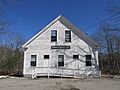
Reunion Grange 303
See also
 In Spanish: Union (Nuevo Hampshire) para niños
