Sand Spring Run facts for kids
Quick facts for kids Sand Spring Run |
|
|---|---|

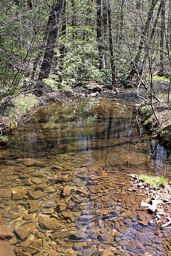
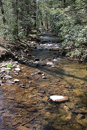
Sand Spring Run looking downstream
|
|
| Physical characteristics | |
| Main source | shallow valley on a mountain in Lewis Township, Union County, Pennsylvania 1,768 ft (539 m) |
| River mouth | White Deer Creek in West Buffalo Township, Union County, Pennsylvania near White Deer 1,033 ft (315 m) ACoordinates: Unknown argument format |
| Length | 5.7 mi (9.2 km) |
| Basin features | |
| Progression | White Deer Creek → West Branch Susquehanna River → Susquehanna River → Chesapeake Bay |
| Tributaries |
|
Sand Spring Run is a small stream, also called a tributary, located in Union County, Pennsylvania, in the United States. It flows into White Deer Creek. The stream is about 5.7 miles (9.2 km) long. It runs through two areas: Lewis Township and West Buffalo Township.
The area of land that drains into Sand Spring Run, called its watershed, covers about 4.94 square miles (12.8 km2). This stream is known for being clean and healthy, meaning it's not considered a polluted or "impaired" waterbody. It's a natural stream found in the mountains, and much of it flows through the beautiful Bald Eagle State Forest.
Contents
Where Does Sand Spring Run Flow?
Sand Spring Run starts in a shallow valley on a mountain in Lewis Township. It flows east for a short distance, passing through two small ponds. Then, it turns south as its valley gets deeper.
The stream then turns west-southwest for a bit before turning south-southeast. After a short distance, it goes under Interstate 80. It then turns east-northeast and flows alongside Interstate 80 through a valley for a few miles.
As it flows, Sand Spring Run receives water from smaller streams, called unnamed tributaries. It then enters West Buffalo Township. Here, it continues flowing east-northeast, getting more water from other small tributaries. Finally, its valley widens, and it meets White Deer Creek. Sand Spring Run joins White Deer Creek about 12.48 miles (20.08 km) before White Deer Creek reaches its own end.
How Much Water Does Sand Spring Run Carry?
Sand Spring Run is a healthy stream and is not listed as having water quality problems. On average, the stream's daily water flow, or discharge, was once measured at about 6.06 cubic feet per second (0.172 m3/s).
There is a special measuring station, called a stream gauge, on Sand Spring Run near White Deer. This gauge helps scientists keep track of how much water is flowing in the stream.
The Land Around Sand Spring Run
The lowest point of Sand Spring Run, where it meets White Deer Creek, is about 1,033 feet (315 m) above sea level. The highest point, where the stream begins, is about 1,768 feet (539 m) above sea level.
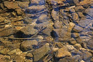
Sand Spring Run is located in a region known as the Ridge-and-Valley Appalachians. This area has many mountains and valleys. The stream itself is a "freestone stream," which means its water flows over rocks and gravel, not over soft soil or clay.
The Sand Spring Run Watershed
The entire area of land that collects water for Sand Spring Run, its watershed, covers about 4.94 square miles (12.8 km2). The end of the stream is located near the town of White Deer.
The main purpose for Sand Spring Run, as decided by environmental groups, is to support aquatic life. This means it's important for fish and other water creatures. A road called State Route 1010 (also known as White Deer Pike Road/Sugar Valley Narrows Road) runs next to the stream. Interstate 80 also follows parts of the stream.
History and Fun Facts
Sand Spring Run was officially added to the Geographic Names Information System on August 2, 1979. This system keeps track of names and locations of places in the United States.
A railroad called the Sugar Valley Railroad used to run near Sand Spring Run. It was built in 1900 but was no longer used by 1904 or 1905.
Almost all of Sand Spring Run flows within the boundaries of Bald Eagle State Forest. This means it's a great place for nature and outdoor activities.
Wildlife in Sand Spring Run
Sand Spring Run is home to wild trout. These fish naturally reproduce in the lower 4.47 miles (7.19 km) of the stream. Both brook trout and brown trout live in the waters of Sand Spring Run.
 | Toni Morrison |
 | Barack Obama |
 | Martin Luther King Jr. |
 | Ralph Bunche |


