Sandy River (Kennebec River tributary) facts for kids
Quick facts for kids Sandy River (Kennebec River) |
|
|---|---|

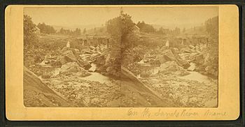
Stereoscopic view of the river c. 1875
|
|
| Country | United States |
| Physical characteristics | |
| Main source | Phillips, Maine 1,700 feet (520 m) |
| River mouth | Kennebec River 156 feet (48 m) 44°45′52″N 69°53′23″W / 44.7644°N 69.8898°W |
| Length | 73 miles (117 km) |
| Basin features | |
| Tributaries |
|
The Sandy River is a river in Maine, a state in the United States. It flows for about 73 miles (118 kilometers) and eventually joins the larger Kennebec River. The river is an important part of the local environment and history.
Contents
Where the Sandy River Flows
The Sandy River starts in a place called Sandy River Ponds. These ponds are high up, about 1,700 feet (518 meters) above sea level. From there, the river flows south.
It then turns east and passes through towns like Madrid and Phillips. As it continues, it flows southeast through villages such as Phillips and Strong.
The river then heads south towards Farmington. After Farmington, it flows northeast through New Sharon. Finally, it empties into the Kennebec River near Norridgewock.
Roads Along the River
Several roads follow the Sandy River. Maine State Route 4 runs alongside the river from its starting point. It crosses the river in Strong and again in Farmington. U.S. Route 2 also crosses the river in Farmington. This route then follows the river downstream to New Sharon, where it crosses the river one last time before the Sandy River meets the Kennebec.
A Look at the River's Past
For a long time, the Abenaki people, who are Native Americans, used the lower part of the Sandy River. It was a great route for traveling by canoe. Phillips was also a very important place for fishing. Fish like salmon would swim up the river to lay their eggs. However, dams built later stopped these fish from traveling upstream.
Early Settlers and Mills
European settlers started arriving in the river valley during the American Revolutionary War. They built water-powered mills along the river. These mills helped towns grow, even as far upstream as Madrid by 1820, when Maine became a state.
Early settlers farmed the flat lands near the river. They grew crops between the last frost in spring and the first frost in autumn. In winter, from December to March, they would cut down trees. They used sleds to move logs and lumber when there was snow on the ground.
The "Pumpkin Freshet" Flood
In October 1869, a huge flood hit the area. People called it the "pumpkin freshet." This flood was so powerful that it destroyed every bridge over the river. Most of the early mills were also washed away.
After the flood, bigger mills were built in Phillips, Farmington, and New Sharon. A special narrow-gauge railway, the Sandy River Railroad, was built in 1879. It followed the river from Phillips to Farmington.
Logging and the Railroad
Later, in 1891, the Phillips and Rangeley Railroad was built. This allowed people to cut down trees in the areas higher up the river. Large sawmills, which cut logs into lumber, were set up. Between 1891 and 1908, many of the original spruce forests were cut down for lumber.
The railroad continued to be used for moving pulpwood (wood used to make paper) even through World War I. However, there weren't enough trees left to keep the railroad running profitably. The railroad faced financial trouble in 1923 and was taken apart between 1934 and 1936.
Another Big Flood
In March 1936, heavy rain combined with melting winter snow caused another massive flood. This flood washed away a dam and created the largest river flow ever recorded for the Sandy River.
 | Tommie Smith |
 | Simone Manuel |
 | Shani Davis |
 | Simone Biles |
 | Alice Coachman |

