
Scheduled monuments in Derbyshire Dales facts for kids
Derbyshire Dales is home to many amazing historical sites! These special places are called scheduled monuments. They are important archaeological sites or historic buildings that the government protects. Think of it like a VIP list for ancient treasures!
These monuments are considered "nationally important" because they tell us a lot about the past. English Heritage, a group that looks after England's history, helps decide which sites get this special protection. Once a site is on the list, it's protected from changes that could harm its historical value.
Derbyshire has over 500 scheduled monuments. These include ancient stone circles, burial mounds called barrows, old lead mining sites, and even more than 20 historic bridges! Each one helps us understand the people who lived here long ago.
Contents
Discovering Derbyshire's Ancient Treasures
What Are Scheduled Monuments?
A scheduled monument is a very important historical place or building. It gets special protection from the government. This means no one can change or damage it without permission. These sites are often archaeological, meaning they hold clues about people from thousands of years ago.
English Heritage helps find and protect these sites. They make sure these ancient places stay safe for everyone to learn from. Sometimes, a scheduled monument can also be a "listed building." This means it's also protected for its architectural beauty.
Amazing Ancient Sites in Derbyshire Dales
Derbyshire Dales is full of incredible historical spots. Let's explore some of the most interesting ones!
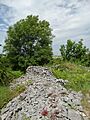
Mysterious Burial Mounds and Stone Circles
Many scheduled monuments are ancient burial sites or places used for ceremonies. These give us clues about how people lived and what they believed thousands of years ago.
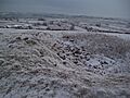
- Arbor Low Henge: Near Monyash, this is a huge Neolithic (New Stone Age) henge. It has about 50 large limestone blocks arranged in an egg shape. It's a bit like a giant outdoor museum!

- Benty Grange Hlaew: This is a large Anglo-Saxon burial mound near Monyash. In 1848, explorers found a very rich burial here. It even included the famous Benty Grange helmet!
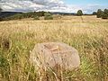
- Blackstone's Low Bowl Barrow: Located in Ballidon, this is a bowl barrow. These are round mounds of earth used for burials in the Bronze Age.
.jpg)
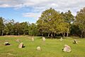
- Doll Tor Stone Circle: Near Stanton in Peak, this small Bronze Age stone circle is also known as the Six Stones. It has six standing stones and was explored in 1852.

- Five Wells Chambered Tomb: You can find this ancient tomb near Taddington. It's a mound with chambers inside. It was excavated in 1846, revealing human remains.

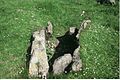
- Green Low Chambered Tomb: Near Aldwark, this tomb is made of limestone slabs. When it was excavated in 1843, archaeologists found human and animal remains, plus ancient pottery and a polished axe!

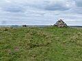
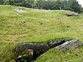
- Hob Hurst's House: This unique Bronze Age burial mound is near Beeley. Unlike most round barrows, Hob Hurst's House is rectangular! It originally had 13 stones, but only five remain.

- Nine Stone Close: This small Bronze Age stone circle is near Winster. It's sometimes called Grey Ladies.

- Wet Withens Embanked Stone Circle: Located on Eyam Moor, this prehistoric stone circle has about 10 upright boulders. It's surrounded by an earth bank.

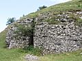
Old Mines and Industrial History
Derbyshire has a long history of mining, especially for lead. Many old mine sites are now protected.
- Alport Smelt Mill: Near Alport, these are the remains of furnaces used to melt lead. The mill was used between 1845 and 1875.
- Bonsall Leys Lead Mines: In Bonsall, you can see ruins, pits, and spoil heaps from lead mining that started as early as the 1540s!
.jpg)
- Cackle Mackle and Stadford Hollow Lead Mines: These mines are on Longstone Moor near Great Longstone.

- Lathkill Dale and Mandale Mines: Near Youlgreave, these lead mines are a rare example of mining activity from the 13th century! They include ruined engine houses and mine shafts.

- Lumford Mill: In Bakewell, this site includes earthworks and structures for managing water for Richard Arkwright's mill, which started in 1777. It has a weir, stream, pond, and tunnel.

- Lumsdale Mills: In Matlock, this area has various mills and ponds in the Lumsdale Valley. There were 17th-century lead smelting mills here.

- Magpie Mine: Near Sheldon, this site shows lead mining from the late 1600s until 1958! You can see the ruins of the Cornish engine house and a tall chimney.

- Old Millclose Engine House: In South Darley, this engine house was built in 1859 to pump water from the Old Millclose lead mine.
.jpg)
- High Peak Junction Workshops: In Cromford, these workshops are part of the Derwent Valley Mills World Heritage Site. Goods were moved here between canal barges and trains on one of the world's oldest railways!

Strongholds and Homes of the Past
These sites show us where people lived, worked, and defended themselves in ancient times.
- Atlow Moated Site: In Atlow, this is a moated site with enclosures and a causeway. Moats were ditches filled with water, often around important buildings.

- Castle Ring Defended Settlement: North of Harthill Moor Farm, this is an oval earthwork ditch with inner and outer banks. It's thought to be part of a Bronze Age landscape.

- Conksbury Deserted Medieval Settlement: Near Youlgreave, this was a village in the Middle Ages (around 1086 AD). You can still see the earthworks and buried remains of buildings.

- Cratcliff Rocks Defended Settlement: In Birchover, this site is a round enclosure with a 5-meter-wide ditch cut into the rock. It has platforms where buildings once stood.

- Medieval Settlement at Ballidon: South of Ballidon village, this site has earthworks and buried remains of a medieval settlement. It even shows old field boundaries and farming patterns.

- Padley Hall: In Grindleford, these are the ruins of a large medieval house. It's famous for being the place where two Catholic priests were found in 1588.

- Pilsbury Castle Hills: Near Pilsbury, this is the site of a Norman castle overlooking the River Dove.

- Yeaveley Preceptory: At Stydd Hall in Yeaveley, this moated site was founded in 1190. Preceptories were like farms that raised money for the Knights Hospitaller's crusades.

Ancient Crosses and Bridges
Many old crosses and bridges are also protected. They show us how people traveled and marked important places.
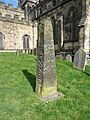
- Anglian High Cross, Eyam: In the churchyard of St Lawrence's Church, Eyam, this is an ancient cross. It's also a Grade I listed building.

- Anglian High Cross, Bakewell: You can find this cross in the churchyard of All Saints' Church, Bakewell. It's also a Grade I listed building.

- Ashford Bridge: In Ashford-in-the-Water, this bridge is also a Grade II listed building.


- Baslow Bridge: In Baslow, this bridge crosses the River Derwent and is a Grade I listed building.
.jpg)
- Cromford Bridge: This bridge in Cromford spans the River Derwent and is a Grade II* listed building.

- Darley Bridge: Located in South Darley, this bridge is a Grade II* listed building.

- Dove Bridge: In Doveridge, this bridge spans the River Dove and is a Grade II* listed building.

- Ellastone Bridge: This 18th-century bridge crosses the River Dove between Norbury and Ellastone. It's a Grade II listed building.

- Froggatt Bridge: In Calver, this bridge crosses the River Derwent and is a Grade II listed building.

- Grindleford Bridge: This bridge in Grindleford spans the River Derwent and is a Grade II listed building.

- Holme Bridge: In Bakewell, this bridge is a Grade I listed building.

- Matlock Bridge: This bridge in Matlock spans the River Derwent and is a Grade II* listed building.

- One Arch Bridge: Near Chatsworth in Edensor, this bridge over the River Derwent was built in 1760. It's a Grade II* listed building.

- Rowsley Bridge: In Rowsley, this bridge spans the River Derwent and is a Grade II* listed building.

- Sheepwash Bridge: In Ashford-in-the-Water, this medieval packhorse bridge has a stone sheep pen. Lambs were held in the pen while ewes were driven across the river to clean their fleeces! It's a Grade II* listed building.

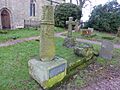
- Standing Cross, Taddington: This cross is in the churchyard of St Michael and All Angels in Taddington.

- Viator's Bridge: In Milldale, this bridge crosses the River Dove and is a Grade II listed building.

- Wheston Cross: This standing cross is known as Wheston Cross.

Hidden Caves and Other Wonders
Derbyshire Dales also has fascinating caves and other unique historical features.
- Batham Gate: This is a Roman road near Tideswell. About a mile long, it shows us how the Romans built their roads.

- Calver Weir and Water Management System: In Calver, this system helped manage water.

- Camp Green Ringwork: In Hathersage, this is an earthwork. Ringworks were early types of castles or fortified sites.

- Civil War Redoubt: Near Tissington, this square earthbank enclosure was used as a military defense during the English Civil War. Tissington Hall was a Royalist base in 1643.

- Cratcliff Rocks Hermitage: Also in Birchover, this is a medieval hermit's cave from the 13th-14th century. It even has a carved crucifix inside!

- Cromford Canal Engine House: In Cromford, this site is part of the Derwent Valley Mills World Heritage Site. It includes Leawood Pump House, built in 1849 to pump water into the Cromford Canal. The steam engine could move 4 tonnes of water with every stroke!

- Dowel Cave: Near Glutton Bridge, this narrow cave has been used by humans for thousands of years! Explorers found objects from the Stone Age, Bronze Age, Iron Age, and Roman times.

- Fin Cop Promontory Fort: In Ashford-in-the-Water, this is an Iron Age hill fort built around 440-390 BC.

- Fox Hole Cave: Near Earl Sterndale, this limestone cave has several chambers. Excavations found objects from the Stone Age and Roman times. Some are even in the Buxton Museum!

- Harboro' Cave: In Brassington, this natural cavern has evidence of human life since the Ice Age! A lead miner's family even lived here in the early 1700s.

- Mouldridge Grange Earthworks: In Brassington, these are the earthworks and buried remains of a medieval monastic farm.

- Rainster Rocks Romano-British Settlement: In Brassington, this site has terraces, embankments, and platforms from a Romano-British settlement.

- Stanage Edge Roman Road: This is part of the Long Causeway that ran between Sheffield and Hathersage. It's a Roman road!

- Tides Low Bowl Barrow, Limekiln and Standing Stone: In Tideswell, this site includes a burial mound, a limekiln, and a standing stone.

- Wardlow Hay Cop Bowl Barrow: In Wardlow, this is another example of a bowl barrow.

- White Cliff Bowl Barrow: Near Little Longstone, this is a bowl barrow.
.jpg)
Images for kids
-
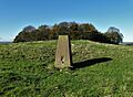
Aleck Low bowl barrow
-
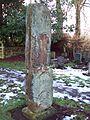
Anglian high cross in the churchyard of All Saints' Church, Bradbourne
-
Anglo-Scandinavian high cross from Two Dales, Darley, now in the churchyard of All Saints' Church, Bakewell
-
Anglo-Scandinavian high cross shaft and medieval cross base in the churchyard of All Saints' Church, Brailsford
-
Arbourseats Veins and Sough, Wardlow Sough, Nay Green Mine and Washing Floors, Hading Vein and Seedlow Rake
-
Black Rakes, Welshmans Venture and Bondog Hole Mines, and Merry Tom and Thumper Sitch Levels
-
Blackstone's Low bowl barrow
-
Boars Low bowl barrow
-
Bowl barrow and wayside cross
-
5 Bowl barrows on Calton Pastures
-
2 Bowl barrows on Longstone Moor
-
2 bowl barrows at Osmaston Fields, north
-
2 bowl barrows on Chelmorton Low
-
Bronze Age burial, ceremonial and settlement remains on Stanton Moor
-
Chambered tomb and two bowl barrows on Minning Low
-
Carsington Pasture, Nickalum, Perseverance, West Head, Break Hollow and other small mines and medieval field boundaries
-
Tinker's Inn bowl barrow, south
-
Tideslow Rake lead rake and lime kiln
-
Rolley Low bowl barrow
.jpg)
.jpg)
.jpg)


.jpg)

.jpg)
.jpg)

.jpg)
.jpg)

.jpg)


