Seymour Mountain (Franklin County, New York) facts for kids
Quick facts for kids Seymour Mountain |
|
|---|---|

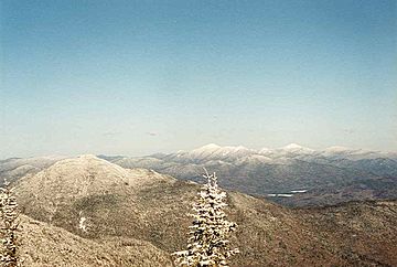
Seymour Mt. (L) seen from Donaldson Mt.
|
|
| Highest point | |
| Elevation | 1,247 metres (4,091 ft) |
| Prominence | 310 m (1,020 ft) |
| Listing | Adirondack High Peaks 34th |
| Geography | |
| Location | Franklin County, New York |
| Parent range | Seward Mountains |
| Topo map | USGS Ampersand Lake |
Seymour Mountain is a cool mountain found in Franklin County, New York. It got its name from Horatio Seymour, who was an important leader. He served as the Governor of New York twice in the 1800s.
This mountain is part of the Seward Mountains, which are a group of peaks within the famous Adirondacks. Seymour Mountain is located right across from Seward Mountain, with a spot called Ouluska Pass between them.
Where Does the Water Go? Understanding Seymour Mountain's Watershed
Seymour Mountain is part of a watershed. Think of a watershed as a giant funnel. All the rain and snow that falls on Seymour Mountain eventually flows into the Raquette River. This river is quite long! It travels all the way into Canada and then empties into the Saint Lawrence River. From there, the water reaches the Gulf of Saint Lawrence, which is part of the Atlantic Ocean.
How Water Flows Down Seymour Mountain
Water from different sides of Seymour Mountain takes different paths:
- The east and southeast sides of the mountain have many small streams. These streams flow into the Cold River. The Cold River is a tributary, meaning it's a smaller river that flows into a bigger one. In this case, it flows into the Raquette River.
- On the west side, water flows into Seward Brook. This brook also joins the Cold River, and then the Raquette River.
- The northern slopes of Seymour Mountain drain into Ward Brook. Ward Brook then flows into Ampersand Lake, then Ampersand Brook, Stony Creek, and finally, the Raquette River.
Exploring Seymour Mountain's Location in the Adirondack Park
Seymour Mountain is located inside the High Peaks Wilderness Area. This is a special protected part of New York's huge Adirondack Park. The park is known for its beautiful wild areas, tall mountains, and many lakes and rivers. Being in a wilderness area means the mountain and its surroundings are kept as natural as possible. This helps protect the plants, animals, and natural beauty for everyone to enjoy.
 | Leon Lynch |
 | Milton P. Webster |
 | Ferdinand Smith |


