Sgùrr nan Ceannaichean facts for kids
Quick facts for kids Sgùrr nan Ceannaichean |
|
|---|---|

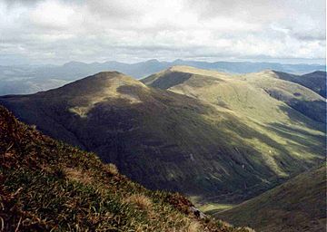
Sgùrr nan Ceannaichean seen from Sgùrr Choinnich, 3.5 km to the south.
|
|
| Highest point | |
| Elevation | 913.4 m (2,997 ft) |
| Prominence | 181 m |
| Listing | Corbett, Marilyn |
| Naming | |
| English translation | Peak of the Merchants or Pedlars |
| Language of name | Gaelic |
| Geography | |
| Location | Wester Ross, Scotland |
| Parent range | Northwest Highlands |
| OS grid | NH087480 |
| Topo map | OS Landranger 25, OS Explorer 429 |
Sgùrr nan Ceannaichean is a mountain in Scotland. It's about 13 kilometers (8 miles) southwest of a village called Achnasheen. This mountain sits on the south side of Glen Carron, inside the Glencarron and Glenuig Forest. It's part of the Highland area in Ross and Cromarty.
Contents
What's in a Name?
The name Sgùrr nan Ceannaichean comes from the Gaelic language. It means Peak of the Merchants or Pedlars.
People think it got this name because it was a very important landmark. Long ago, the main path between eastern and western Scotland went through the Strathconan valley, which is just north of the mountain. Traders and travelers might have used Sgùrr nan Ceannaichean to guide their way.
How Tall Is It?
Mountains in Scotland are often grouped by their height. Sgùrr nan Ceannaichean has had its height status changed a few times!
At first, it was called a Corbett. A Corbett is a Scottish mountain between 762 meters (2,500 feet) and 914.4 meters (3,000 feet) tall.
Then, in 1981, it was reclassified as a Munro. Munros are mountains in Scotland that are over 914.4 meters (3,000 feet) high. This change happened after new air surveys showed its height was about 915 meters.
However, in 2009, The Munro Society did a very accurate survey. They found the mountain's exact height is 913.43 meters. This meant it was just under the 914.4-meter mark. So, Sgùrr nan Ceannaichean went back to being a Corbett.
Mountain Shape and Features
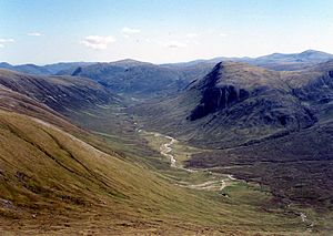
Sgùrr nan Ceannaichean is a really interesting mountain to explore. Its western side is very steep and rocky. It drops down into the valley of the Allt a’ Chonais, with two impressive, deep gullies.
On the northeast side, you'll find a beautiful corrie called Coire Toll nam Bian. A corrie is a bowl-shaped hollow formed by glaciers. There's another smaller corrie, Coire an Tuill Bhàn, just east of the top. This one slopes down to the southeast, near Glenuig Lodge.
The very top of the mountain is a flat area with several cairns (piles of stones). The cairn furthest south is actually the highest point.
This mountain also sits on a major watershed in Scotland. This means that rain falling on one side flows to the west coast, while rain on the eastern slopes forms the start of the River Meig, which flows to the east coast's Cromarty Firth.
How to Climb Sgùrr nan Ceannaichean
Many people climb Sgùrr nan Ceannaichean along with its neighbor, Moruisg. You can start your climb from a spot west of Loch Sgamhain on the A890 road. From there, you can choose which mountain to climb first.
Another way to climb Sgùrr nan Ceannaichean directly is to start at a small village called Craig. From Craig, you follow the valley of the Allt a' Chonais for about five kilometers. Then, a special path used by stalkers (people who manage deer) goes steeply up the mountain's southern slopes to the summit. If you want to continue to Moruisg from there, you head northeast and then north along the edge of the Coire Toll nam Bian.
 | Tommie Smith |
 | Simone Manuel |
 | Shani Davis |
 | Simone Biles |
 | Alice Coachman |


