Shire of Bridgetown–Greenbushes facts for kids
Quick facts for kids Shire of Bridgetown GreenbushesWestern Australia |
|||||||||||||||
|---|---|---|---|---|---|---|---|---|---|---|---|---|---|---|---|

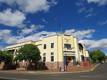
The Bridgetown-Greenbushes shire offices
|
|||||||||||||||

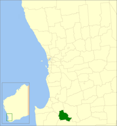
Location in Western Australia
|
|||||||||||||||
| Established | 1970 | ||||||||||||||
| Area | 1,339.8 km2 (517.3 sq mi) | ||||||||||||||
| Shire President | Jenny Mountford | ||||||||||||||
| Council seat | Bridgetown | ||||||||||||||
| Region | South West | ||||||||||||||
| State electorate(s) | Warren-Blackwood | ||||||||||||||
| Federal Division(s) | O'Connor | ||||||||||||||
 |
|||||||||||||||
| Website | Shire of Bridgetown Greenbushes | ||||||||||||||
|
|||||||||||||||
The Shire of Bridgetown–Greenbushes is a special area in Western Australia. It is like a local government, which means it helps manage things for the people living there. This Shire is located in the South West part of the state.
It is about 80 kilometers (50 miles) southeast of Bunbury. It is also about 260 kilometers (160 miles) south of Perth, which is the capital city of Western Australia. The Shire covers a large area of about 1,340 square kilometers (517 square miles). The main town and where the government offices are located is Bridgetown.
Contents
History of the Shire
The Shire of Bridgetown–Greenbushes was created a long time ago. It was formed on March 26, 1970. This happened when two smaller areas, the Shire of Bridgetown and the Shire of Greenbushes, joined together.
First Peoples of the Land
The land where the Shire of Bridgetown–Greenbushes is located has a rich history. It is the traditional home of the Bibulman and Wardandi people. Both of these groups are part of the larger Noongar nation. These Indigenous people have lived on and cared for this land for thousands of years.
How the Shire is Governed
Since 2021, the Shire of Bridgetown–Greenbushes has changed how it is run. It is no longer divided into smaller sections called wards. Instead, all nine people who are elected to be councillors represent the entire Shire. This means they work for everyone in the whole area.
Towns and Localities in the Shire
The Shire of Bridgetown–Greenbushes includes several towns and smaller areas called localities. These places have different numbers of people living in them. The information below comes from the most recent count of people, called the Australian census.
| Locality | Population | Area | Map |
|---|---|---|---|
| Bridgetown | 3,168 (SAL 2021) | [convert: needs a number] | |
| Catterick | 171 (SAL 2021) | [convert: needs a number] | |
| Glenlynn | 112 (SAL 2021) | [convert: needs a number] | |
| Greenbushes | 365 (SAL 2021) | [convert: needs a number] | |
| Hester | 101 (SAL 2021) | [convert: needs a number] | |
| Hester Brook | 127 (SAL 2021) | [convert: needs a number] | |
| Kangaroo Gully | 512 (SAL 2021) | [convert: needs a number] | |
| Kingston | 16 (SAL 2021) | [convert: needs a number] | |
| Maranup | 60 (SAL 2021) | [convert: needs a number] | |
| North Greenbushes | 174 (SAL 2021) | [convert: needs a number] | |
| Sunnyside | 100 (SAL 2021) | [convert: needs a number] | |
| Wandillup | 64 (SAL 2021) | [convert: needs a number] | |
| Winnejup | 176 (SAL 2021) | [convert: needs a number] | |
| Yornup | 94 (SAL 2021) | [convert: needs a number] |
Places of Historical Importance
The Shire of Bridgetown–Greenbushes has many places that are important to its history. As of 2023, there are 139 places listed as heritage sites. Twelve of these places are so important that they are on the State Register of Heritage Places. One famous example is the Freemasons Hotel, Bridgetown. These sites help us remember the past and learn about how people lived long ago.

