Silverado, California facts for kids
Quick facts for kids
Silverado, California
|
|
|---|---|

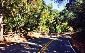
Silverado Canyon Road, 2015
|
|
| Country | United States |
| State | California |
| County | Orange |
| Elevation | 1,211 ft (369 m) |
| Time zone | UTC-8 (PST) |
| • Summer (DST) | UTC-7 (PDT) |
| ZIP code |
92676
|
| Area code(s) | 714 |
| Reference #: | 202 |
Silverado is a small community in Silverado Canyon. It is located in the Santa Ana Mountains in eastern Orange County, California. Part of the town is on land that used to be a large Mexican ranch. Silverado is right next to the Cleveland National Forest. This area is a California Historical Landmark. It is also near where the old village of Puhú used to be.
Contents
Discovering Silverado's Past
Silverado started in 1878. People came here to mine for silver in the late 1800s and early 1900s. You can still find parts of old mining operations. One example is the Blue Light Mine. Trees were also cut down to be used for the railroad. Coal was mined in a nearby place called Carbondale.
Ancient Discoveries
You can find old sea life fossils in the sandstone cliffs here. Long ago, during Spanish rule, explorers visited this canyon. They called it Cañada de la Madera, which means "Timber Canyon." There is a town in Spain with the same name that looks a lot like Silverado. The name Silverado itself means "a place where silver is found." It's like the famous "El Dorado" story.
A Popular Getaway
In the 1940s, Silverado became a popular place for vacations. People came to enjoy the hot springs. Hotels and restaurants did very well during this time. Many small cabins were also built for weekend trips.
Silverado Today
Today, Silverado is home to about 2,000 people. Many artists and craftspeople live here. The town has a general store, a cafe, and a public library. There is also a church, two fire stations, and a community center. The town hosts summer concerts and an annual Country Fair. They also have an Easter breakfast. A well-known spot near Silverado is Cook's Corner. It is a bar that is popular with motorcyclists.
Facing Natural Challenges
Heavy rains from Pacific storms caused big floods. This happened in 1939 and again in 1969. Homes were washed away, and roads and bridges were destroyed. The 1969 storm even caused some deaths.
On October 26, 2007, people had to leave the area. This was because of the Santiago Fire. In September 2014, another fire burned about 1,000 acres (400 hectares) in the canyon. Luckily, no buildings were lost in that fire.
Future Growth
New homes and developments are growing closer to the canyons. These are coming from nearby cities. The biggest planned projects are by the Irvine Company. They plan to build two large developments. These will stretch along Santiago Canyon Road.
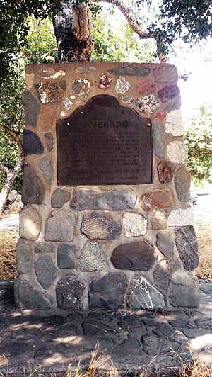
Historical Marker
There is a special marker at the site that tells its history. It says:
- Located in Cañada de la Madera (Timber Canyon), Silverado was a mining boom town founded in 1878 when silver was discovered nearby. During the colorful life of the boom, 1878-1881, miners, flocking to the area, established a thriving community, served daily by stage from Los Angeles and Santa Ana. This marker was put up by the California State Park Commission. (Marker Number 202.)
Silverado's Population
The United States Census Bureau started counting Silverado as a special place for statistics. This began before the 2020 census.
How Many People Live Here?
In 2020, the population of Silverado was 932 people. Most of the people living in Silverado are White. There are also smaller groups of Asian, Black, Native American, and Pacific Islander people. Some residents are of mixed race. About 12.5% of the population is Hispanic or Latino.
 | Bessie Coleman |
 | Spann Watson |
 | Jill E. Brown |
 | Sherman W. White |


