
Smith County, Mississippi facts for kids
Quick facts for kids
Smith County
|
|
|---|---|

Smith County courthouse in Raleigh
|
|

Location within the U.S. state of Mississippi
|
|
 Mississippi's location within the U.S. |
|
| Country | |
| State | |
| Founded | 1833 |
| Named for | David Smith |
| Seat | Raleigh |
| Largest town | Raleigh |
| Area | |
| • Total | 637 sq mi (1,650 km2) |
| • Land | 636 sq mi (1,650 km2) |
| • Water | 1.0 sq mi (3 km2) 0.2% |
| Population
(2020)
|
|
| • Total | 14,209 |
| • Estimate
(2023)
|
14,099 |
| • Density | 22.306/sq mi (8.612/km2) |
| Time zone | UTC−6 (Central) |
| • Summer (DST) | UTC−5 (CDT) |
| Congressional district | 3rd |
Smith County is a special area in the state of Mississippi in the United States. It's like a big neighborhood with its own local government. In 2020, about 14,209 people lived here. The main town, where the county government is located, is called Raleigh.
Contents
History of Smith County
Smith County got its name from a person named Major David Smith. The county was officially started in the year 1833.
Geography of Smith County
Geography is all about the land, water, and features of a place. Smith County covers a total area of about 637 square miles. Most of this area, about 636 square miles, is land. Only a small part, about 1 square mile, is water.
Main Roads in Smith County
Many important roads help people travel through Smith County. These roads connect different towns and areas.
 Mississippi Highway 13
 Mississippi Highway 18
 Mississippi Highway 28
 Mississippi Highway 35
 Mississippi Highway 37
 Mississippi Highway 540
 Mississippi Highway 481
 Mississippi Highway 501
 Mississippi Highway 902
Neighboring Counties
Smith County shares its borders with several other counties. These are like its neighbors.
- Scott County (to the north)
- Jasper County (to the east)
- Jones County (to the southeast)
- Covington County (to the south)
- Simpson County (to the west)
- Rankin County (to the northwest)
Protected Natural Areas
Part of a large natural area, the Bienville National Forest, is located within Smith County. This forest helps protect nature and wildlife.
Population of Smith County
The word "demographics" means studying the people who live in a place. This includes how many people there are and what groups they belong to.
| Historical population | |||
|---|---|---|---|
| Census | Pop. | %± | |
| 1840 | 1,961 | — | |
| 1850 | 4,071 | 107.6% | |
| 1860 | 7,638 | 87.6% | |
| 1870 | 7,126 | −6.7% | |
| 1880 | 8,088 | 13.5% | |
| 1890 | 10,635 | 31.5% | |
| 1900 | 13,055 | 22.8% | |
| 1910 | 16,603 | 27.2% | |
| 1920 | 16,178 | −2.6% | |
| 1930 | 18,405 | 13.8% | |
| 1940 | 19,403 | 5.4% | |
| 1950 | 16,740 | −13.7% | |
| 1960 | 14,303 | −14.6% | |
| 1970 | 13,561 | −5.2% | |
| 1980 | 15,077 | 11.2% | |
| 1990 | 14,798 | −1.9% | |
| 2000 | 16,182 | 9.4% | |
| 2010 | 16,491 | 1.9% | |
| 2020 | 14,209 | −13.8% | |
| 2023 (est.) | 14,099 | −14.5% | |
| U.S. Decennial Census 1790-1960 1900-1990 1990-2000 2010-2013 |
|||
In 2020, there were 14,209 people living in Smith County. These people lived in about 5,820 households, which are like homes or families living together.
Towns and Villages in Smith County
Smith County has several towns and one village where people live and work.
Towns in Smith County
- Mize
- Raleigh (This is the main town, also called the county seat)
- Taylorsville
- Polkville
Villages in Smith County
Education in Smith County
Kids in Smith County go to school in one main school system, which is called the Smith County School District. After high school, students can also attend Jones College, which serves this area.
Images for kids
-
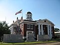
The Smith County courthouse in Raleigh, where local government happens.
See also
 In Spanish: Condado de Smith (Misisipi) para niños
