Sourdough Peak facts for kids
Quick facts for kids Sourdough Peak |
|
|---|---|

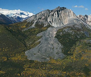
Sourdough Peak with rock glacier
|
|
| Highest point | |
| Elevation | 6,201 ft (1,890 m) |
| Prominence | 1,901 ft (579 m) |
| Isolation | 3.64 mi (5.86 km) |
| Geography | |
| Location | Wrangell-St. Elias National Park Valdez-Cordova Borough Alaska, United States |
| Parent range | Wrangell Mountains |
| Topo map | USGS McCarthy B-5 |
Sourdough Peak is a mountain in Alaska, United States. It stands 6,201 feet (1,890 meters) tall. This peak is found at the southern edge of the Wrangell Mountains. It is also part of the huge Wrangell–St. Elias National Park and Preserve.
Sourdough Peak is about 7 miles (11 km) east-southeast of a town called McCarthy. It sits on the north bank of the Nizina River. A cool feature of the mountain is a rock glacier on its south side. This is like a very slow-moving river of rocks and ice.
The name "Sourdough Peak" comes from early gold miners and explorers. The USGS reported this name in 1908. A "sourdough" was a nickname for an experienced miner or an old-timer in the western U.S. or Canada. They were called this because they often carried sourdough starter with them. This starter was used to bake bread, even in remote areas. The mountain's closest taller neighbor is Porphyry Mountain, which is about 5.1 miles (8.2 km) away.
Mountain Weather
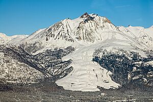
Sourdough Peak has a subarctic climate. This means it has very long, cold, and snowy winters. The summers are usually cool.
The Gulf of Alaska is a large body of water nearby. Winds from the Gulf blow towards the Wrangell Mountains. When these winds hit the mountains, they are forced upwards. This process is called orographic lift. It causes a lot of rain and snow to fall on the mountains.
Winter temperatures can drop below −20 °C (–4 °F). With the wind, it can feel even colder, below −30 °C (–22 °F). If you want to visit or climb Sourdough Peak, the best time is usually from May through June. The weather is most pleasant during these months.
 | Delilah Pierce |
 | Gordon Parks |
 | Augusta Savage |
 | Charles Ethan Porter |


