Valdez–Cordova Census Area, Alaska facts for kids
Quick facts for kids
Valdez–Cordova Census Area
|
|
|---|---|

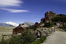
Abandoned mining camp at Kennecott, Alaska.
|
|

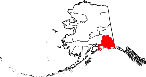
Location within the U.S. state of Alaska
|
|
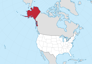
 Alaska's location within the U.S. |
|
| Country | |
| State | |
| Existed | 1980-2019 |
| Largest city | Valdez |
| Area | |
| • Total | 40,340 sq mi (104,500 km2) |
| • Land | 34,240 sq mi (88,700 km2) |
| • Water | 6,100 sq mi (16,000 km2) 15.1%% |
| Population | |
| • Estimate
(2019)
|
9,202 |
| • Density | 0.28/sq mi (0.11/km2) |
| Time zone | UTC−9 (Alaska) |
| • Summer (DST) | UTC−8 (ADT) |
| Congressional district | At-large |
The Valdez–Cordova Census Area was a special area in Alaska, United States. It was like a county, but it didn't have its own local government. This is because it was part of Alaska's Unorganized Borough, which means it was directly managed by the state.
In 2010, about 9,636 people lived there. However, on January 2, 2019, this area was divided. It became two new areas: the Chugach Census Area and the Copper River Census Area.
Contents
Exploring the Geography of Valdez–Cordova
The Valdez–Cordova Census Area was very large. It covered about 40,340 square miles. To give you an idea, that's bigger than many U.S. states! Most of this area, about 34,240 square miles, was land. The rest, about 6,100 square miles, was water, including many lakes and rivers.
Neighboring Regions
The Valdez–Cordova area shared its borders with several other parts of Alaska and even another country.
- To the north was the Southeast Fairbanks Census Area, Alaska.
- To the southeast was the Yakutat City and Borough, Alaska.
- To the west were the Kenai Peninsula Borough, Alaska, the Municipality of Anchorage, Alaska, and the Matanuska-Susitna Borough, Alaska.
- To the east, it bordered the Yukon Territory in Canada.
Protected Natural Areas
This region was home to parts of several important national parks and wildlife refuges. These areas help protect Alaska's amazing nature and animals.
- Alaska Maritime National Wildlife Refuge (part of the Gulf of Alaska unit), which includes Middleton Island.
- Part of the Chugach National Forest, a huge forest with mountains and glaciers.
- Part of the Tetlin National Wildlife Refuge, a place for birds and other wildlife.
- Part of the Wrangell-St. Elias National Park and Preserve, the largest national park in the U.S. It also included part of the Wrangell-Saint Elias Wilderness.
People and Population
| Historical population | |||
|---|---|---|---|
| Census | Pop. | %± | |
| 1960 | 2,844 | — | |
| 1970 | 3,098 | 8.9% | |
| 1980 | 8,348 | 169.5% | |
| 1990 | 9,952 | 19.2% | |
| 2000 | 10,195 | 2.4% | |
| 2010 | 9,636 | −5.5% | |
| 2019 (est.) | 9,202 | −4.5% | |
| U.S. Decennial Census 1790–1960 1900–1990 1990–2000 2010–2018 |
|||
In 2000, about 10,195 people lived in the Valdez–Cordova Census Area. Because the area was so big, there were less than 1 person per square mile. This means it was a very spread out and wild place!
Most people identified as White (about 75.90%). There was also a significant number of Native American people (about 13.25%) and people of Asian descent (about 3.55%). About 2.81% of the population were Hispanic or Latino.
The average age of people living there was 36 years old. About 29.60% of the population was under 18, showing that many families lived in the area.
Towns and Villages
The Valdez–Cordova Census Area had a few cities and many smaller communities.
Main Cities
Smaller Communities (Census-Designated Places)
These are smaller towns or villages that are recognized for census purposes.
Other Places of Interest
- Copperville (used to be a census-designated place)
- Eyak (located within Cordova)
See also
 In Spanish: Área censal de Valdez–Cordova para niños
 | DeHart Hubbard |
 | Wilma Rudolph |
 | Jesse Owens |
 | Jackie Joyner-Kersee |
 | Major Taylor |


