South Holland District facts for kids
Quick facts for kids
South Holland District
|
|
|---|---|
|
Non-metropolitan district
|
|
|
|
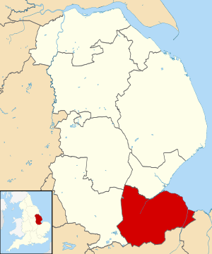
Shown within the ceremonial county of Lincolnshire
|
|
| Sovereign state | United Kingdom |
| Constituent country | England |
| Region | East Midlands |
| Administrative county | Lincolnshire |
| Admin. HQ | Spalding |
| Government | |
| • Type | South Holland District Council |
| Area | |
| • Total | 286.6 sq mi (742.4 km2) |
| Area rank | 48th |
| Population
(2005 est.)
|
|
| • Total | 95,019 |
| • Rank | Ranked 254th |
| • Density | 331.490/sq mi (127.989/km2) |
| Ethnicity (2021) | |
| • Ethnic groups |
List
|
| Religion (2021) | |
| • Religion |
List
63% Christianity
35.4% no religion 0.5% Islam 0.2% Buddhism 0.5% other |
| Time zone | UTC+0 (Greenwich Mean Time) |
| • Summer (DST) | UTC+1 (British Summer Time) |
| ONS code | 32UF (ONS) E07000140 (GSS) |
| South Holland District Council | |
|---|---|
 |
|
| Type | |
| Type |
Non-metropolitan district
|
| Leadership | |
|
Leader
|
|
|
Rob Barlow
Since October 2021 |
|
| Structure | |
| Seats | 37 |
|
Political groups
|
Administration (20)
Other parties (17)
|
| Elections | |
|
Last election
|
4 May 2023 |
|
Next election
|
2027 |
| Meeting place | |
 |
|
| Council Offices, Priory Road, Spalding, PE11 2XE | |
South Holland is a special area in Lincolnshire, England. It's called a local government district. This means it has its own council that helps run things for the people living there. The main office for the council is in a town called Spalding.
Other important towns and villages in South Holland include Crowland, Sutton Bridge, Donington, Holbeach, and Long Sutton. The name "South Holland" comes from an old part of Lincolnshire known as the Parts of Holland.
South Holland shares borders with other districts like Boston, North Kesteven, South Kesteven, Peterborough, Fenland, and King's Lynn and West Norfolk.
Contents
History of South Holland
How the District Was Formed
The South Holland district was officially created on April 1, 1974. This happened because of a law called the Local Government Act 1972. Before this, the area was made up of three smaller districts, which were then combined:
- East Elloe Rural District
- Spalding Rural District
- Spalding Urban District
The new district was named South Holland because it's located in the southern part of "Holland," one of the three historic areas of Lincolnshire.
Working Together with Other Councils
In 2021, the South Holland District Council decided to work closely with two other councils: East Lindsey District Council and Boston Borough Council. They formed something called the "South and East Lincolnshire Councils Partnership." This partnership helps them share managers and other staff, making things more efficient.
How South Holland Is Governed
Local Services and Responsibilities
The South Holland District Council is in charge of local services for the district. These are things like collecting rubbish, planning new buildings, and managing local parks.
Bigger services, like education and major roads, are handled by the Lincolnshire County Council. Many parts of the district also have smaller local groups called parishes. These parishes help with very local matters. The town of Spalding, however, does not have a parish council.
Council Leadership
The person in charge of the council is called the Leader of the Council. Here are the leaders since 2003:
| Councillor | Party | From | To | |
|---|---|---|---|---|
| Gary Porter | Conservative | 2003 | 7 May 2023 | |
| Nick Worth | Conservative | 17 May 2023 | ||
Who Makes Up the Council?
After the local election in 2023 and a special election in November 2023, this is how the council is made up:
| Party | Councillors | |
|---|---|---|
| Conservative | 20 | |
| South Holland Independents | 14 | |
| Independent | 3 | |
| Total | 37 | |
The "South Holland Independents" and other independent councillors work together as the "Independent Group." The next election for the council is planned for 2027.
Council Buildings
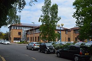
The council's main office is located on Priory Road in Spalding. The first part of the building was finished in 1954 for an older council that used to manage the area. A large new section was added to the front of the building in 1991.
Council Elections
Since 2007, the council has had 37 councillors. These councillors represent 18 different areas called wards. Each ward elects one, two, or three councillors. Elections are held every four years to choose these representatives.
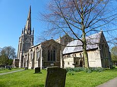
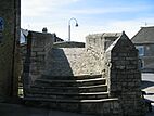
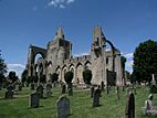
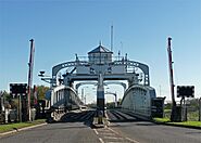
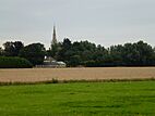
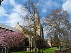
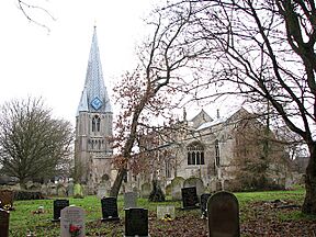
Landmarks from top left to bottom right:
- Trinity Bridge
- Crowland Abbey
- Crosskeys Bridge, Sutton Bridge
- Spalding Parish Church
- Sessions House, Spalding
- Ayscoughfee Hall, Spalding
- Skyline of Deeping St Nicholas in the Deepings
- Holbeach
- Long Sutton
People and Land in South Holland
Population and Age
In 2001, about 76,512 people lived in the South Holland district. The average age of people living there was almost 43 years old.
By 2011, the population had grown to 88,270 people. There were 37,264 households, with about 1.2 people living in each hectare of land.
Religion in the District
According to the 2001 census, 82.6% of people in South Holland said they were Christian. This was the highest percentage of Christians in any district in the East Midlands region.
Protecting the Land from Floods
Much of the land in South Holland is very flat and great for farming. However, because it's so low, it needs to be protected from flooding. This job is handled by the South Holland Internal Drainage Board and the Environment Agency. They work to keep the land safe and dry.
Media and Communications
Television Channels
If you live in South Holland, you can usually watch TV channels from BBC Yorkshire and Lincolnshire and ITV Yorkshire. These are broadcast from the Belmont transmitter.
Some people can also get channels from BBC East Midlands and ITV Central from the Waltham TV transmitter. In the very southern part of the district, a few homes might even receive BBC East and ITV Anglia.
Radio Stations
Here are some of the radio stations you can listen to in the South Holland area:
- BBC Radio Lincolnshire on 104.7 FM and 94.9 FM
- BBC Radio Cambridgeshire on 95.7 FM
- Lincs FM on DAB
- Greatest Hits Radio Lincolnshire on 96.7FM and 102.2 FM
- Connect Radio on 106.8 FM
- Heart Peterborough on 102.7 FM
- Tulip Radio (especially for Spalding) on 107.5 FM
District Symbols: Coat of Arms
|
The district of South Holland has its own special symbols, called a Coat of Arms. These symbols tell a story about the area.
- Shield: The main part of the shield has wavy blue and silver lines, which represent the water and drainage systems important to the area. In front of two crossed shepherd's staffs (crosiers), there's a stone called the Elloe Stone, which is a historical landmark. At the top, there's a golden band with an open book and two red tulip flowers. The book stands for learning, and the tulips represent the area's famous flower industry.
- Crest: Above the shield, there's a heron, a type of bird often seen in watery areas. The heron is holding a "cornucopia," which is a horn filled with flowers, fruits, and grains. This symbolizes the rich farming land and the good harvests in South Holland.
- Motto: The motto, or saying, for South Holland is "Progress Through Endeavour." This means that success and improvement come from hard work and effort.
- Badge: The badge shows the Elloe Stone in front of two crossed shepherd's staffs, similar to the shield.
See also
 In Spanish: South Holland (Lincolnshire) para niños


