South Yadkin River facts for kids
Quick facts for kids South Yadkin River |
|
|---|---|
|
Confluence of the South Yadkin River and Yadkin River at High Rock Lake.
|
|
| Country | United States |
| State | North Carolina |
| Counties | Alexander, Davie, Iredell, Rowan, Wilkes |
| Physical characteristics | |
| Main source | Alexander County 36°01′58″N 81°09′22″W / 36.0329095°N 81.1561943°W |
| River mouth | Confluence with the Yadkin River High Rock Lake 35°44′45″N 80°27′39″W / 35.7456947°N 80.4608909°W |
| Basin features | |
| Progression | South Yadkin River → Yadkin River → Pee Dee River → Atlantic Ocean |
| River system | Yadkin–Pee Dee River Basin |
| GNIS | 995225 |
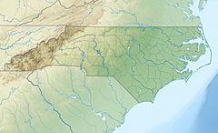
The South Yadkin River is a river that flows through several counties in North Carolina. These counties include Alexander, Davie, Iredell, Rowan, and Wilkes. This river is an important part of the local environment. It eventually joins a larger river, the Yadkin River, and together they help form High Rock Lake.
Contents
Exploring the South Yadkin River
The South Yadkin River is a natural waterway in the western part of North Carolina. It plays a role in the landscape and the water system of the region. Understanding rivers helps us learn about geography and how water moves across the land.
Where Does the River Begin?
The South Yadkin River starts its journey in Alexander County. This is where the river's source, or beginning, is located. It begins as smaller streams and creeks. These small waterways collect water from rain and groundwater.
As these small streams flow downhill, they join together. This makes the South Yadkin River grow wider and deeper. It gathers more water as it travels through the landscape.
Traveling Through North Carolina
From Alexander County, the river flows through several other counties. It passes through Davie, Iredell, Rowan, and Wilkes counties. Each county has different types of land. The river flows through forests, farmlands, and sometimes near towns.
The path of the river is shaped by the land it crosses. It might wind around hills or flow through flatter areas. Rivers are like natural highways for water. They carry water from higher elevations to lower ones.
Joining Other Waters
The South Yadkin River does not flow directly into the ocean. Instead, it is a tributary. A tributary is a smaller river or stream that flows into a larger river or lake. The South Yadkin River's journey ends when it meets the Yadkin River.
This meeting point is called a confluence. The confluence of the South Yadkin River and the Yadkin River is special. It is where High Rock Lake begins. High Rock Lake is a large reservoir. A reservoir is a human-made lake used to store water.
The Yadkin-Pee Dee River Basin
After joining the South Yadkin River, the Yadkin River continues its flow. It then becomes part of a much larger river system. This system is known as the Yadkin–Pee Dee River Basin. A river basin is all the land where water drains into a particular river or its tributaries.
The Yadkin River eventually becomes the Pee Dee River as it flows into South Carolina. The Pee Dee River then continues its long journey. Finally, it empties into the Atlantic Ocean. So, the water from the South Yadkin River eventually makes its way to the sea!
Importance of Rivers
Rivers like the South Yadkin are very important. They provide water for plants and animals. Many different types of fish, birds, and other wildlife depend on rivers for their homes and food. Rivers also help shape the land over many years.
People also use rivers for different things. They can be used for recreation, like fishing or boating. Sometimes, rivers are used for transportation or to generate electricity. Protecting rivers helps keep our environment healthy for everyone.
 | Sharif Bey |
 | Hale Woodruff |
 | Richmond Barthé |
 | Purvis Young |


