Southmead facts for kids
Quick facts for kids Southmead |
|
|---|---|
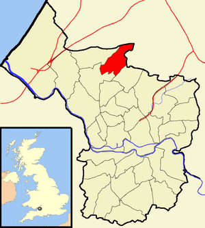 Boundaries of the city council ward |
|
| Population | 11,956 (2011.Ward) |
| OS grid reference | ST582785 |
| Unitary authority | |
| Ceremonial county |
|
| Region | |
| Country | England |
| Sovereign state | United Kingdom |
| Post town | BRISTOL |
| Postcode district | BS10 |
| Dialling code | 0117 |
| EU Parliament | South West England |
| UK Parliament |
|
Southmead is a lively area in the northern part of Bristol, a city in the south west of England. It's like a neighborhood or a "ward" within the city. Southmead shares its borders with other places like Filton in South Gloucestershire, and Monks Park, Horfield, Henleaze, and Westbury on Trym in Bristol.
A small river called the River Trym starts its journey in Southmead. It flows through a special natural area called Badock's Wood, which is a Local Nature Reserve. You can also find an ancient round barrow (a type of burial mound) near the top of the wood. Another interesting spot is Pen Park Hole, which is a Site of Special Scientific Interest because of its unique geology.
Contents
Discovering Southmead's Past
A Look Back in Time
Southmead was once a part of a larger area called Westbury on Trym. Records from 1319 mention a manor house here. This old house was located near where Southmead Road is today. Most of the land, which was about 313 acres, was sold in the late 1800s.
By 1888, Southmead was just a small village along Southmead Road. Later, in 1924, Southmead Hospital opened its doors. It used to be a workhouse before it became a hospital.
Growing into a Community
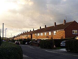
Big changes came to Southmead starting in 1931. The city of Bristol built 1,500 new homes north of Southmead Road. These homes helped families who were moving out of crowded areas in central Bristol. They also helped with the general housing shortage at the time.
After the Second World War, another 1,100 houses were built. Because of this, people in Southmead often talk about the "pre-war estate" (the older homes) and the "post-war estate" (the newer homes). They sometimes call them "the old estate" and "the new estate."
Southmead Today
What Southmead Looks Like
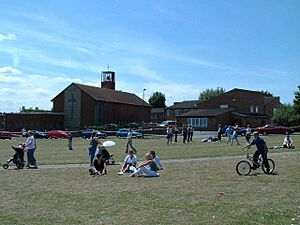
The main part of Southmead today is around Greystoke Avenue. This is a wide road with grassy areas. It's a bit north of where the original village used to be on Southmead Road.
Some parts of Southmead, especially to the south and west, are now part of the Westbury-on-Trym and Henleaze area. Other parts, like the hospital, are in the Horfield area.
Community and Services
People in Southmead have worked hard to make their area even better. They've improved local services and the environment. There are now more types of homes available. This has brought new opportunities to the area.
Big workplaces like Filton, MOD Abbey Wood, and the growing Southmead Hospital have created more jobs. This has helped the community become stronger. There are also more shops and facilities, making it easier for everyone to get what they need.
Even with all these improvements, some parts of Southmead are still working to overcome challenges. The central area is still considered to be among the more developing areas in England. But efforts are ongoing to make things better step by step.
Getting Around and Staying Healthy
It's easy for residents to reach important services. While some public services have moved online, there's still a small police office at the hospital. There's also a fire station on Southmead Road.
Bus services are available and run often. You can catch a bus to the Gloucester Road area, the City Centre, and Cribbs Causeway for shopping. The closest train station, Filton Abbey Wood, is about 2 to 3 miles away.
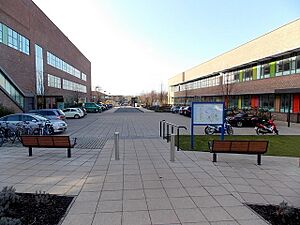
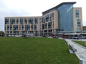
Southmead has good health services. There's a doctor's surgery on Ullswater Road and at the Greenway Centre. Southmead Hospital is a large hospital with an emergency room. There are also places like The Lannercost that help people with physical and learning needs. Several care homes and sheltered housing options are available too.
Parks and Sports
Southmead has many parks and places for sports. There's a private sports club called David Lloyd near Badock's Wood. The Greenway Centre has sports fields and a gym. You can also find pitches at Charlton Mead.
Filton Golf Course is right next to Southmead. For younger people, there's an Adventure Playground and a Multi-Use Games Area (MUGA) off Doncaster Road. Play areas are also located at Glencoyne Square, Charlton Mead, and Greystoke Avenue.
Just a mile south of Southmead is Horfield Sports Centre. It has pitches, a gym, a sports hall, and a swimming pool that the public can use. Other green spaces like Blaise Castle, Coombe Dingle, and Kingsweston House are only a few miles away.
Learning and Growing
Children in Southmead have access to several primary schools, including Baddocks Wood, Little Mead, and Fonthill. The Baddocks Wood Children Centre also helps with early years education for younger children.
Community Spirit in Southmead
Southmead is known for its strong community spirit. Locals often say it's "a great place" with "lots of community activity and lots of optimism for the future." People in the area work together to make it a better place for everyone.
The community has a special plan that aims for Southmead to be "a great place for everyone to live." This plan focuses on residents working together and helping each other achieve their goals. The Southmead Development Trust (SDT) helps to organize and manage this plan.
 | Georgia Louise Harris Brown |
 | Julian Abele |
 | Norma Merrick Sklarek |
 | William Sidney Pittman |


