Sprouts of the Mohawk River facts for kids
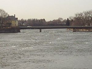
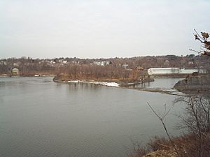
The Sprouts of the Mohawk River are the many channels of the Mohawk River. They flow into the Hudson River, forming a delta in New York State. Most of these channels are in Albany County. The northern channels are in Saratoga County. They meet the Hudson River at the border with Rensselaer County.

The islands created by these channels are, from north to south: Peebles Island, Polrump Island, Bock Island, Goat Island, Second Island, Van Schaick Island, and Simmons Island. Green Island used to be an island too. But the channel that separated it from Albany County was filled in when Interstate 787 and NY Route 787 were built.
Contents
History of the Sprouts
Early Explorers and Land Ownership
In 1609, Henry Hudson sent a small boat from his ship, the Half Moon, up the Hudson River. He wanted to see if the river was the Northwest Passage, a sea route to Asia. His crew might have reached the sprouts.
The islands and sprouts (called spuyten in Dutch) were part of a large piece of land. This land was given to Philip Pieterse Schuyler and Gozen Gerritse Van Schaick in 1665. The Native Americans called this area Nach-te-Nack. The Dutch settlers called it Halve-Maen, which means Halfmoon in English.
In 1674, Schuyler gave his land rights to Van Schaick. Later, in 1687, Van Schaick's son, Anthony Van Schaick, became the only owner. This was confirmed by Governor Thomas Dongan.
Crossing the River and Wars
Some parts of the sprouts were very shallow, less than 2 feet (0.6 meters) deep. This made it easy to cross the river on foot. The town of Waterford got its name from a place where people could cross to Peebles Island. Soldiers during the US Revolutionary War made this name popular.
Mohicans, Dutch settlers, and English settlers used these shallow crossings. They traveled from Fort Orange and Albany to Montreal and Canada. Soldiers used them during the French and Indian Wars.
During the American Revolutionary War, military forts were built on the islands. These forts protected the shallow crossings and the road to Albany from invading armies from Canada. Many forts were built on Peebles Island and Van Schaick Island. The Van Schaick House was the military headquarters.
Canals and Railroads
The Rensselaer and Saratoga Railroad was built in 1832. It crossed the Hudson River from Troy onto Green Island. Then it traveled north over three of the sprouts into Saratoga County.
In 1828, the King's Power Canal was built. Two dams were placed across the Fourth Branch, between Waterford and Bock Island, and then between Bock and Peebles Island.
A state dam near Cohoes and Waterford was rebuilt in 1868. This dam is where the sprouts leave the main Mohawk River channel. The dam was for the Champlain Canal. It allowed canal boats to cross the Mohawk River to the canal channel on the other side. Before, boats used an aqueduct bridge. The new dam was taller to prevent boats from going over the edge.
The River Channels (Sprouts)

Over the years, the different channels of the Mohawk River have been given various names. From north to south, they are:
- Fourth Branch: This channel separates Peebles Island from the mainland of Saratoga County. It is also called the North Sprout. A power plant is located here in the town of Waterford.
- Third Branch: This channel separates Peebles Island from Van Schaick Island. It is also known as the Middle Branch. There is a rapid here called Buttermilk Falls. The New York State Assembly also called this the White Sprout in 1833. The middle of the Third Branch is the border between Saratoga and Albany counties.
- First Branch: This channel separates Van Schaick and Green islands from the mainland of Albany County.
- Second Branch: This channel separates Van Schaick Island from Green Island. It is the border between the city of Cohoes and the town/village of Green Island.
The Islands of the Sprouts
- Green Island: This was once the largest island formed by the sprouts. It was separated from Watervliet, Colonie, and Cohoes by the First Branch. The Second Branch separated it from Van Schaick Island. The Hudson River separated it from Troy. Today, it is part of the village and town of the same name.
- Van Schaick Island: This is a large island with many people living on it. It has the historic Van Schaick House, a country club, the historic Matton Shipyard, marinas, and an elementary school. The First Branch separates it from the mainland of Cohoes and Simmons Island. The Third Branch separates it from Peebles Island. The Second Branch separates it from Green Island. The Hudson River separates it from Troy. It is part of the city of Cohoes.
- Simmons Island: This is a small island in the middle of the First Branch. Van Schaick Island is to its east, and the mainland of Cohoes is to its west. It is part of the city of Cohoes.
- Peebles Island: At 132 acres (53 hectares), this is the largest island in the town of Waterford and Saratoga County. It is part of Peebles Island State Park. The New York State Office of Parks, Recreation, and Historic Preservation has its main office here.
- Second Island: This is the second largest island in Waterford. It was once called King's Island. A Boy Scouts of America camp, Camp Kavanaugh, is located here.
- Goat Island: This island is in the middle of the Fourth Branch and is owned by New York State.
- Bock Island: This island has two dams, one on each side. These dams connect it to the Saratoga County mainland and to Peebles Island. It is in the middle of the Fourth Branch and is owned by Mohawk Paper. The island is 1.38 acres (0.56 hectares) in size.
- Polrump Island: This island is in the middle of the Fourth Branch and is owned by New York State.
Fun Things to Do
Peebles Island is part of Peebles Island State Park. It's a natural park with fun hiking paths. You can also see old military forts from the US Revolutionary War there. The main office for New York State Parks is on this island.
There's a public fishing spot on the northern end of Simmons Island. Peebles Island also has places to fish from the shore and areas where you can safely walk in the river. All fishing in the sprouts is "catch and release." This means you must put the fish back in the water because of certain chemicals (PCBs) that were once in the water.
A former railroad bridge over the Second Branch has been turned into a bike and hike trail. This trail connects the towns and villages of Watervliet, Green Island, Cohoes, and Waterford. There's also a visitor's center with public docks on the northern shore of the Fourth Branch in the village of Waterford.
Some areas are set aside for swimming, and some people even enjoy river surfing here!

