St. Peter, Wisconsin facts for kids
Quick facts for kids
St. Peter, Wisconsin
|
|
|---|---|
|
Census-designated place
|
|

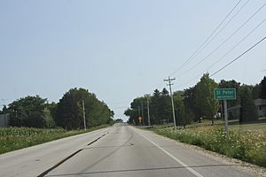
Looking south at the sign for St. Peter
|
|
| Nickname(s):
Gateway to the Holyland
|
|
| Country | |
| State | |
| County | Fond du Lac |
| Area | |
| • Total | 9.41 km2 (3.633 sq mi) |
| • Land | 9.40 km2 (3.628 sq mi) |
| • Water | 0.01 km2 (0.005 sq mi) |
| Elevation | 324 m (1,063 ft) |
| Population
(2010)
|
|
| • Total | 1,489 |
| • Density | 158.25/km2 (409.85/sq mi) |
| Time zone | UTC-6 (Central (CST)) |
| • Summer (DST) | UTC-5 (CDT) |
| ZIP codes |
53049, 54937
|
| Area code(s) | 920 |
| GNIS feature ID | 1573503 |
St. Peter, Wisconsin is a small community located in Fond du Lac County, Wisconsin, in the United States. It is known as a census-designated place, which means it's an area identified by the government for statistics, but it doesn't have its own local government like a city or town. St. Peter is part of the Town of Taycheedah.
This community is about 2 miles (3.2 km) northeast of Peebles and 1 mile (1.6 km) south of Silica. In the past, it was located along Wisconsin Highway 149. However, this highway was later changed to a county road, now called County Highway WH. According to the 2010 census, St. Peter had a population of 1,489 people.
Exploring The Holyland Area
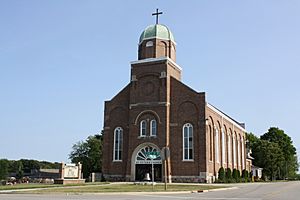
St. Peter is located in a special region of eastern Wisconsin known as "The Holyland". This area includes parts of Fond du Lac County, Wisconsin and Calumet County. It got its unique name because many German immigrants settled here. These settlers built their communities around Catholic churches.
Villages of The Holyland
The Holyland region is home to several villages, each with its own Catholic church. These communities include:
These villages share a rich history and cultural heritage, all connected by their founding traditions.
See also
 In Spanish: St. Peter (Wisconsin) para niños
 | Kyle Baker |
 | Joseph Yoakum |
 | Laura Wheeler Waring |
 | Henry Ossawa Tanner |


