Stack's Mountains facts for kids
Quick facts for kids Stack's Mountains |
|
|---|---|

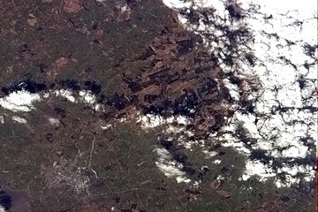
The Stack's Mountains from the International Space Station, with Tralee at bottom left.
|
|
| Highest point | |
| Peak | Crusline |
| Elevation | 355 m (1,165 ft) |
| Geography | |
| Country | Republic of Ireland |
| Provinces of Ireland | Munster |
The Stack's Mountains are a group of hills in County Kerry, Ireland. They are located about seven kilometers (about 4 miles) northeast of the town of Tralee. You can find them near the N69 road.
The tallest point in the Stack's Mountains is called Crusline. It stands 355 meters (1,165 feet) high. Crusline is the highest peak in Kerry north of Tralee. Other nearby hills include Ballincollig Hill (353 meters), Beennageeha Mountain (321 meters), and Stack's Mountain (Irish: Cnoc an Stacaigh; 323 meters).
Contents
Nature and Landscape
The Stack's Mountains have a mix of landscapes. You will find wide areas of moorland, which are open, uncultivated lands. There are also some open pastures where animals can graze.
Forests in the Mountains
A large part of the area, about 4,700 hectares, is covered with young forests. Most of these trees are Sitka spruce, which is a type of conifer. Other trees planted here include Japanese larch, pines, firs, and cedars. You can also see some broadleaved trees like birch, ash, alder, oak, willow, sycamore, and holly. Most of these forests are managed by a company called Coillte.
Animals of the Stack's Mountains
The forests, open moors, and grasslands are home to many different animals. You might spot birds like the hen harrier, red grouse, snipe, cuckoo, and meadow pipit. Mammals like the Irish hare and red fox also live here.
The Glanaruddery Mountains are located to the southeast. The Smearlagh River valley separates them from the Stack's Mountains.
Energy and Resources
The Stack's Mountains area has been used for energy resources.
Peat Harvesting
In the past, a company called Bord na Móna used to dig up turf (a type of soil made from decayed plants) from Lyreacrompane Bog. They extracted about 250,000 tons of turf between 1938 and 1963. Today, local people still harvest turf. They use special machines called hopper machines instead of older tools.
Wind Power
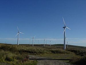
The mountains are also a good place for wind farms. You can see wind turbines on Stack's Mountain and Ballincollig Hill. These turbines help to create clean energy.
Fun Activities and Recreation
The Stack's Mountains offer some great ways to explore nature.
Walking Trails
Local groups have worked with Coillte to create walking paths. One path is the "Mass Path and River Walk." It is about four miles long and follows the banks of the Smearlagh River. Another trail is the "Fionn MacCumhaill" trek, which is ten miles long. This trek takes you through open countryside and the Coillte forests.
The Smearlagh River
The Smearlagh River is about seven miles long. It starts in the Stack's Mountains and Glanaruddery Mountains. Several smaller streams, like the Broghane Stream and Lyreacrompane River, join together to form it. The Smearlagh River flows into the River Feale near Listowel. This meeting point is known as "The Joinings." The Smearlagh is a fast-flowing river, and it is a good spot for fishing for salmon and sea trout.
 | Jewel Prestage |
 | Ella Baker |
 | Fannie Lou Hamer |


