Steele, Missouri facts for kids
Quick facts for kids
Steele, Missouri
|
|
|---|---|
 |
|

Location of Steele, Missouri
|
|
| Country | United States |
| State | Missouri |
| County | Pemiscot |
| Named for | Leonidas Lucilius Steele (1845–1907) |
| Area | |
| • Total | 2.19 sq mi (5.67 km2) |
| • Land | 2.16 sq mi (5.60 km2) |
| • Water | 0.03 sq mi (0.07 km2) |
| Elevation | 259 ft (79 m) |
| Population
(2020)
|
|
| • Total | 1,853 |
| • Density | 857.08/sq mi (330.85/km2) |
| Time zone | UTC-6 (Central (CST)) |
| • Summer (DST) | UTC-5 (CDT) |
| ZIP code |
63877
|
| Area code(s) | 573 |
| FIPS code | 29-70558 |
| GNIS feature ID = | 2395961 |
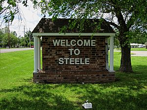
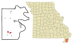
Steele is a city located in the southern part of Pemiscot County, in the southeastern part of Missouri, United States. It's often called part of the "Missouri Bootheel" because of its unique shape on the map. In 2020, about 1,853 people lived in Steele.
Contents
History of Steele
The post office in Steele was open for many years, from 1896 until 2017. The community got its name from Leonidas Lucilius Steele. He was an early settler who moved to Pemiscot County in 1874 and then to Steele in 1885. There, he ran a hotel and a store that sold many different goods.
Steele grew quickly in its early days because it was the only way for people and goods to cross the Little River Swamp. This crossing was important for reaching Cottonwood Point and the Mississippi River. The city was also a stop along the St. Louis–San Francisco Railway, which helped it connect to other places. In 1912, Steele had seven general stores, three cotton gins (machines that separate cotton fibers), a sawmill, and a gristmill (a mill for grinding grain).
Steele's Airfield History
In 1942, during World War II, the U.S. Army built a small airfield northwest of Steele. This airfield was one of four smaller fields that supported Blytheville Army Airfield in Blytheville, Arkansas. Blytheville was a training school for pilots learning to fly the B-25 bomber plane.
After the war, in August 1946, the Blytheville base and its smaller airfields, including the one at Steele, were no longer needed by the military. A local person named James K. Burton then leased the Steele airfield for five years to run a flying school there.
Geography and Location
Steele is in the southern part of Pemiscot County, about five miles north of the border between Missouri and Arkansas. The city is located along Missouri Route 164 and U.S. Route 61. The major highway, Interstate 55, runs just east of the city. Another city, Caruthersville, is about eleven miles northeast of Steele, located on the Mississippi River.
According to the United States Census Bureau, Steele covers a total area of about 1.87 square miles (4.84 square kilometers). Most of this area, about 1.84 square miles (4.77 square kilometers), is land, and a small part, about 0.03 square miles (0.08 square kilometers), is water.
Population Information
| Historical population | |||
|---|---|---|---|
| Census | Pop. | %± | |
| 1910 | 833 | — | |
| 1920 | 751 | −9.8% | |
| 1930 | 1,219 | 62.3% | |
| 1940 | 1,585 | 30.0% | |
| 1950 | 2,360 | 48.9% | |
| 1960 | 2,301 | −2.5% | |
| 1970 | 2,107 | −8.4% | |
| 1980 | 2,419 | 14.8% | |
| 1990 | 2,395 | −1.0% | |
| 2000 | 2,263 | −5.5% | |
| 2010 | 2,172 | −4.0% | |
| 2020 | 1,853 | −14.7% | |
| U.S. Decennial Census | |||
Steele's Population in 2010
In 2010, the census showed that 2,172 people lived in Steele. There were 838 households, and 551 of these were families. The city had about 1,180 people per square mile. There were 919 housing units, which are places where people live, like houses or apartments.
The people living in Steele came from different backgrounds:
- 77.53% were White
- 18.69% were Black or African American
- 0.46% were Native American
- 0.37% were Asian
- 1.38% were from other races
- 1.57% were from two or more races
About 2.16% of the population identified as Hispanic or Latino.
The average age of people in Steele was 35.4 years old. About 29.1% of residents were under 18 years old. About 14.9% were 65 years or older. The city had slightly more females (53.4%) than males (46.6%).
Education in Steele
The local school district in Steele is called South Pemiscot Schools. This district runs several public schools for students of different ages:
- East Elementary School, for Kindergarten students.
- Central Elementary School, for students in grades 1 through 6.
- South Pemiscot High School, for older students in grades 7 through 12.
Steele also has a public library where people can borrow books and other materials. It's called the Steele Public Library.
Notable People from Steele
- Isaac Harmon Severn – He was a political friend and supporter of President Harry S. Truman.
See also
 In Spanish: Steele (Misuri) para niños
 | Sharif Bey |
 | Hale Woodruff |
 | Richmond Barthé |
 | Purvis Young |

